Ngerebelas
| Ngerebelas | ||
|---|---|---|
| Satellite image, Ngerebelas on the right | ||
| Waters | Pacific Ocean | |
| Archipelago | Kayangel (Atoll) | |
| Geographical location | 8 ° 3 ' N , 134 ° 42' E | |
|
|
||
| Map of the Kayangel Atoll | ||
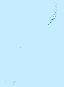
Ngerebelas (also: Caraparasu To , Carapellas , Ngarapalas ) is a tiny island in the Kayangel Atoll , which is located in the north of the Pacific island state of Palau , approx. 60 km north of the capital Melekeok .
geography
The flat island, together with the neighboring, even smaller oracle, forms the southern tip of the Kayangel Atoll. To the south, the atoll is separated from the Ngkesol reef by the Ngcheangel Passage (Kekerel Euchel) . Administratively, the island belongs to the Palau state of Kayangel .
Individual evidence
literature
- Republic of Palau Adventure and Dive Guide. Guide to the undisputed Best Diving in the World. Franko Maps Ltd. 2016.


