Noon Hill
|
Noon Hill
|
||
|
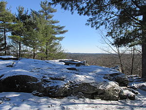
View from the highest point of Noon Hill |
||
| location | Massachusetts , United States | |
| surface | 83 ha | |
| WDPA ID | 55554048 | |
| Geographical location | 42 ° 10 ' N , 71 ° 19' W | |
|
|
||
| Setup date | 1959 | |
| administration | The Trustees of Reservations | |
Noon Hill is the name of a 204 acres (0.8 km² ) nature reserve around the hill of the same name near Medfield in the state of Massachusetts in the United States . It is managed by The Trustees of Reservations organization.
Protected area
The area surrounding the hill is covered with dense forest, with approximately 4.5 mi (7.2 km ) of hiking trails running through it , offering opportunities for hiking, horseback riding, cross-country skiing, and mountain biking . The trail network is part of the Bay Circuit Trail .
Noon Hill reaches a height of 370 ft (112.8 m ) and offers good views of Walpole and Norfolk from its highest point . The nearby Holt Pond is a small reservoir from the 18th century that was created to operate a mill. The trails around Noon Hill connect to the neighboring Shattuck Reservation . The slope of the hill slopes gently towards the Charles River or its tributary Stop River .
See also
Individual evidence
- ^ About Noon Hill. The Trustees of Reservations , accessed April 8, 2014 .


