Ofenberg (Wolfhagen)
| Ofenberg | ||
|---|---|---|
|
The Ofenberg Tower |
||
| height | 372.5 m above sea level NHN | |
| location | at Wolfhagen ; District of Kassel , Hessen ( Germany ) | |
| Mountains | West Hessian mountainous region | |
| Coordinates | 51 ° 19 '39 " N , 9 ° 11' 24" E | |
|
|
||
| Development | Road to the summit region | |
| particularities | Ofenberg tower | |
The Ofenberg near Wolfhagen in the northern Hessian district of Kassel is 372.5 m above sea level. NHN high mountain of the Wolfhager hill country belonging to the West Hessian mountains .
geography
location
The Ofenberg rises in the Habichtswald Nature Park immediately east of the core town of Wolfhagen . To the north, the mill water flows past the mountain as a tributary of the Erpe in a south-west-north-east direction. To the east of the mountain, an agriculturally used plateau leads over the wooded Hohe Ridge ( 341.5 m ) to the Philippinenburg location of the Wolfhagen district of Philippinenburg and -thal on the Helfenberg ( 366.2 m ; former location of Helfenberg Castle ) . The massive Isthaberg ( 523.1 m ) rises to the southeast of the mountain or south of this district ; to the west, the small Limeckebach flows through the Wolfhager valley as a southwestern Mühlenwasser tributary .
The mountain or hill group of Ofenberg, Festberg , Helfenberg and Isthaberg is also known locally as "Wolfhager Switzerland".
Natural allocation
The Ofenberg is located in the main natural unit group West Hessisches Bergland (No. 34) in the main unit Ostwaldecker Randsenken (341) on the border of the natural areas Ehringer Senke (341.30) in the west and Altenhasunger Graben (341.33) in the east, both of which form the Wolfhager Hügelland (341.3 ) belong.
Buildings
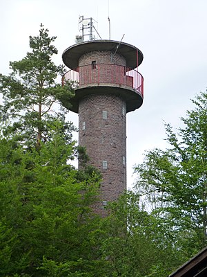
The Ofenberg observation tower , which is predominantly forested by beech and pine trees , has been standing on the Ofenberg tower since 1964 , from which one can see parts of Wolfhagen and the Wolfhagen hill country. A few meters southwest below the summit region and tower is the Wolfsschänke forest restaurant . There is a water tank on the road leading there .
The Hessenklinik Wolfhagen district hospital is located on the Kleiner Ofenberg , the southern foothills of the Ofenberg .
Traffic and walking
To the south and south-east past the Ofenberg, the district road 102 leads between Wolfhagen and Philippinenburg. From this a spur road branches off to the aforementioned hospital, from which a dead-end road leads to the hikers' car park near the summit region. Forest, forest and hiking trails crisscross the mountain and woodland landscape of the Ofenberg, through which a section of the Märchenlandweg hiking trail between Wolfhagen and Nothfelden, a section of the student trail between Wolfhagen and Altenhasungen and a section of the Wolfhagen Eco-Path cultural history trail lead .
Individual evidence
- ↑ a b Map services of the Federal Agency for Nature Conservation ( information )
- ↑ a b Inscription on the information board on the tower (July 1984, Wolfhagen Tourist Office)
- ↑ Martin Bürgener: Geographical Land Survey: The natural spatial units on sheet 111 Arolsen. Federal Institute for Regional Studies, Bad Godesberg 1963. → Online map (PDF; 4.1 MB)
- ↑ Eco-path cultural history Wolfhagen , on eco-pfade.de

