
Orcia
| Orcia | ||
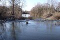
 The Orcia near Borgo Santa Rita (district of Cinigiano ) |
||
| Data | ||
| location | Tuscany ( Province of Siena , Province of Grosseto ), Italy | |
| River system | Ombrone | |
| Drain over | Ombrone → Tyrrhenian Sea | |
| River basin district | Appennino Settentrionale | |
| source |
Monte Cetona near Sarteano 42 ° 56 ′ 20 ″ N , 11 ° 52 ′ 39 ″ E |
|
| muzzle | near Monte Antico (district of Civitella Paganico ) in the Ombrone coordinates: 42 ° 58 ′ 15 ″ N , 11 ° 21 ′ 0 ″ E 42 ° 58 ′ 15 ″ N , 11 ° 21 ′ 0 ″ E
|
|
| length | 70 km | |
| Left tributaries | Formone , Zancone, Vellora, Vivo , Duck | |
| Right tributaries | Gucenna, Landola, Gragnano, Miglia, Tresa, Sambuco, Rigo, Asso | |
| Communities | Sarteano , San Casciano dei Bagni , Radicofani , Pienza , San Quirico d'Orcia , Castiglione d'Orcia , Montalcino , Castel del Piano , Cinigiano , Civitella Paganico | |
The Orcia is a 70 km long river in the region Tuscany in Italy , the provinces of Siena and Grosseto crossed from east to west and Monte Antico (village of Civitella Paganico in) as a left tributary Ombrone flows.
course
The river has its source in the hills south of Monte Cetona in the municipality of Sarteano in the province of Siena and initially flows south towards San Casciano dei Bagni , whose territory it only touches a few meters. From there the course of the river first leads northwest to Radicofani , whose municipal area it flows through for 11 km and where the Torrenti Gucenna, Landola and Gragnano flow in from the right. At the end of the village, the 16 km long Torrente Formone , which represents the border with Castiglione d'Orcia , joins the river from the left and from the south. Further to the northwest it touches the southern districts of Pienza , where it marks the border with Castiglione d'Orcia. Coming from the north, the Rigo joins first from the right and then the Vellora (13 km) from the south from the local area of Castiglione d'Orcia from the left. Shortly before the estuary, it passes the provincial road SP 18, which leads from Gallina to Pienza, with its ancient bridge Ponte di Pian di Maggio . This has been a bridge ruin since the end of November 2012 when it collapsed due to flooding. After the Castello di Spedaletto (Pienza, also called Spedale del ponte dell'Orcia due to the nearby ruined bridge), it receives the waters of the Torrente Tresa (13 km), which comes from the north on the right. In the section between the inflow of the Formone and shortly after Spedaletto, the river runs south and parallel to the SP 53 provincial road, then passes the ruins of the Antico Ponte sull'Orcia bridge , which was blown up by the Wehrmacht in 1944 . In the local area of San Quirico d'Orcia , where he spends a total of only 2 km, he first crosses the new bridge of Via Cassia and shortly before the thermal town of Bagno Vignoni the old stone bridge Ponte sull'Orcia , which was built in 1528 as a connection to the fortress opposite Rocca d'Orcia (district of Castiglione d'Orcia) was built by Baldassare Peruzzi , but has been renovated and reinforced several times, also due to the destruction of the Wehrmacht. Then he passes the bridge ruins Ponte di Mulina , which existed at the (now defunct) mill of Bagno Vignoni and which collapsed around 1929.
After Bagno Vignoni, the river turns southwest, where it passes Ripa (also Ripa d'Orcia , district of Castiglione d'Orcia) and flows into the southern municipal areas of Montalcino or initially serves as a border river to Castiglione d'Orcia. The Asso River flows in here from the right and the Siena – Grosseto railway follows the course of the river to its mouth. In Stazione di Monte Amiata (also called Monte Amiata Scalo , stopping point ( Scalo ) of the railway line. The place belongs to the right (north) of the Orcia to Montalcino and south to Castiglione d'Orcia.) The Orcia is from the aqueduct Acquedotto del Vivo (also Acquedotto di Siena ) crossed. The duck flows south of Castelnuovo dell'Abate (district of Montalcino, near the Abbey of Sant'Antimo ) and after a few kilometers it passes the provincial border to the province of Grosseto near Sant'Angelo in Colle (Montalcino) and the municipal areas of the northwest of Monte Amiata lying places of Castel del Piano (district Montenero d'Orcia ) and Cinigiano (district Borgo Santa Rita at 102 meters above sea level). From there it reaches Paganico ( Civitella Paganico ), in whose district Monte Antico the course of the river ends with the inflow into the Ombrone .
Val d'Orcia
→ Main article: Val d'Orcia
The Orciatal has been part of the world cultural heritage since 2004 .
Nature parks
The Riserva Naturale Lucciolabella (also known as Lucciola bella ) is located on the upper reaches of the river between Pienza and Sarteano .
photos

The Orcia at the Ponte di Pian di Maggio bridge between Gallina and Pienza, which collapsed in 2012

The Acquedotto del Vivo above the Orcia at Monte Amiata Scalo (Stazione), district of Montalcino and Castiglione d'Orcia
The Orcia at Sant'Angelo in Colle (also called Sant'Angelo Scalo or Stazione Sant'Angelo-Cinigiano )


literature
- Giorgio Battini: Il fiume racconta. Viaggio nella Toscana dei fiumi , Bonechi Editrice, Florence 1993, ISBN 88-7009-941-5
- Emanuele Repetti: ORCIA (Urcia e Urcius fl.). In Dizionario Geografico Fisico Storico della Toscana (1833–1846), online edition of the University of Siena on the Orcia River (PDF, Italian)
Web links
- Official website of the Sistema Informativo Ambientale della Regione Toscana (SIRA) on the Orcia River , accessed on April 17, 2013 (Italian)
- Website La mia terra di Siena zum Orcia , accessed on April 17, 2013 (Ital.)
- Riccardo Pizzinelli: Gli interventi di Jacomo Franchini (1665-1736) al ponte sull'Orcia a Bagno Vignoni , Per la Valdorcia of December 20, 2012, retrieved on April 17, 2013 (Italian)
Individual evidence
- ↑ a b c d SIRA
- ↑ Fabio Pellegrini: CROLLA LO STORICO PONTE DI PIAN DI MAGGIO. NON HA RETTO ALLA VIOLENZA DEL FIUME. ( Memento of the original from December 4, 2012 in the Internet Archive ) Info: The archive link was inserted automatically and has not yet been checked. Please check the original and archive link according to the instructions and then remove this notice. In: Corrieri di Siena, November 30, 2012 (Italian)
- ↑ Emanuele Repetti: Spedaletto in Val d'Orcia. In Dizionario Geografico Fisico Storico della Toscana (1833–1846), online edition of the University of Siena on Spedaletto (PDF, Italian)
- ↑ Valdorcia Senese website on Spedaletto, accessed on April 17, 2013
- ↑ a b Pizzinelli
- ↑ Repetti
- ↑ Official website of the ISTAT ( Istituto Nazionale di Statistica ) for the districts 2001 in the province of Siena, accessed on April 17, 2013 (Italian)
- ↑ Official website of the ISTAT ( Istituto Nazionale di Statistica ) for the districts 2001 in the province of Grosseto, accessed on December 25, 2012 (Italian)
- ↑ Parks.it website on Riserva Nationale Lucciolabella , accessed on April 17, 2013 (Italian)
- ↑ Guido Ceccolini, Anna Cenerini: Parchi e Aree protette della Toscana. Editrice Il mio Amico, Roccastrada 2004, ISBN 88-88345-10-8 , p. 224