
Oudomxay Province
| ອຸ ດົມ ໄຊ Oudomxay
|
|
|---|---|
  |
|
| Basic data | |
| Country | Laos |
| Capital | Muang Xay |
| surface | 15,370 km² |
| Residents | 307,622 (2015 census) |
| density | 20 inhabitants per km² |
| ISO 3166-2 | LA-OU |
 |
|
Coordinates: 20 ° 42 ' N , 101 ° 48' E
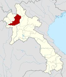
Oudomxay (also Udomxay , Lao ອຸ ດົມ ໄຊ ) is a province in the northwest of Laos . The provincial capital is called Muang Xay .
geography

Neighboring provinces are (clockwise from north): Phongsali , Luang Prabang , Sayaburi , Bokeo and Luang Namtha . In the northwest there is an approximately 15-kilometer-long border with the Xishuangbanna Autonomous District of the People's Republic of China .
With an area of 15,370 square kilometers, Oudomxay is the ninth largest province in Laos.
topography
The topography of Oudomxay is strongly characterized by mountains and hills. Heights vary between 300 and 1800 meters above sea level.
Waters
About 60 rivers flow through Oudomxay, the largest of which are Nam Phak, Nam Sae, Nam Beng, Nam Kor and Nam Nga. The provincial capital Muang Xay is traversed by the Nam Kor.
history
The province was created in 1976 when it was split off from Luang Prabang Province . In 1987, Muang Xay became the capital in place of Ban Nahin .
In 1992, the Paktha and Pha Oudom Districts were assigned to Bokeo Province.
Local history books give the history of the provincial ethnic groups as follows:
Already before the year 700 Oudomxay was settled by members of the ethnic group of the Khmu (also "Khom"). Around 1260, Lao Ly settled in Oudomxay , who came from the Sipsongpanna region ("twelve thousand rice fields") in southern China. They founded a village called Ban Luang Cheng ("big village"), which laid the foundation stone for today's provincial capital, Muang Xay . Ban Luang Cheng is now a district of Muang Xay, called "Ban Cheng" for short.
The Ly culture, which was shaped by Buddhism on the one hand and by traditions of the Khmu on the other, became very influential in the province. Ly and Khmu lived on overlapping areas in the province and cultivated rice fields together. To protect against enemies, fortifications were built between the two villages of Ban Na Sao and Ban Na Lai.
Thai peoples like the Thai Dam (also "Thai Sor") and Thai Khao ("Thai Dong") came from Muang Theng and Dien Bein Fu in North Vietnam to settle in Oudomxay.
Members of the Hmong ethnic group came to Oudomxay from China in 1828; the first settlement areas are not known.
Demographics
The exact proportions of the approximately 14 different ethnic minorities living in the province in the population of Oudomxay have not yet been determined. According to the provincial administration, the following estimates can be assumed:
- Khmu (including Khmu Lu, Khmu Khong, Khmu Am, Khmu Bit) 60–80%
- Lao Loum 25%
- Hmong (including Hmong Khao, Hmong Dam and Hmong lai) 15%

Also represented are:
- Akha
- Phouthai (including Thai Dam and Thai Khao )
- Phou Noy (Phou Xang, Phou Kongsat, Phou Nhot)
- Lao Houy (also "Lenten")
- Phouan
- Ly
- Yang
- Ikho
- Ho
climate
The Oudomxay Province has a temperate monsoon climate . Due to higher elevations, there are greater annual temperature fluctuations and a cooler dry period than in the rest of the country.
- from April to September: rainy season
- from October to January: cold dry season
- from February to March: warm dry season
The annual rainfall is around 1900 mm – 2600 mm. Temperatures are around 18-19 ° C from February to March and over 31 ° C from April to May.
Infrastructure
Due to the topographical conditions of Oudomxay, the expansion of the infrastructure is very complex and is therefore only progressed slowly. Many villages have no access to a road, which prevents access to important social infrastructure such as schools or hospitals. The population of these villages is also as good as cut off from integration into the regional markets where they could sell their agricultural products. Administrative institutions can often hardly or only very poorly be reached by people who live in remote areas.
The severely restricted accessibility of the mountain villages also hinders the economic development of the rural regions.
The supply of electricity to households is below 10% in many areas. Only in the few larger towns like Muang Xay is sufficient supply guaranteed.
Agriculture and Forestry
Around 40,000 hectares of land are cultivated in Oudomxay for agriculture, with rice being the main type of cultivation.
Subsistence farming
The province of Oudomxay is still strongly characterized by subsistence farming. Slash-and- burn agriculture is predominantly practiced , mostly in connection with dry rice cultivation - 45% of the rural villages of Oudomxay are dependent on this type of arable farming due to the mountainous topography of the province. This form of agriculture is labor-intensive and uses a lot of land, as it takes time to restore the soil to its original productivity.
Wet rice cultivation is only possible in flat plains, i.e. especially in the valley areas, which in Oudomxay are in the minority in terms of area.
Both the rice on the numerous mountain slopes and most of the less cultivated areas in the valleys are irrigated only by natural precipitation. Few rice fields in the valleys have artificial irrigation systems.
Other important crops are corn , soybeans , fruits, vegetables, cassava ( manioc ), coffee, sugar cane , tobacco , cotton , tea and peanuts .
In cooperation with international organizations, the government tries to increase agricultural yields through measures for the sustainable use of resources.
In addition to the use of the land as cultivation area for various crops, around 400,000 hectares of land are forested or used as pastures. Animal husbandry, especially water buffalo , pigs , cattle and chickens , is an important component of the livelihood of the rural population. IUCN estimates that around 12% of Oudomxay's forests are primary and 48% are secondary. The forests are not only suppliers of wood for the population, but also contribute to the income of families with fruits, herbs and meat.
Cash crops
The region, which for a long time was only characterized by shifting cultivation and subsistence farming, is slowly opening up to the use of the highlands for multifunctional and commercial purposes.
In addition to the traditional subsistence economy, “ cash crops ” are now playing an increasingly important role, with corn and sugar cane being the most important cultivation and export products: In 2004, around 10,000 tons of sugar cane and 45,000 tons of corn were produced in Oudomxay. Onions, watermelons and tobacco are also exported. The production quantities of the various products vary greatly from year to year, as the fluctuating world market prices give farmers different incentives to choose one or the other cultivation product. This applies above all to sugar cane and corn, cultivated products that are mainly exported to China, where they are processed into industrial sugar or alcohol, for example. There is no further processing in the region, which means that opportunities for added value remain unused.
Individual farmers often conclude contracts with Chinese investors: they often make better seeds available, but also determine the crop and its price. This practice creates a certain - common on the world market - dependency. It also happens that Laotian fields are rented to the Chinese and cultivated by Chinese migrant workers.
tourism
For some years now, efforts have been made in Oudomxay to promote the burgeoning tourism and use it as an opportunity to reduce the poverty of the population. A tourism office has existed since 1997 and has been supported by the German Development Service (DED) since March 2005 - with the aim of boosting the income of rural communities and small businesses in particular through tourism and thus contributing to the protection of natural resources. In August 2007, the tourism office was elevated to a government department ("Provincial Tourism Department ").
development
Due to the location of Oudomxay as the most important traffic junction in northern Laos (the only road from south to north leads via Muang Xay), the province has been mainly visited by tourists in recent years, for example from Luang Prabang to Luang Namtha.
The average length of stay of tourists in the provincial capital was short. Oudomxay had the image of a touristically undeveloped transit place, which was reflected in the presentation of the place in popular travel guides in 2004.
This image has been changing for several years. Oudomxay is now seen more as a province in which one can experience the “original” Laos individually, especially in terms of ecotourism. For several years now, the tourist office in Oudomxay has been offering guided trekking tours, a cooking class and a workshop in traditional paper making. In Oudomxay there are now two travel agencies, one of which offers guided bike tours through Laos.
According to the “Statistical Report on Tourism in Laos 2008” by the “Lao National Tourism Administration”, the number of tourists in Oudomxay increased from around 18,600 to around 102,000 between 2001 and 2008. Around 17% of all 1.7 million travelers to Laos came to Oudomxay in 2008. According to the report, Oudomxay has eight hotels and around 52 guesthouses. Most of these are located in the provincial capital, Muang Xay, followed by the Pak Beng river traffic junction.
potential

A total of 1286 beds are available in the province of Oudomxay (as of 2006). In 2008, the occupancy of these available beds was around 60% (compared with Luang Prabang: 73%).
The previously untapped tourist potential of Oudomxay is particularly clear from the example of the recently rediscovered “ Chom Ong ” cave :
The "Chom Ong Cave", 45 kilometers from Muang Xay, is the largest known cave in Northern Laos. It has a length of more than 16 kilometers, ceiling heights of up to 50 meters, a river running in the cave and is described by various speleology magazines as "unique" ("exeptionelle") and as the "most important discovery and main attraction" in Northern Laos designated.
The road conditions on the way to the village of Chom Ong Thai, from which the cave can be reached in about an hour's walk, are very poor, especially in the rainy season. Due to the difficult access to the cave, one day each for arrival and departure must be planned.
With regard to other offers such as trekking tours in villages of ethnic minorities (for example the Khamu), these infrastructural restrictions do not exist, which is why they are used a little more.
Flora and fauna
The vegetation of Oudomxay is characterized by monsoon forests. Various types of bamboo , an abundance of flowering plants (for example orchids ), but also teak and mahogany can be found in the province. The last-mentioned, dearly traded hardwoods are important sources of income for the population.
Natural resources
Oudomxay has salt , bronze , zinc , antimony , lignite , kaolin and iron deposits .
Administrative units
The province consists of the following districts:
| code | District | Lao |

|
|---|---|---|---|
| 04-01 | Xai (Xay) | ເມືອງ ໄຊ | |
| 04-02 | La | ເມືອງ ຫຼາ | |
| 04-03 | Namo (Namor) | ນາ ໝໍ້ | |
| 04-04 | Nga | ເມືອງ ງາ | |
| 04-05 | Beng | ແບ່ງ | |
| 04-06 | Houn (Hoon) | ຮຸນ | |
| 04-07 | Pakbeng | ປາກ ແບ່ງ |
Individual evidence
- ↑ Linda Dailey Paulson: Bokeo . In: David Levinson, Karen Christensen (Eds.): Encyclopedia of Modern Asia . tape 1 . Charles Scribners & Sons, New York 2002, ISBN 978-0-684-80617-4 , pp. 304 .
- ↑ Khana Sinam Gaan Khon Khua Hiabhiang (Provincial Government Leader Group of Research and Data Collection): “Phavatsaat Muunsya Khweeng Oudomxay” (History of Oudomxay Province) , 2004, pp. 19-28
- ^ A b c d Oudomxay Provincial Tourism Department: Welcome to Oudomxay Lao PDR brochure In: Tourist Department Reference Library, Oudomxay Provincial Government
- ↑ a b Leek 2007: Rural Livelihood Strategies and Natural Resources in Oudomxay, Lao PDR p. 1
- ^ A b W. Roder Slash and Burn Rice Systems in the Hills of Northern Lao PDR: Description, Challenges, and Opportunities. 2001
- ^ Lao Atlas 2009 . Retrieved December 10, 2009.
- ↑ Agriculture in Oudomxay Province ( Memento of the original from July 21, 2011 in the Internet Archive ) Info: The archive link was inserted automatically and has not yet been checked. Please check the original and archive link according to the instructions and then remove this notice. . Provincial Tourism Department Oudomxay website. Retrieved November 19, 2009.
- ^ S. Thongmanivong and Y. Fujita 2006: Recent Land Use and Livelihood Transitions in Northern Laos ; in "Mountain Research and Development", pp. 242-244
- ^ German Development Service: Oudomxay Annual Report 2009
- ↑ Trekking Tours ( Memento of the original from September 18, 2009 in the Internet Archive ) Info: The archive link was inserted automatically and has not yet been checked. Please check the original and archive link according to the instructions and then remove this notice. Provincial Tourism Department Oudomxay website. Retrieved January 15, 2010.
- ↑ Activities in Town ( Memento of the original from July 21, 2011 in the Internet Archive ) Info: The archive link was inserted automatically and has not yet been checked. Please check the original and archive link according to the instructions and then remove this notice. . Provincial Tourism Department Oudomxay website. Retrieved January 15, 2010.
- ^ A b Lao National Tourism Administration; Planning an Cooperation Department; Statistics Unit: " 2008 Statistical Report on Tourism in Laos "
- ^ A b British Cave Research Association: Speleology , May 13, 2009, p. 34
- ↑ Michael Laumanns / Francois Brouiquisse La nouvelle plus longe grotte du Nord Laos In: Spelunca No. 113, 2009, p. 9.
- ↑ Lonely Planet 2008: Laos p. 73
Web links
Provinces: Attapeu | Bokeo | Bolikhamsai | Champasak | Houaphan | Khammuan | Luang Namtha | Luang Prabang | Oudomxay | Phongsali | Sainyabuli | Salavan | Savannakhet | Saysomboun | Sekong | Vientiane | Xieng Khouang
Prefecture: Vientiane