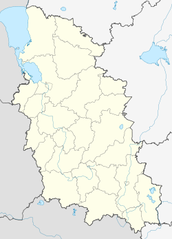
Palkino (Pskov)
| Urban-type settlement
Palkino
Палкино
|
||||||||||||||||||||||||||||
|
||||||||||||||||||||||||||||
|
||||||||||||||||||||||||||||
Palkino ( Russian Па́лкино ) is an urban-type settlement in the Pskov Oblast in Russia with 2924 inhabitants (as of October 14, 2010).
geography
The place is about 40 km as the crow flies southwest of the Pskov Oblast Administrative Center on Lake Smolina ( Lake Smolinskoje). The Lake entfließt the Smolinka that nearly 10 km east from the left of the Velikaya flows.
Palkino is the administrative center of the Rajons Palkinski . The settlement is the seat and only locality of the municipality (gorodskoje posselenije) Palkino and the rural municipality (selskoje posselenije) Palkinskaja wolost with almost 150 villages, to which Palkino itself does not belong.
history
The place arose from several villages, one of which was first mentioned in the 16th century under the name Palkino . Nearby, on September 13, 1502, the Battle of Lake Smolina between troops of the Livonian Confederation and the Grand Duchy of Moscow took place. As a result, the village belonged to the Ujesd Pskow of the Pskow governorate and became the seat of a Volost .
On August 1, 1927, Palkino became the administrative seat of a newly created Rajons named after him, which was temporarily dissolved from September 20, 1931 to February 15, 1935. During the Second World War , Palkino was occupied by the German Wehrmacht on July 8, 1941, and recaptured by the Red Army on July 27, 1944 as part of the Pskov-Ostrower operation .
Since October 15, 1985, Palkino has had urban-type settlement status.
Population development
| year | Residents |
|---|---|
| 1939 | 512 |
| 1959 | 925 |
| 1970 | 1334 |
| 1979 | 1845 |
| 1989 | 3406 |
| 2002 | 3201 |
| 2010 | 2924 |
Note: census data
traffic
The regional road 58A-313 runs through Palkino, which connects Isborsk , located 20 km north-northwest on the federal highway A212 Pskov - Estonian border (part of European route 77 ), with the south-east neighboring Ostrov district center on the federal highway R23 Saint Petersburg - Pskov - Belarusian border (part of the European route 95 ) connects. Down the Velikaya, the 58K-327 leads directly to the Pskov oblast center.
The nearest railway stations are in Ostrow on the route Saint Petersburg - Pskov - Daugavpils ( Latvia ) and distant km in also about 30 north Nowy izborsk (Station Nowoisborsk ) on the route Pskov - Pechory - Estonian border.
Web links
Individual evidence
- ↑ a b Itogi Vserossijskoj perepisi naselenija 2010 goda. Tom 1. Čislennostʹ i razmeščenie naselenija (Results of the All-Russian Census 2010. Volume 1. Number and distribution of the population). Tables 5 , pp. 12-209; 11 , pp. 312–979 (download from the website of the Federal Service for State Statistics of the Russian Federation)


