Newel (Pskov)
| city
Newel
Невель
|
||||||||||||||||||||||||||||||||||||||||
|
||||||||||||||||||||||||||||||||||||||||
|
||||||||||||||||||||||||||||||||||||||||
| List of cities in Russia | ||||||||||||||||||||||||||||||||||||||||
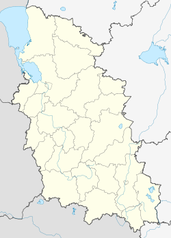
Newel ( Russian: Невель ) is a city with 16,324 inhabitants (as of October 14, 2010) in the Pskov Oblast in northwestern Russia . It is the center of the Rajons Newel and lies on the banks of the lake of the same name, 242 km southeast of the regional capital Pskov . The nearest town is Novosokolniki about 40 km north.
history
A first documented mention of Newel can be traced back to the year 1503. At that time the place was a fortress of Russian tsarism and had a castle. The origin of the city name is assumed in the Baltic Finnish languages and could have meant something like "swamp".
From the 16th to the 18th century, Newel was fought over several times as a border town and at times belonged to Poland-Lithuania , for example for almost 100 years from 1678 to 1772, when the place finally came to the Russian Empire with the First Partition of Poland . Shortly thereafter, Newel received city status and was assigned to the Pskov governorate . In 1778 Tsarina Catherine the Great approved a development plan for Newel. Three years later, the city coat of arms became Newel's official symbol.
In the war against Napoleon in 1812 , Newel again served as a fortress town with several hospitals . In the course of the 19th century, several industrial companies sprang up in the city, and Newel was also known for regular agricultural fairs. It became an important railway junction.
In Newel lived 6,000 Jews in the 1920s, they made up half the population and had a Yiddish state school. During the Second World War , Newel was occupied by troops of the Army Group Center of the Wehrmacht on July 15, 1941, less than a month after the start of the German Russian campaign . In August, a ghetto for the local Jews was set up on the territory of the Golubaya dacha (“Blue Datscha ”) park near the city . On September 6, 1941, there was mass murder of around 800 Jews, mostly women and children, by the SS with the participation of local police forces. A total of about 2000 Jews from Newel Rajon died during the occupation.
In October 1943 Newel was retaken by the Red Army . The city was largely destroyed by the fighting, especially during the reconquest. In the course of intensive industrialization in the post-war period , the damage was largely repaired.
Population development
| year | Residents |
|---|---|
| 1897 | 9,349 |
| 1926 | 12,923 |
| 1939 | 15,569 |
| 1959 | 14,634 |
| 1970 | 17,804 |
| 1979 | 20,579 |
| 1989 | 22,472 |
| 2002 | 18,545 |
| 2010 | 16,324 |
Note: census data
coat of arms
Description: In green, a black rider with a flying silver helmet decoration on a red- bridled black horse over an upturned golden shield base, holding a red shield with a white double cross in his left hand and swinging a silver sword in the other hand .
Economy and Transport
In today's Newel there are around 15 industrial companies, including shoe and textile industries. With two train stations serving two railway lines - namely that from Saint Petersburg to Vitebsk and that from Velikije Luki to Polatsk - the city is an important rail hub. The next trunk road is the R23 , which runs near the city and which also connects to the M9 .
sons and daughters of the town
- Marija Judina (1899–1970), Russian pianist and piano teacher
- Dov Schwartzman (1921–2011), ultra-Orthodox rabbi
- Grigori Woitinski (1893–1953), Soviet politician and sinologist
literature
- Nevel , in: Guy Miron (Ed.): The Yad Vashem encyclopedia of the ghettos during the Holocaust . Jerusalem: Yad Vashem, 2009 ISBN 978-965-308-345-5 , pp. 519f.
Web links
- Unofficial website Newels (Russian)
- Newel on mojgorod.ru (Russian)
Individual evidence
- ↑ a b Itogi Vserossijskoj perepisi naselenija 2010 goda. Tom 1. Čislennostʹ i razmeščenie naselenija (Results of the All-Russian Census 2010. Volume 1. Number and distribution of the population). Tables 5 , pp. 12-209; 11 , pp. 312–979 (download from the website of the Federal Service for State Statistics of the Russian Federation)
- ↑ Memorial Golubaja dacha on the website of the Committee of the Oblast pskov to protect the cultural heritage (Russian)


