Mushroom bucket
| Mushroom bucket | ||
|---|---|---|
|
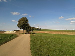
The mushroom bucket from the southeast |
||
| height | 597.8 m above sea level NN | |
| location | Saxony ( Germany ) | |
| Mountains | Ore Mountains | |
| Coordinates | 50 ° 43 '36 " N , 13 ° 5' 53" E | |
|
|
||
The Pilzhübel is 597.8 m above sea level. NN high and about 600 meters long elevation in the Saxon Ore Mountains southwest of the district Krumhermersdorf of the city of Zschopau .
geography
The Pilzhübel is located on the southern edge of the Zschopau widening, where the medium-high mountain ranges begin, which continue southwards to Marienberg. The result is an impressive panorama.
Surname
The name Pilzhübel comes from the early owner of the hooves above it . The name Wittigshübel , which is related to the nearby Wittigsgut, was also in use earlier.
view
From the ridge and the highest point there is an impressive all-round view that is only restricted by the Deutsche Telekom radio tower, which is not accessible. In the southeast you can see large parts of the Bornwald as far as the Adlerstein , in an easterly direction you can see the heights of Saidenberg and Saydaer Höhe. To the north you can see the eastern part of the Zschopau widening with Krumhermersdorf, Waldkirchen , Mörbitz , Augustusburg hunting lodge , Erdmannsdorf , Flöha and the staircases near Frankenberg . When the visibility is very good, you can even see the Collmberg near Oschatz . Götzhöhe , Altenhainer Spitzberg, Galgenberg, Adelsberg and Dittersdorfer Höhe stand out in the northwest . The south-west is dominated by the wide elevation of the Greifenstein area, whose granite cliffs can be seen when visibility is good. Further south follow the striking basalt mountains Pöhlberg , Bärenstein and Scheibenberg of the upper Ore Mountains and behind them Fichtelberg and Keilberg . In the far south is the Dreibrüderhöhe near Marienberg .
literature
- The middle Zschopau area (= values of our homeland . Volume 28). 1st edition. Akademie Verlag, Berlin 1977, pp. 191-192.

