
Plastau
|
Plastau
City of Wittingen
Coordinates: 52 ° 39 ′ 33 ″ N , 10 ° 51 ′ 15 ″ E
|
|
|---|---|
| Height : | 81 m above sea level NHN |
| Area : | 2.67 km² |
| Residents : | 41 (Dec. 31, 2017) |
| Population density : | 15 inhabitants / km² |
| Incorporation : | March 1, 1974 |
| Incorporated into: | Ohrdorf |
| Postal code : | 29378 |
| Area code : | 05836 |
 Location of Plastau in Wittingen
|
|
Plastau is a district of the city of Wittingen in Lower Saxony .
geography

Village center
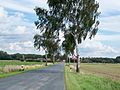
View from the west


Plastau is two kilometers north of Radenbeck and two kilometers south of Zasenbeck in the Gifhorn district . It is also around two kilometers to the border with Saxony-Anhalt . Plastau has 41 inhabitants (as of 2017).
history
On March 1, 1974, the municipality of Plastau came to the municipality of Ohrdorf , which exactly one month later became part of the city of Wittingen.
politics
The head of the village is Eckhard Behn.
Economy and Infrastructure
The place and the surrounding area are dominated by agriculture. There are no street names. Plastau is on the B 244 between Wittingen and Brome . A district road leads west to Schneflingen . A stop on the Wittingen – Rüßen railway line was abandoned in 1974.
Individual evidence
- ↑ Population figures and area from wittingen.de (PDF file, 34 kB, last accessed on May 9, 2017)
- ↑ Population figures from wittingen.de (PDF file, 34 kB, last accessed on August 27, 2019)
- ↑ Mayor of the City of Wittingen , accessed on May 9, 2017
Boitzenhagen | Darrigsdorf | Erpensen | Use | Gannerwinkel | Glüsingen | Hagen | Kakerbeck | Knesebeck | Küstorf | Lüben | Mahnburg | Ohrdorf | Plastau | Wheel | Radenbeck | Schneflingen | Sticks | Suderwittingen | Teschendorf | Transvaal | Pre-hop | Wollerstorf | Wunderbüttel | Zasenbeck