Porto Cristo
| Manacor municipality: Porto Cristo | ||
|---|---|---|

|
||
| coat of arms | Map of Spain | |

|
|
|
| Basic data | ||
| Autonomous Community : | Balearic Islands | |
| Island: | Mallorca | |
| Comarca : | Llevant | |
| Coordinates | 39 ° 33 ' N , 3 ° 20' E | |
| Residents : | 7,355 (2011) INE | |
| Postal code : | 07680 | |
| Area code: | 07033000900 | |
Porto Cristo ("Christ Harbor"), also called Port de Manacor or Es Port , is a tourist destination on the Spanish Balearic island of Mallorca . It is located on the east coast of the island in the region ( comarca ) Llevant . Porto Cristo belongs to the municipality of the inland town of Manacor . The place has 7355 inhabitants (status: 2011), of which 607 live outside the actual settlement core, but in the immediate vicinity. This means that around 18% of the inhabitants of the municipality live in Porto Cristo.
location
Porto Cristo is located 63 kilometers east of the center of Palma and 13 kilometers from Manacor on the Cala Manacor , a natural bay between the Morro de Sa Carabassa and the small peninsula Punta Pagell on the east coast of Mallorca. The town can be reached from the west on the MA-4020 from Manacor, from the south from Cales de Mallorca via the MA-4010 and from the north from Son Carrió via the MA-4024 and from Cala Millor via the MA-4023. Neighboring towns on the coast are the twin towns of Cala Anguila - Cala Mendia in the southwest and S'Illot-Cala Morlanda in the northeast. In the past, Porto Cristo was the port of Manacor.
description

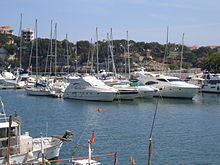
The development of the place extends today around the entire bay of Cala Manacor , into which the torrent Torrent de ses Talaioles flows, in the port area called es Riuet ('the river '). The bay is largely developed as a marina and there is a pier for excursion boats. The older districts of the former fishing village are north of the port. The place was gradually expanded so that the suburbs now reach in the south to the cave system of the Coves del Drac on the bay of Cala Murta and in the northeast almost to the Caló de sa Ferradura . The northern border of the town forms the junction to Son Carrió and Cala Millor. To the west, the expansion of the settlement area has so far been prevented by the meandering river bed of the Riuet .
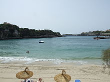
Porto Cristo benefits from its location at the end of the narrow sheltered bay at the mouth of the Riuet . The small port with its yacht berths of the “Club Nàutic de Porto Cristo” founded in 1969 by Joan Servera Amer stretches deep into the interior to the mouth of the stream. There is a small sandy beach in the bay immediately below the town center, east of the landing stage for excursion boats.
Porto Cristo has a lovely old town with narrow streets and numerous historical buildings. In the center is the local church Església Mare de Déu del Carme . Nearby at 31 Carrer d'En Gual there is a branch of the Manacor municipal administration. Some of the new development areas surrounding the old town have the character of villas . Most of the shops and restaurants are concentrated on Passeig de la Sirena behind the pier. On the promenade there is a sculpture by the sculptor Pere Pujol, which was erected in 1988 and replaced a mermaid sculpture that was destroyed in the Spanish civil war .
The entire coastal area of the cliff around Porto Cristo is interspersed with countless caves and rock overhangs, the entrances of which are mostly at sea level, often below. Visiting such caves is therefore not without risk, such as the "pirate caves" near Cala Falcó south of S'Estany d'en Mas , such as the Cova des Moro , the Cova des Pirata or the Cova des Pont . The larger cave systems of the Coves del Drac and the smaller Coves dels Hams are now open to tourists. Smaller caves are also located within Cala Manacor not far from the beach of Porto Cristo, such as the Cova de Sa Patroneta , the Coves Blanques and the Cova des Correu . It is known of the Coves Blanques that these natural caves were already carved out by humans in Talaiotic times. Later they were used as a refuge for seafarers and fishermen.
history
After knowledge of the use of caves like the Coves Blanques in the time of the Talaiot culture, finds in the harbor basin also prove a Roman presence at today's Porto Cristo. Traces of early Christian settlement were discovered in 1909 when the remains of a basilica were excavated, of which only the baptismal font from the 5th century has survived.
According to legend, the name Porto Cristo goes back to a sailor who was rescued from extreme distress at sea in 1260 and who set up a crucifix on site in gratitude for his salvation . The place itself was only founded in 1888. Until then, Cala Manacor was a haven for fishermen in the Manacor region.
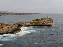
Against the background of the constant attacks and raids by pirates and Moorish pirates on Mallorca's coasts from the 15th to the 18th century, a signal and watchtower, the Torre del Serral dels Falcons , was built in 1577 south of the entrance to the bay . It was part of a network of defense towers that were built along the entire coast of Mallorca. In the Spanish Civil War by a bomb attack by the Republican destroyed troops, it was restored by the owner and can be visited today.
Porto Cristo was one of the few places in Mallorca that got involved in the Spanish Civil War when republican troops landed on the island on August 16, 1936 during the Battle of Mallorca and occupied parts of the east coast. The advance was repulsed by September 12, 1936 by the nationalist troops and their Italian allies.
At the beginning of the 21st century, a legal dispute arose over the high bridge built between 1999 and 2003 over the Torrent d'es Riuet at the port, over which the main road to Cales de Mallorca leads. A court declared the construction approved by the politicians at the time to be illegal. At the end of 2011, a northern alternative route had to be built in order to enable the demolition of the high bridge, which was to cost almost one million euros and which took place in October / November 2011. In order to relieve the town center, a bypass road was built for 4.7 million euros, which was inaugurated on June 12, 2012.
Culture and sights
Churches
Església Mare de Déu del Carme
The Mare de Déu del Carme local church on Plaça del Carme is dedicated to the patroness of the fishermen and sailors Mare de Déu del Carme and is built in the neo-Romanesque style.
Aquarium
The Aquàrium of the village in Carrer Gambí 7 , which opened in 1974 and has since been closed (February 2010), showed the flora and fauna of the Mediterranean and other places of the underwater world in 115 showcases on two floors .
Buildings
The signal and watchtower, built in 1577, stands south of the entrance to Cala Manacor on the Serral dels Falcons , at the end of Avinguda d'en Joan Servera Camps . It is also known as Torre de Porto Cristo or historically under the names Torre de Manacor , Torre de Cala Manacor or Torre del Port de Manacor . The tower was badly damaged during the Spanish Civil War in 1936 by a bomb attack by Republican troops during the temporary occupation of the east coast. After the restoration by the owners, it can now be viewed free of charge. With its predestined location at the port entrance, it is a landmark of Porto Cristo.
Baptisteri Basílica Sa Carrotja
The scanty remains of the first Majorcan Christians in the Porto Cristo area were discovered in 1909 on Avinguda d'en Joan Amer on the Punta Pagell peninsula . Only the baptismal font has been preserved from the early Christian basilica Sa Carrotja from the 5th century.
caves
Coves del Drac
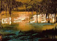
The Coves del Drac ("Dragon Caves") are located on the Carretera de les Coves road in the direction of Cales de Mallorca and are immediately south of the development of the village of Porto Cristo. The entrance to the caves is near Avinguda d'en Joan Servera Camps , a road that continues towards the coast to the Torre dels Falcons . The stalactite cave system of the Coves del Drac extends over 1700 meters, about one kilometer of which is accessible. In it is the largest underground lake in Europe and one of the largest in the world, the Llac Martel or Martelsee . The lake is named after the French cave explorer Édouard Alfred Martel , who in 1896 managed to explore and map about 1,300 meters of the cave system. The Llac Martel is 177 meters long and an average of 40 meters wide, with a depth of up to 9 meters. Today classical concerts are performed there every day, with the musicians on individual boats moving through the grotto. The plays of light in the caves, which were opened to visitors from 1935, date back to 1934 by the engineer Dr. Carles Buïgas i Sans.
Coves dels Hams
The Coves dels Hams ("Fish Hook Caves") were discovered on March 2, 1905 by Pedro Caldentey . They are about a kilometer west of Porto Cristo on the road to Manacor. There is also an underground lake in this ramified cave system, but it is less extensive than the one in the Coves del Drac . The explorer's son, Lorenzo Caldentey, equipped the caves with the lighting that can be seen today. There are guided tours in small groups including short concerts for visitors.
Coves Blanques
The small natural caves of the Coves Blanques ("White Caves") are located on the east side of Cala Manacor not far from the beach of Porto Cristo. The interesting thing about them is that traces of elaborations from the time of the Talaiotic were discovered in them. Later they were used as a refuge by seafarers and fishermen.
Beach
The resort's approximately 200 meter long beach is located within Cala Manacor across from the marina. It extends below the Passeig de la Sirena between the southwestern ship landing stage to Plaça Costa d'en Bau in the northeast. The beach is separated from the Carrer Bordils street and the parking lots behind it only by a wall. Access is via stairs from the higher street. The average width of the beach is 14 meters with a maximum width of 20 meters. In 2006 both the sandy beach in the area of the port of Porto Cristo and the marina itself received the " Blue Flag " for excellent water quality.
Festivals
Festa popular de Sant Antoni
The feast of Sant Antoni in honor of Saint Anthony is celebrated in Porto Cristo on January 16 and 17 each year. It begins on the evening of January 16 with a “Fire Night” and the “Dance of the Devils”. On the afternoon of January 17th, after a parade, the animal blessing "Beneïdes" takes place.
Festa de Mare de Déu del Carme
Every year on July 16, the feast of the patron saint of fishermen Mare de Déu del Carme is celebrated. On this occasion there is a fireworks display as well as a procession of fishing boats at sea and a night market on the promenade.
Markets
The weekly market in Porto Cristo takes place every Sunday morning on Passeig de la Sirena .
Personalities
- From the 1920s, Juan Servera Camps (1878–1957) lived in Porto Cristo. He opened the dragon caves to the public.
- The Spanish tennis coach Toni Nadal (* 1961) lives in the village .
literature
- “Information, culture and leisure”, brochure by the Ajuntament de Manacor , Delegació de Turisme
- “Coastal travel guide from the air - Mallorca”, author: Bartomeu Amengual Gomila, publisher geo planeta
Web links
- Porto Cristo website
- Map of Porto Cristo (PDF file; 2.6 MB)
Individual evidence
- ^ INE Accessed December 7, 2012 (English / Spanish).
- ^ Controversy over bridge: Alkalde resigned . In: Mallorca Magazin . No. 35/2011 . Palma September 1, 2011, p. 10 .
- ↑ Demolition of the bridge: It’s down to business (No longer available online.) In: mallorcazeitung.es. October 13, 2011, formerly in the original ; Retrieved June 25, 2012 . ( Page no longer available , search in web archives ) Info: The link was automatically marked as defective. Please check the link according to the instructions and then remove this notice.
- ↑ Porto Cristo inaugurates the bypass. In: mallorcazeitung.es. June 7, 2012, Retrieved June 25, 2012 .
- ↑ Bartomeu Amengual Gomila: Mallorca's coasts from the air . Detailed and practical travel guide with aerial photos of Mallorca's coasts. 6th edition. Editorial GeoPlaneta, Barcelona 2000, ISBN 84-08-01821-3 , Portocristo, p. 70 (Spanish: Aeroguía del litoral de Mallorca . Translated by Gabriele Grauwinkel and Susanne Pospiech).


