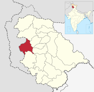
Punch (District, India)
| District Punch | |
|---|---|

|
|
| Union Territory | Jammu and Kashmir |
| Division : | Jammu |
| Administrative headquarters : | Punch |
| Area : | 1674 km² |
| Residents : | 476,835 (2011) |
| Population density : | 285 inhabitants / km² |
| Website : | http://poonch.nic.in/ |
Punch (also Poonch ; Urdu ضلع پونچھ, Hindi पुंछ ) is a district in the Indian Union Territory of Jammu and Kashmir .
The district is bounded on three sides by the Line of Control (LoC). In 1947/48, the then Punch district was divided in the war between India and Pakistan.
administration
The administrative seat of the district is the city of Punch . The district is divided into eight tehsils : Haveli, Mandi, Mendhar, Surankote, Chandak, Mankote, Balakote and Bufliaz. The district is further divided into six blocks: Punch, Mandi, Mendhar, Balakote, Surankote and Buffliaz. Each block consists of a series of panchayats .
economy and politics
In 2006 the Ministry of Panchayati named Raj Punch on a list of the 250 least developed districts in India. The district is one of three in Jammu and Kashmir to receive funding from the Backward Regions Grant Fund Program (BRGF).
The district has three constituencies: Surankote, Mendhar and Poonch Haveli.
population
According to the 2011 census, the district has 476,835 inhabitants. It ranks 549 out of 640 in India. The population density is 285 inhabitants per square kilometer. The population growth from 2001 to 2011 was 27.97%. The gender distribution was 893 women per 1,000 men. The literacy rate was 66.74%. 87% of the population are Muslim.
The district's ethnic groups include the Gujjar, Bakerwal, Pahari, Punjabi, Kashmiri, and Rajputs . The Gujjar mostly live on the slopes of the mountains, where they cultivate small fields and keep cattle. The Bakerwal are a nomadic people. Gujjar and Bakerwal speak Gojri while the rest of the population, with the exception of the Kashmiri, speak Pahari / Poonchi. The common language is an important link between the different ethnic groups.
traffic
A bus that connects Punch with Rawalakot via the LoC is an important contribution to peace in the disputed region.
The Indian army maintains a runway, which is used almost exclusively by army aircraft.
gallery
See also
Web links
Individual evidence
- ↑ Statement showing the number of blocks in respect of 22 Districts of Jammu and Kashmir State including newly Created Districts ( Memento from September 10, 2008 in the Internet Archive ) from March 13, 2008, accessed on August 30, 2008 (PDF)
- ^ A b Ministry of Panchayati Raj: A Note on the Backward Regions Grant Fund Program . National Institute of Rural Development. September 8, 2009. Archived from the original on April 5, 2012. Info: The archive link was automatically inserted and has not yet been checked. Please check the original and archive link according to the instructions and then remove this notice. Retrieved September 27, 2011.
- ↑ 2011 census data, Punch District
- ↑ Sumantra Bose, Geography, Politics and the Fighters of Kashmir ( December 16, 2011 memento in the Internet Archive ) London School of Economics
- ↑ About Poonch - Official site of District Poonch of J&K
Coordinates: 33 ° 46 ' N , 74 ° 6' E


