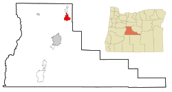
Redmond, Oregon
| Redmond | |
|---|---|
| Nickname : The Heart of Central Oregon | |
 Business Highway 97 in Redmond |
|
| Location in county and state | |
| Basic data | |
| Foundation : | 1910 |
| State : | United States |
| State : | Oregon |
| County : | Deschutes County |
| Coordinates : | 44 ° 16 ′ N , 121 ° 11 ′ W |
| Time zone : | Pacific ( UTC − 8 / −7 ) |
| Residents : | 26,215 (as of 2010) |
| Population density : | 602.8 inhabitants per km 2 |
| Area : | 43.49 km 2 (approx. 17 mi 2 ) of which 43.49 km 2 (approx. 17 mi 2 ) is land |
| Height : | 938 m |
| Postal code : | 97756 |
| Area code : | +1 (541) 923 |
| FIPS : | 41-05800 |
| GNIS ID : | 1137914 |
| Website : | www.ci.redmond.or.us |
| Mayor : | George Endicott |
 Milton Odem House |
|
Redmond is a city in Deschutes County , Oregon , United States that was founded on July 6, 1910. It is east of the Cascade Range , in the High Desert, in the middle of Central Oregon consisting of Deschutes, Jefferson and Crook Counties . Starting from Redmond, there are a variety of options for active recreation, such as fishing , hiking , camping , climbing , rafting , skiing and golf . The population was 26,215 at the 2010 US census .
The urban area covers 43.49 km² and lies on a plateau at an altitude of 938 m. Redmond is 15 miles north of Bend - the county seat of Deschutes County - 232 km southeast of Portland and 208 km east of Salem - the capital of Oregon.
history
Oregon was a United States state for 45 years before Redmond was founded in 1910 as a city of fewer than 300 people. It was named after Frank T. Redmond, who had settled in the area with his wife Josephine since 1905. As early as 1911, just one year after it was founded, Redmond was electrified and connected to the railroad . The latter led to farmers and traders settling in the area. By 1930, Redmond had around 1,000 residents, with the population nearly doubling by 1940. In the 1940s, due to the Second World War , Redmond served as the base for the US Army Air Forces and Roberts Field laid the foundation for commercial aviation in the area. After the Second World War, the population grew only quite slowly, which only began to change in the 1980s. However, in the 1990s, along with the rest of Deschutes County, the population began to grow rapidly. Between 2000 and 2006, when it reached 23,500, it increased by as much as 74.3%, making Redmond one of the fastest growing cities in Oregon. The growth was mainly due to the jobs available and the comparatively low cost of living .
The National Park Service listed four structures and sites on the National Register of Historic Places for Redmond in 2019 , including the Milton Odem House .
geography
Redmond lies at an altitude of 938 m .
Redmond is 15 miles north of Bend, Oregon on US Highway 97 and 2 miles south of Smith Rock State Park . Based on data from the United States Census Bureau , the urban area covers an area of 43.49 km². The climate in Redmond is typical of the high desert and is due to both the location east of the Cascade Range and the altitude and the latitude (which roughly corresponds to that of Genoa ).
The Horse Lava Tube System runs from Redmond Caves , where it enters the metropolitan area, to Redmond Canyon and beyond.
traffic
air
In Redmond, Roberts Field is the Central Oregon airfield with a connection to commercial air traffic. It is served by Alaska Airlines , American Airlines , Delta Air Lines and United Airlines and has direct flights to Portland , Seattle , Denver , Salt Lake City , Los Angeles and San Francisco . The US Forest Service also uses the airfield as a base and training facility for fighting forest fires . The local company Butler Aircraft also operates forest fire-fighting flights from Roberts Field.
Streets
Redmond is located at the intersection of US Highway 97 and Oregon Route 126 and thus offers a north-south connection as well as an east-west route that leads from the coast to central Oregon.
train
The city is connected to the rail network via a BNSF line, which runs along the north-south axis through Redmond, and also has branches from the route for various freight customers. The nearest passenger train station, which Amtrak serves, is in Chemult, Oregon, a town with about 300 residents, about 120 km south.
Web links
Individual evidence
- ↑ US Census Bureau QuickFacts: Redmond city, Oregon; United States. United States Census Bureau , accessed July 5, 2020 .
- ↑ Search mask database in the National Register Information System. National Park Service , accessed January 7, 2019.
- ↑ US Gazetteer files 2010 . United States Census Bureau . Archived from the original on February 20, 2011. Retrieved on December 21, 2012.
- ^ Skeels: Horse Lava Tube System . February 13, 2009. Archived from the original on August 21, 2008. Retrieved July 5, 2009.
- ^ Duane E. Champion: Mapping Newberry Volcano's Extensive North Flank Basalts . May 2002. Retrieved July 27, 2009.
