
Ritzville
| Ritzville | |||
|---|---|---|---|
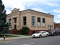
 The Gritman Building in Downtown Ritzville |
|||
| Location in Washington | |||
|
|||
| Basic data | |||
| Foundation : | 1888 (as Town ) and again on July 17, 1890 (as City ) ( incorporated , i.e. recognized as a local authority ) | ||
| State : | United States | ||
| State : | Washington | ||
| County : | Adams | ||
| Coordinates : | 47 ° 8 ′ N , 118 ° 23 ′ W | ||
| Time zone : | Pacific ( UTC − 8 / −7 ) | ||
| Residents : | 1,665 (as of 2015) | ||
| Population density : | 378.4 inhabitants per km 2 | ||
| Area : | 4.40 km 2 (approximately 2 mi 2 ) of which 4.40 km 2 (approximately 2 mi 2 ) is land |
||
| Height : | 554 m | ||
| Postal code : | 99169 | ||
| Area code : | +1 509 | ||
| FIPS : | 53-58725 | ||
| GNIS ID : | 1512607 | ||
| Website : | City of Ritzville | ||
 Location of Ritzville in Adams County |
|||

Ritzville is a city ( City ) in Adams County in the State of Washington . As of the 2010 United States Census , Ritzville had 1,673 residents. The city is the county seat of Adams County. It is part of the Micropolitan Statistical Area Othello , which includes all of Adams County and is part of the larger Combined Statistical Area Moses Lake-Othello.
history
The first white settler in what is now Ritzville was William McKay in 1880. The city was named after Philip Ritz, who settled in the area two years earlier. By December 1880, the location of Ritzville was parceled out by John W. Sprague on behalf of his company, the Northern Pacific Railway . In 1881 McKay built the city's first house. The slope of the Northern Pacific was built in the neighborhood and McKay's home was used as a makeshift hotel for workers and relatives passing through.
The railroad brought a new wave of settlers to the area. In the summer of 1881 McKay opened the first shop and the railway built a train station nearby, which also served as a hotel, theater and meeting room. At that time there were around 50 greenhorns living in the village and the school consisted of a simple shelter at a house. The city's water supply came from the railroad's water tank because it was not expected to find groundwater. The first Adams County services were held in Ritzville at the McKay home in April 1882, and the First Congregational Church was organized soon after; a church building should be built in 1885. The post office was founded in 1883 by JL Johnson of Walla Walla , who also bought McKay's shop. Many other businesses were soon to open in the city. At the end of the 1880s, the city began to play its leading role in the wheat trade of the "Big Bend Country" (Eng. About land on the Great Loop [Columbia]) and continued to grow.


When the city's water supply from the railroad's water tank began to run out, a search for groundwater was initiated. No water was found at first, but a well was eventually drilled about a mile (1.6 km) east of the village. Most of the landowners agreed to move the town to the source, only a large hotel that could not be moved was left out. Finally, water was found in the original location as well, and the town did not have to be relocated. By 1887, Ritzville had three general stores, a drugstore, a saloon, two farriers, two woodpiling areas, two boarding houses, a harness maker, two hotels and a large two-story school building for 100 students.
On June 6, 1888, a fire broke out due to a defective chimney , which extinguished almost the entire business district of the city. Ritzville did not have a fire station at the time, and residents were unable to fight the flames effectively. Reconstruction got under way quickly and in 1889 the first stone building was erected by the city's first mayor, NH Greene. It still stands and is now part of the Ritzville Historic District , an ensemble of buildings listed on the National Register of Historic Places .
In the wake of the fire Ritzville in 1888 as a small town ( Town ) and again on 17 July 1890 as a city ( City recognized) after Washington became the state. The first bank, The Adams County Bank (later First National Bank ), followed in April 1891. The Adams County's first permanent courthouse was built in 1892. After another fire in downtown in 1894, a waterworks for $ 20,000 was installed.
After the stock market crash of 1893 subsided around 1898, Ritzville experienced a new boom that demanded new land and houses to be built. A telephone network was put into operation in August 1899. By the turn of the century, the population had grown to 1,200 people. Finally, in 1901, a volunteer fire brigade was founded, the equipment of which was financed by the citizens. In the same year, Ritzville won the title of the largest wheat trading center in the world. Between August 1901 and August 1902, an estimated 1,967,725 bushels (69,340,804.87 liters) of wheat were stored in the Ritzville warehouses for shipment and 1,990 wagons of wheat and flour were sold. These numbers were only reached in 1902. On January 17, 1902, Ritzville was electrified with the help of a dynamo powered by a steam engine . The Chamber of Commerce was founded in 1903. The following year the courthouse was doubled. A Carnegie Library was established in the city in 1907 , the only one in Adams County. It still serves as the city library today.
Until the Great Depression , growth slowed and Ritzville established itself as a small town. In the 1960s, Interstate 90 was built around the south end of town; the US Highway 10 was replaced as and US Highway 395 realigned in Washington, so the traffic on the inner city was bypassed. The town's limited development added to its charm from then on and helped designate the Ritzville Historic District in 1990.
Much of the history of Ritzville and Adams Counties is documented in the AM Kendrick Collection. This archive of images, illustrating everyday life in eastern Washington, was originally owned by the Adams County Rural Library District No. 2 (formerly the Ritzville Public Library ), and is now held in digital form in the Washington State Digital Archives .
geography
.jpg)
Ritzville is located approximately 53 mi (85 km) southwest of Spokane on Interstate 90 and US Highway 395 . According to the United States Census Bureau , the city occupies a total of 4.4 square kilometers, which does not include water.
climate
Ritzville has a semi-arid climate (according to the Köppen and Geiger climate classification , abbreviated "BSk"). The average annual rainfall is 302 mm. The average temperature in January is 27 ° F (-2.8 ° C), in July 69 ° F (20.6 ° C). The mean annual snowfall reaches 20 in (508 mm).
| Ritzville | ||||||||||||||||||||||||||||||||||||||||||||||||
|---|---|---|---|---|---|---|---|---|---|---|---|---|---|---|---|---|---|---|---|---|---|---|---|---|---|---|---|---|---|---|---|---|---|---|---|---|---|---|---|---|---|---|---|---|---|---|---|---|
| Climate diagram | ||||||||||||||||||||||||||||||||||||||||||||||||
| ||||||||||||||||||||||||||||||||||||||||||||||||
|
Monthly Average Temperatures and Rainfall for Ritzville
Source: Western Regional Climate Center
|
||||||||||||||||||||||||||||||||||||||||||||||||||||||||||||||||||||||||||||||||||||||||||
Demographics
| Population development | |||
|---|---|---|---|
| Census | Residents | ± in% | |
| 1900 | 761 | - | |
| 1910 | 1859 | 144.3% | |
| 1920 | 1900 | 2.2% | |
| 1930 | 1777 | -6.5% | |
| 1940 | 1748 | -1.6% | |
| 1950 | 2145 | 22.7% | |
| 1960 | 2173 | 1.3% | |
| 1970 | 1876 | -13.7% | |
| 1980 | 1800 | -4.1% | |
| 1990 | 1725 | -4.2% | |
| 2000 | 1736 | 0.6% | |
| 2010 | 1673 | -3.6% | |
| 2016 estimate | 1626 | -2.8% | |
| US Decennial Census 2015 Estimate |
|||
2010 Census
As of the 2010 census , Ritzville had 1,673 residents, 751 households, and 444 families. The population density was 380 per km². There were 902 housing units at a mean density of 204.9 per km².
The population consisted of 94.5% whites , 0.1% Afro-Americans , 0.8% Indians , 0.5% Asians , 2.4% from other "races" and 1.7 % % from two or more "races" . Hispanics or Latinos of "any race" made up 5.7% of the population.
Of the 751 households, 23% had children under the age of 18, 46.1% were run by married couples living together , 8.7% by single mothers and 4.4% by single fathers; 40.9% were non-families. 36.2% of households were singles and 18% were single people over 65 years of age. The average household size was 2.15 and the average family size was 2.75 people.
The median age in the city was 48.1 years. 20.6% of the population were under 18, 6.4% between 18 and 24, 19.2% between 25 and 44, 30.5% between 45 and 64 and 23.3 65 years or older. 48.8% of the population were men and 51.2% women.
Census 2000
As of the 2000 census , Ritzville had 1,736 residents, 777 households, and 470 families. The population density was 198.4 per km ². There were 873 housing units at an average density of 261.3 per km².
The population consisted of 95.79% white , 0.35% African American , 0.58% Indian , 0.58% Asian , 0.86% other "races" and 1.84 % % from two or more "races" . Hispanics or Latinos of "any race" made up 2.36% of the population.
Of the 777 households, 24.1% had children under the age of 18, 48.5% were run by married couples living together, and 8.9% by single mothers; 39.4% were non-families. 36.4% of households were singles and 17.6% were single people over 65 years of age. The average household size was 2.15 and the average family size was 2.75 people.
The median age in the city was 46 years. 21.7% of the population were under 18, 5.1% between 18 and 24, 21.8% between 25 and 44, 26.3% between 45 and 64 and 25.1 65 years or older. There were 93.5 men for every 100 women, and 86.3 men for every 100 women over the age of 18.
All information on median income relates to the median. The median household income was US $ 32,560, with families it was US $ 40,240. Men had a median income of US $ 32,500 compared to US $ 21,083 for women. The per capita income was US $ 18,308. About 8.4% of families and 14.3% of the total population lived below the poverty line ; this affected 20.1% of those under 18 and 8.6% of those over 65.
Attractions

Five individual buildings in Ritzville are listed on the National Register of Historic Places :
- The Burroughs (Dr. Frank R.) House on Main Street
- the Northern Pacific Railroad Depot
- the Greene (Nelson H.) House on South Adams Street
- the Ritzville Carnegie Library on West Main Street
- the Ritzville High School (also "Old Ritzville High School") on Seventh Avenue. The Burroughs House and the National Pacific Depot have both been ceded to the city and maintained as museums by volunteers.
The Ritzville Historic District , bordered by Broadway, Division Street, Railroad Avenue, and Washington Street is also on the register.
The New Ritz Theater was opened in 1937 and designed by the famous cinema architect Bjarne Moe in the northwest. The architecture and the auditorium for 400 people have been preserved in their original state.
Ritzville is currently hosting the largest annual rodeo in east Washington .
The Ritzville Carnegie Library

The New Ritz Theater

The Northern Pacific Railway Depot


Mirror in pop culture
The grunge band Mudhoney from Seattle played on their 1992er Album Piece of Cake is a one-titled Ritzville song.
Christopher Bingham of the pagan rock band Gaia Consort recorded the two songs Ritzville and South of Ritzville on his 1995 solo album Angel and the Hanged Man .
Individual evidence
- ↑ a b Population Estimates . United States Census Bureau . Archived from the original on October 19, 2016. Retrieved July 12, 2016.
- ^ Find a County . National Association of Counties. Retrieved June 7, 2011.
- ^ Phillips, James W. Washington State Place Names . 8th ed.Seattle: University of Washington Press, 1971.
- ^ A b An Illustrated History of The Big Bend Country, Embracing Lincoln, Douglas, Adams and Franklin Counties . Spokane, Washington: Western Historical Publishing Company, 1904.
- ↑ AM Kendrick Collection
- ↑ AM Kendrick Collection . Washington State Digital Archives. Retrieved June 16, 2013.
- ↑ US Gazetteer files 2010 . United States Census Bureau . Archived from the original on January 24, 2012. Retrieved on December 19, 2012.
- ^ Weatherbase: Weather for Ritzville, Washington, United States of America . Weatherbase. 2007. Accessed December 1, 2007.
- ↑ Ritzville 1 SSE, WASHINGTON (457,059) . Western Regional Climate Center. Retrieved June 6, 2016.
- ^ Population and Housing Unit Estimates . Retrieved June 9, 2017.
- ↑ United States Census Bureau : Census of Population and Housing . Retrieved October 3, 2013.
- ↑ American FactFinder . United States Census Bureau . Retrieved December 19, 2012.
- ^ Historic Ritzville . Retrieved December 5, 2007.
- ^ National Register of Historic Places: Washington, Adams County . National Park Service. Retrieved December 5, 2007.
- ↑ Box Office Magazine, September 8, 1937 . Box Office Media, LLC. Retrieved on June 16, 2013. ( Page no longer available , search in web archives ) Info: The link was automatically marked as defective. Please check the link according to the instructions and then remove this notice.
- ↑ Biography, Bjarne H. Moe . Washington State Department of Archeology and Historic Preservation. Retrieved June 16, 2013.
- ↑ Ruth Kirk, Carmela Alexander: Exploring Washington's Past: a road guide to history . University of Washington Press, Seattle 1990, revised 1995, ISBN 0-295-97443-5 .
swell
- An Illustrated History of The Big Bend Country, Embracing Lincoln, Douglas, Adams and Franklin Counties . Spokane, Washington: Western Historical Publishing Company, 1904.
- Kirk, Ruth and Carmela Alexander (1990, revised 1995) Exploring Washington's Past: a road guide to history (Revised Edition) , University of Washington Press, Seattle. ISBN 0-295-97443-5
Web links
- City of Ritzville - Official Website
- Ritzville Heritage - a local history collection from the Ritzville Public Library and the Adams County Historical Society
- Ritzville Public Library (English)
- History of Ritzville at HistoryLink (English)
- List of known speed traps in Ritzville (English)
- Ritzville Fire Department (English)
- Top Hat Motel Ritzville (English)