Rothenstein (Bad Groenenbach)
|
Rothenstein
Market Bad Groenenbach
Coordinates: 47 ° 52 ′ 1 ″ N , 10 ° 12 ′ 11 ″ E
|
|
|---|---|
| Height : | 687 m |
| Residents : | 32 (December 1, 2009) |
| Postal code : | 87730 |
| Area code : | 08334 |
|
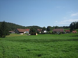
North view of Rothenstein
|
|
The hamlet of Rothenstein is a part of the Kneipp spa Bad Grönenbach in the Unterallgäu district in Bavaria .
geography
topography
Rothenstein is located in Upper Swabia in the Danube-Iller region, about two kilometers southwest of Bad Grönenbach at an altitude of 687 m above sea level. NN . Starting clockwise from the north, Rothenstein is bordered by the Rechberg , the Bad Grönenbach market, Herbisried , the hamlets of Greit , Manneberg and Au . The main part of the village is on the MN21 district road from Bad Grönenbach to Legau, other farmsteads are located on a hill ( 731 m above sea level ) slightly south of it.
geology
The subsoil of Rothenstein consists of the undivided Upper Freshwater Molasse which was formed in the Miocene . The soil consists of clays , silt , marl , sand and partly gravel . The houses on the southern elevation of Rothenstein are partly on gravel from the Mind Ice Age , consisting of gravel, sand and partly conglomerate .
Population development

Architectural monuments
The Rothenstein castle ruins are located south of the village of Rothenstein . The castle, built at the beginning of the 11th century, collapsed on March 9, 1873 in a landslide. There are only a few remains of the wall of the former complex that are under monument protection. Furthermore, a farmhouse with a half-timbered gable and gable roof from the 18th century is a listed building.
Web links
literature
- Karl Schnieringer: Grönenbach - Its development from taking land on the Ach to a market and Kneipp spa . Kurverwaltung Grönenbach, Grönenbach 1975, p. 54-59 .
Individual evidence
- ^ Geological map of Bavaria 1: 500,000. Bavarian State Ministry of Finance, Regional Development and Homeland, accessed on November 21, 2015 .
- ^ Bavarian State Office for the Preservation of Monuments: Entry D-7-78-144-39
- ^ Bavarian State Office for Monument Preservation: Entry D-7-78-144-37


