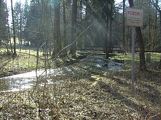
Southern Regnitz
|
Southern Regnitz Czech name: Rokytnice |
||
|
The southern Regnitz at the border triangle Bavaria-Saxony-Bohemia |
||
| Data | ||
| Water code | EN : 5614 | |
| location | District of Hof , Upper Franconia | |
| River system | Elbe | |
| Drain over | Saale → Elbe → North Sea | |
| origin | The confluence of the Zinnbach and the Ziegenbach at Huschermühle 50 ° 18 ′ 20 ″ N , 12 ° 7 ′ 33 ″ E |
|
| Source height | 553 m above sea level NN (Zinnbach: 650 m above sea level, Ziegenbach: 610 m above sea level) | |
| muzzle | at Hof in the Saale coordinates: 50 ° 17 ′ 47 " N , 11 ° 56 ′ 5" E 50 ° 17 ′ 47 " N , 11 ° 56 ′ 5" E |
|
| Mouth height | approx. 480 m above sea level NN | |
| Height difference | approx. 73 m | |
| Bottom slope | approx. 2.2 ‰ | |
| length | 33.8 km | |
| Catchment area | 114.8 km² | |
| Discharge at the gauge Kautendorf A Eo : 92.5 km² Location: 4.7 km above the mouth |
NNQ MNQ 1958/2008 MQ 1958/2008 Mq 1958/2008 MHQ 1958/2008 HHQ (2006) |
4 l / s 90 l / s 877 l / s 9.5 l / (s km²) 9.56 m³ / s 20 m³ / s |
| Left tributaries | Kleppermuehlbach | |
| Right tributaries | Quellitz | |
| Communities | Regnitzlosau , Döhlau | |
The Südliche Regnitz or Obere Regnitz , Rokytnice in Czech , is a right tributary of the Saxon Saale in the district of Hof in Upper Franconia .
geography
It arises from two source streams. The longer rises as Lužní Potok (dt. Zinnbach ) approx 650 m above sea level. NN in the Bieretwiese north of Štítary ( 50 ° 14 ′ 46 ″ N , 12 ° 8 ′ 22 ″ E ) and flows about 9 km mainly to the north, the last 5 km as a border stream between Bavaria and Bohemia . The shorter and more watery second source stream is called Rokytnice in Czech , and the German population calls it the Ziegenbach . Its source is about 610 m above sea level. NN high southeast of Hranice (dt. Roßbach ) shortly before the border to Saxony near the road towards Bad Elster ( 50 ° 17 ′ 26 ″ N , 12 ° 11 ′ 23 ″ E ). After about 7 km in a west-north-westerly direction, it joins the first source stream Lužni potok at the Huschermühle below the Regnitzlosau district of Oberprex . From here to the border triangle of Bavaria-Saxony-Bohemia, the Regnitz forms the state border between Germany and the Czech Republic , then it crosses permanently into German territory. In a wide meadow valley it meanders to the west, then to the southwest through Regnitzlosau. The only settlement on the lower course, which again runs in the main west direction, is Tauperlitz (part of the municipality of Döhlau ). After a total of about 30 km it flows 480 m above sea level. NN in the southeast of Hof in the Saale.
history
A first settlement on the course of the southern Regnitz has been documented as early as the Hallstatt period. At Osseck a. Wald , a burial ground with grave attachments of the Celts was discovered in 1981 . Even in the Middle Ages, the Regnitz area was a relatively early settlement area. However, the mixed forests that were predominant in the past have largely been cleared.
In the Middle Ages the area of today's Bavarian Vogtland was called Regnitzland . The city of Hof was first called Stadt am Regnitzhof , later Hof an der Rekkenze . The first settlement of Hof was probably not far from where the Regnitz flows into the Saale. The Tauperlitz tower hill castle was part of an early system to secure trade on the old streets .
The Klötzlamühle with an overshot water wheel was the last mill operation on the southern Regnitz.
environment
fauna
In the course of the above-mentioned route between the formation near the Huschermühle to the Dreiländereck, the largest river pearl mussel population in Central Europe was to be found until 1947 . In 1947 it is estimated that up to 80% of the population did not survive the extremely hot summer; Even 60 years later, thousands of bowls can be found in the stream bed and on the adjacent meadows. In order to protect the remaining existing stock, a nature reserve was established in the area by both the Bavarian and the Czech side ; Among other things, the embankment was partially secured and the water speed reduced. However, these measures have met with some serious criticism in the regional environment. As older residents report, the largest stocks always lived in the vicinity of mills, of which there were very many on the Regnitz. In order to operate the mills as efficiently as possible, the stream was often cleaned and attention was paid to the rapid flow of water. This makes the current effort appear controversial.
literature
- Johann Kaspar Bundschuh : Regnitz . In: Geographical Statistical-Topographical Lexicon of Franconia . tape 4 : Ni-R . Verlag der Stettinische Buchhandlung, Ulm 1801, DNB 790364301 , OCLC 833753101 , Sp. 449 ( digitized version ).
Web links
Individual evidence
- ↑ a b Complete table of the Bavarian water directory of the Bavarian State Office for the Environment (XLS, 10.3 MB)
- ↑ Bavarian Flood News Service (as of September 9, 2011)

