Sant Joan d'Alacant
| Municipality of Sant Joan d'Alacant | ||
|---|---|---|
| coat of arms | Map of Spain | |

|
|
|
| Basic data | ||
| Autonomous Community : | Valencia | |
| Province : | Alicante | |
| Comarca : | Campo de Alicante | |
| Coordinates | 38 ° 24 ′ N , 0 ° 26 ′ W | |
| Height : | 40 msnm | |
| Area : | 9.64 km² | |
| Residents : | 23,915 (Jan. 1, 2019) | |
| Population density : | 2,480.81 inhabitants / km² | |
| Postal code : | 03550 | |
| Municipality number ( INE ): | 03119 | |
| administration | ||
| Mayor : | Jaime Albero Gabriel ( PSOE ) | |
| Website : | www.santjoandalacant.es | |
Sant Joan d'Alacant (Spanish: San Juan de Alicante) is a south-east Spanish municipality ( municipio ) with 23,915 inhabitants (as of January 1, 2019) in the province of Alicante in the Valencian Community .
geography
Sant Joan d'Alacant is located near the Costa Blanca in southeastern Spain. The center of Sant Joan d'Alacant is about 8 km northeast of Alicante and about 35 km northeast of Elche .
In the northwest, the municipality borders on Mutxamel , in the north on El Campello and in the southwest on Alicante. The city is located in the Alicante-Elche metropolitan area .
Population development
| year | 1900 | 1910 | 1920 | 1930 | 1940 | 1950 | 1960 | 1970 | 1981 | 1991 | 1996 | 2001 | 2006 | 2008 |
| Residents | 3,326 | 3,264 | 2,685 | 2,907 | 3,434 | 3,912 | 5,062 | 7.162 | 10,522 | 14,369 | 16.008 | 17,017 | 20,430 | 21,681 |
education
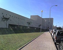
The Miguel Hernández Elche University Health Sciences Campus is located in the community .
Attractions
- San Juan Bautista Church
- Several fortified towers from the 16th century
Web links
Commons : Sant Joan d'Alacant - Album with pictures, videos and audio files
- Homepage of Sant Joan d'Alacant (Spanish, Valencian)
Individual evidence
- ↑ Cifras oficiales de población resultantes de la revisión del Padrón municipal a 1 de enero . Population statistics from the Instituto Nacional de Estadística (population update).
- ↑ Map and detailed city map of Sant Joan d'Alacant

