
Schweinsberg (mountain)
| Schweinsberg | ||
|---|---|---|
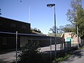
 View from Untergruppenbach- Vorhof to Schweinsberg |
||
| height | 372.8 m above sea level NHN | |
| location | Heilbronn , Baden-Württemberg ( Germany ) | |
| Mountains | Heilbronn mountains | |
| Coordinates | 49 ° 6 '39 " N , 9 ° 14' 59" E | |
|
||
| particularities | ||


The Schweinsberg in the urban area of Heilbronn in Baden-Württemberg is 372.8 m above sea level. NHN high elevation of the Heilbronn mountains and has the second highest point in the area of the independent city after the Reisberg ( 378 m ).
Geographical location
The Schweinsberg is located in the south of the Heilbronn Mountains around 4 km south-southeast of the Heilbronn city center and around 1.5 km (depending on the beeline ) northwest of Donnbronn , a district of Untergruppenbach. He is part of the protected landscape Gallows -Schweinsberg- Staufenberg . Between Heilbronn and Donnbronn, state road 1111 in the south and district road 9550 in the east pass the mountain.
history
Several burial mounds from the Bronze Age have been preserved on the Schweinsberg . The graves were researched by the Heilbronn historian Alfred Schliz . Since most of the graves were opened, they no longer look like hills, but look like craters. The grave finds were lost when the Schliz Museum was destroyed during the air raid on Heilbronn on December 4, 1944. Similar graves in the Heilbronn district are located east of the Wartberg tower , south of the Jägerhaus , near the Waldheide and in the Urklinge.
Julius Cramer According to the Schweinsberg year was 368 venue of the battle of solicinium between the troops of the Roman Emperor I. Valentinian and Alemanni . However, other locations are also suspected to be the site of the battle.
During the War of the Palatinate Succession , the commander-in-chief of the imperial troops, Margrave Ludwig Wilhelm von Baden-Baden , had two earth entrenchments built on the Schweinsberg as possible artillery positions, which are called Ludwigsschanzen after him , to better protect the imperial city of Heilbronn .
Towers
Schweinsberg Tower
From 1874 to 1883 there was a wooden, pyramid-shaped observation tower of the Heilbronner Beautification Association on the Schweinsberg . In 1886 the Beautification Association built the 21 m high Schweinsberg Tower ( ⊙ ) about 80 m west of the mountain peak at a height of 367 m , the historicist and picturesque architecture of which was adapted to the medieval castles of the surrounding area and is now a listed building. From its platform at a height of 387 m , there are views over the Heilbronn Basin and the Schozach Valley with the nearby Stettenfels Castle and other castles.
Telecommunication tower Heilbronn
The telecommunications tower Heilbronn ( ⊙ ) of Deutsche Telekom AG has been around 160 m northeast of the mountain peak since 1954 . The tower stands at a height of 371.1 m , is partly 46 m high within the framework of its reinforced concrete and, with the radio transmission mast attached, reaches a total height of 89.2 m.
Military facilities and Schweinsbergsiedlung
In 1935, a shooting range was set up 600 m north-northwest of the Schweinsberg summit and in 1939, around 400 m west of it, 28 ammunition sheds were built. After the Second World War, the ammunition sheds became the Schweinsbergsiedlung (max. Approx. 315 m ), in which at times 170 people found primitive accommodation. The settlement was dissolved in 1971. The shooting range was acquired by the federal government in 1967 and used by the American troops stationed in Heilbronn. The connecting route between Schweinsbergstrasse and Donnbronner Strasse , once called Aspelesstrasse (after the Aspele , a distinctive crossroads), has been called Panzerstrasse since it was expanded in the course of military use . The now no longer used and largely demolished shooting range has been renatured (as of February 2007).
Schweinsberg elevated tank and forest depot
Between 180 and 230 m northeast of the summit of the Schweinsberg are the 14,000 m³ high Schweinsberg reservoir of the Lake Constance water supply and the forest depot of the city of Heilbronn.

Remains of a barrow on the Schweinsberg
Elevated water tank from 1971


See also
literature
- Rolf Rau: The Heilbronn city forest and its educational trail . Heilbronn City Archives, Heilbronn 1970 (Small series of publications by the Heilbronn City Archives, 5)
Individual evidence
- ↑ a b Map services of the Federal Agency for Nature Conservation ( information )
- ↑ Julius Cramer: The history of the Alamanni as a Gau story , Marcus, Breslau 1899 ( Investigations on German State and Legal History , Vol. 57), p. 158
- ↑ Jürgen Meyer: The battle at Solicinium , riddle of history , Oertel + Spörer, Reutlingen 2003, ISBN 3-88627-268-0
- ^ Julius Fekete , Simon Haag, Adelheid Hanke, Daniela Naumann: Stadtkreis Heilbronn . (= Monument topography Federal Republic of Germany , cultural monuments in Baden-Württemberg, Volume I.5.). Theiss, Stuttgart 2007, ISBN 978-3-8062-1988-3 , pp. 99-100 .
- ^ Rolf Rau: The Heilbronn city forest and its educational trail. History - Description - Walks , Heilbronn City Archives, Heilbronn 1970 ( Small series of publications by the Heilbronn City Archives , 5), p. 62
- ↑ a b board at the Schweinsberg tower, on commons.wikimedia.org
- ↑ Photo of the memorial plaque on the tower, on commons.wikimedia.org
- ↑ The Schweinsbergturm: a piece of city history in the middle of the forest on Stimme.de from April 15, 2017, accessed on September 19, 2017