
Witthoh transmitter
|
Witthoh transmitter
|
||||
|---|---|---|---|---|
 |
||||
| Basic data | ||||
| Place: | Emmingen-Liptingen | |||
| Country: | Baden-Württemberg | |||
| Country: | Germany | |||
| Altitude : | 862 m above sea level NHN | |||
| Coordinates: 47 ° 56 '9.7 " N , 8 ° 49' 36.4" E | ||||
| Use: | Telecommunications tower , broadcasting station | |||
| Accessibility: | Transmission tower not open to the public | |||
| Owner : | Südwestrundfunk | |||
| Tower data | ||||
| Construction time : | 1986 | |||
| Operating time: | since 1986 | |||
| Last renovation (tower) : | 2012 | |||
| Total height : | 117.3 m | |||
| Data on the transmission system | ||||
| Waveband : | FM transmitter | |||
| Radio : | VHF broadcasting | |||
| Send types: | DAB , cellular network | |||
| Position map | ||||
|
||||


The Witthoh transmitter is a basic network transmitter of the Südwestrundfunk (formerly the Südwestfunk ) for radio. It has been on the Witthoh since 1951 , about six kilometers south of Tuttlingen city center. A 108-meter-high, free-standing reinforced concrete tower has been used as the antenna carrier since 1986, which was increased to 117.3 m in 2012.
The district of Tuttlingen , the district of Sigmaringen , the district of Konstanz and parts of the Baar - Heuberg region and the Lake Constance district are supplied from here.
Frequencies and Programs
Analog radio (FM)
The following radio programs are broadcast on VHF by the Witthoh transmitter :
|
Frequency (MHz) |
logo | program | RDS-PS | RDS-PI | Regionalization |
ERP (kW) |
Antenna pattern round (ND) / directional (D) |
Polarization horizontal (H) / vertical (V) |
|---|---|---|---|---|---|---|---|---|
| 89.00 |
|
SWR4 Baden-Württemberg | SWR4_FN_ | DA04 | Bodensee radio | 5 | D (240-120 °) | H |
| 90.40 |
|
SWR2 | __SWR2__ | D3A2 | Baden-Württemberg | 40 | D (90-170 °) | H |
| 92.40 |
|
SWR 1 Baden-Württemberg | SWR1_BW_ | D301 | - | 40 | D (90-170 °) | H |
| 97.10 |
|
SWR3 | __SWR3__ | D3A3 | Alb / Allgäu / Lake Constance | 40 | D (90-170 °) | H |
| 100.60 |
|
Deutschlandfunk | __Dlf___ | D210 | - | 40 | ND | H |
| 102.50 |
 |
Radio 7 | RADIO_7_ | D30B | Tuttlingen | 40 | ND | H |
By the end of the 1980s, the transmitters had a much greater range, especially in the south and southeast. However, due to international agreements with Switzerland, the antenna diagrams had to be changed in such a way that the radiation in the direction of Switzerland is reduced to a minimum. Since then, there have been repeated problems with receiving the broadcast programs on the German shore of Lake Constance. The programs Deutschlandfunk and Radio 7 , which continue broadcasting, are currently an exception .
Digital radio (DAB)
DAB is broadcast in vertical polarization and in single- frequency mode (SFN) with other transmitters. The radio programs of SWR and Deutschlandradio (Deutschlandfunk) (64 kbps-M) and Deutschlandradio Kultur (128 kbps) were broadcast on DAB channel 12B until January 19, 2012. Due to the restart of the digital radio, a channel change was carried out, the programs of the Deutschlandradio are no longer broadcast.
| block | Programs (data services) |
ERP (kW) |
Antenna diagram round (ND), directional (D) |
Polarization horizontal (H) / vertical (V) |
Single frequency network (SFN) |
|---|---|---|---|---|---|
| 8D SWR BW S (D__00235) |
DAB + block of the SWR
|
10 | ND | V |
Bad Urach , Baiersbronn , Blauen , Brandenkopf , Eggberg (Bad Säckingen) , Feldberg in the Black Forest , Freiburg (Schönberg) , Hornisgrinde , Raichberg , Schramberg , Schutterlindenberg , Sigmaringen , Ulm / Kuhberg , Villingen-Schwenningen , Wannerberg , Witthoh
|
photos
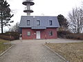
Transmitter house of the basic network transmitter Witthoh
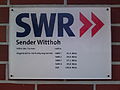
Information sign on the Witthoh transmitter

Tower shaft of the transmitter Witthoh


Web links
Individual evidence
- ^ Theodor Prosch: The Geneva Conference 1984 from the perspective of the state of Baden-Württemberg. In: Media Studies . Volume 3. de Gruyter, Berlin 2002, ISBN 3-11-016676-3 , p. 1938.
- ↑ FMSCAN power and height diagram (Deutschlandfunk, 100.6 MHz). In: Fmscan.org. Retrieved June 26, 2013 .
- ↑ FMSCAN power and height diagram (Radio 7, 102.5 MHz). In: Fmscan.org. Retrieved June 26, 2013 .