
Simeria
|
Simeria Fischdorf / Pischk Piski / Piskitelep |
|||||
|
|||||
| Basic data | |||||
|---|---|---|---|---|---|
| State : |
|
||||
| Historical region : | Transylvania | ||||
| Circle : | Hunedoara | ||||
| Coordinates : | 45 ° 51 ' N , 23 ° 1' E | ||||
| Time zone : | EET ( UTC +2) | ||||
| Height : | 200 m | ||||
| Area : | 45.75 km² | ||||
| Residents : | 12,556 (October 20, 2011) | ||||
| Population density : | 274 inhabitants per km² | ||||
| Postal code : | 335900 | ||||
| Telephone code : | (+40) 02 54 | ||||
| License plate : | HD | ||||
| Structure and administration (as of 2016) | |||||
| Community type : | city | ||||
| Structure : | 6 districts / cadastral communities: Bârcea Mare , Cărpiniș , Săulești , Simeria Veche , Sântandrei , Uroi | ||||
| Mayor : | Emil-Ioan Rîşteiu ( PSD ) | ||||
| Postal address : | St. Avram Iancu, no. 23 loc. Simeria, jud. Hunedoara, RO-335900 |
||||
| Website : | |||||


Simeria ( German Fischdorf or Pischk , Hungarian Piski or Piskitelep ) is a small town in the Hunedoara district in Transylvania , Romania .
location
Simeria is located at the confluence of the Strei River in the Mureș ( Mieresch ), south of the Transylvanian Ore Mountains . The district capital Deva is located about 10 km west of Simeria.
history

Simeria was first mentioned in a document in 1276. For a long time the place - which until 1918 belonged to the Kingdom of Hungary , the Principality of Transylvania and Austria-Hungary - was quite insignificant. In the 19th century it took off due to its convenient location, which was reinforced by the commissioning of the Arad – Alba Iulia railway in 1868 by the First Transylvanian Railway . A few years later, two more railway lines were built from Simeria to the south (to Petroșani and Hunedoara ), so that Simeria became an important railway junction in western Transylvania. A new settlement developed around the station and the marshalling yard , which was significantly larger than the original village. This was given the Hungarian name Ópiski (Rum. Simeria Veche ; "veche" = old) around 1900 . In the following decades, Simeria was mainly shaped economically by the railway. The place has belonged to Romania since 1918/20. In 1952 he received city status. Other important branches of industry are the extraction of building materials, marble and wood processing.
population
In 1850 2419 inhabitants were registered in the area of today's town, all of whom lived in today's six cadastral communities; today's city didn't exist yet. Around 90% were Romanians . The railway construction and economic development led to the influx of other nationalities, especially from Hungarians . In the - albeit controversial - census in 1910 the population had risen to 7607, of which 3889 identified themselves as Hungarians, 3442 as Romanians and 200 as Germans. At that time, 3099 people lived in the "Bahnhofsiedlung". The population continued to grow by 1992 (14,311). Since then the population has been falling slowly. In the 2002 census, 13,895 people lived in Simeria, 11,354 of them in the city proper and 2541 in the cadastral communities. 13,430 identified themselves as Romanians, 420 as Hungarians, 99 as Roma and 94 as Germans.
traffic
In addition to the rail connections mentioned, Simeria has regular bus services to Deva. The European roads 68 and 79 run through the city .
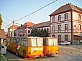
Attractions
- Dendrological Park (70 ha)
- Măgura Uroiului nature reserve (10 ha)

City center

The Uroi mountain

Dendrological Park
Simeria Train Station (2008)


Personalities
- Ferenc Feketehalmy-Czeydner (1890–1946), Hungarian officer and war criminal
- Rudolf Hermann Eisenmenger (1902–1994), Austrian painter
- Sigismund Toduță (1908–1991), Romanian composer
Web links
Individual evidence
- ↑ 2011 census in Romania at citypopulation.de
- ^ Website of the city, accessed on December 23, 2008 ( Memento of the original of June 30, 2009 in the Internet Archive ) Info: The archive link was automatically inserted and not yet checked. Please check the original and archive link according to the instructions and then remove this notice.
- ↑ Censuses in Transylvania 1850–2002 (Hungarian) (PDF; 1.1 MB)
- ↑ Sigismund Toduță at sigismundtoduta.org