
Souro
| Souro | |||

|
|||

|
|||
| Data | |||
| surface | 38.82 km² | ||
| population | 1,987 (2015) | ||
| Chefe de Suco | Estevão da Costa Pereira (election 2009) |
||
| Aldeias | Population (2015) | ||
| Foema'a | 530 | ||
| Louro | 518 | ||
| Nairete | 518 | ||
| Nanacuro | 61 | ||
| Omocano | 247 | ||
| Soru-Lua | 112 | ||
| Tchaivatcha | 1 | ||
|
|||

Souro is an East Timorese place and Suco Souro in the administrative office of Lospalos ( Lautém municipality ).
The place
The place Souro is located in the north of the Sucos at an altitude of 316 m . It is formed from the districts of Louro ( Lauro , Leuro ), Souto and Nairete ( Naitele ). Souro has a primary school and a medical post.
The Suco
| Souro | ||
| places | position | height |
| Caino | 8 ° 31 ' S , 126 ° 57' E | 316 m |
| Comilara | 8 ° 33 ' S , 126 ° 56' E | 304 m |
| Foema'a | 8 ° 33 ' S , 126 ° 57' E | 507 m |
| Haitupuca | 8 ° 34 ' S , 126 ° 58' E | 344 m |
| Louro | 8 ° 31 ' S , 126 ° 57' E | 327 m |
| Maurotubuka | 8 ° 33 ' S , 126 ° 58' E | 360 m |
| Nairete | 8 ° 31 ' S , 126 ° 57' E | 316 m |
| Nanacuro | 8 ° 32 ' S , 126 ° 57' E | 328 m |
| Omocano | 8 ° 33 ' S , 126 ° 57' E | 334 m |
| Soru-Lua | 8 ° 33 ' S , 126 ° 55' E | 303 m |
| Souro | 8 ° 31 ' S , 126 ° 57' E | 316 m |
| Souto | 8 ° 31 ' S , 126 ° 57' E | ? |
| Tchaivatcha Lama | 8 ° 33 ' S , 126 ° 58' E | 371 m |
| Vaurotubuka | 8 ° 33 ' S , 126 ° 59' E | 371 m |

Souro has 1987 inhabitants (2015), of which 963 are men and 1024 women. The population density is 51.2 inhabitants / km². There are 445 households in the Suco. Over 97% of the residents state Fataluku as their mother tongue. Minorities speak Tetum Prasa or Tetum Terik .
The Suco is located in the west of the Lospalos administrative office. In the north it borders on Suco Home , in the east on Fuiloro , in the southeast on Lore II , in the south on Lore I , in the southwest on Cacavei and in the west on Leuro . The river Vahraru flows along part of the border with Cacavei before it flows into the Tchino , the border river to Lore I. The small river Paunara, which rises in the west of the Sucos, is one of the headwaters of the Namaluto . Before the 2015 territorial reform, Souro had an area of 43.40 km². Now there are 38.82 km² after some areas on the eastern border were given up to Fuiloro and Lore II.
Caino is located northwest of the settlement center of Souro . To the south of the village of Souro, the national road from Lospalos to Iliomar leads across the Suco. The villages Foema'a ( Foema ) and Nanacuro lie on it . Nanacuro has a primary school. A little further southeast is the village of Omocano ( Omucano ). The place Soru-Lua ( Sorolua ) is located in the far west of the Sucos, across the river Paunara, directly on the border with Cacavei and Leuro. A little further to the east is the town of Comilara . In the east of Sucos are the places Maurotubuka , Vaurotubuka , Tchaivatcha Lama ( Chaiuacha Lama , Tchaivatxa Lama ) and Haitupuca .
In Souro there are the seven Aldeias Foema'a , Louro , Nairete , Nanacuro , Omocano , Soru-Lua and Tchaivatcha .
history
In 1976, the majority of the population fled the Indonesian invasion to the Matebian and did not return to the region until 1978. Initially, the returnees were interned in the city of Lospalos , later they were allowed to return to their home sucos, even if entire villages, such as Tchaivatcha , were forcibly relocated for better surveillance.
On the evening of July 21, 1985, Luís Monteiro , a son of the Liurais of Cacavei and a member of the UDT , invited fighters of the East Timorese FALINTIL to a meeting at which alcohol was also drunk. This celebration turned out to be an ambush. Fighters of Indonesian civil defense ( Hansip ) attacked the FALINTIL fighters. Nine FALINTIL fighters were killed. On the Indonesian side there were three dead and one wounded. Luís Monteiro was also among the fatalities on the Indonesian side .
Since 2015, a memorial on a hill about one kilometer from Tchaivatcha, which President Taur Matan Ruak and former Prime Minister Xanana Gusmão inaugurated on the anniversary, commemorates the “Tchaivatcha tragedy” .

The fallen FALINTIL fighters are shown in photos at the memorial:
- Miguel Pereira (fighting name Falutxai ), Commander of the Red Brigade, a native of Lospalos
- Orlando José Maria (fighting name Mauvelis ), political commissioner from Mehara
- Hermenegildo dos Santos Gândara (fighting name Herman ), platoon leader (CMDT Pelotão) from Bauro
- Zeca Rocha, soldier from Lore I.
- Armindo Monteiro (fighting name Maukady ), soldier from Baduro
- Cirilo Correia, section commander from Tchaivatcha
- João Paulo, soldier from Souro
- Américo da Costa (fighting name Sanak ), soldier from Lore II
- Salvador Nogueira (battle name Sala ), section commander from Lore I.
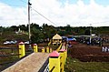
Way to the monument

Inauguration by Taur Matan Ruak and his wife Isabel da Costa Ferreira

Wreath laying at the inauguration


politics
In the 2004/2005 elections , Luis Nunes was elected Chefe de Suco. In the 2009 elections , Estevão da Costa Pereira won .
Sons and daughters
- Francelina Cabral (* 1985), mountain biker and Olympic participant
Web links
- Results of the 2010 census for the Suco Souro ( tetum ; PDF; 8.6 MB)
- Results of the 2015 census for the Suco Souro (tetum; PDF)
- Seeds of Life: Suco information sheets Lospalos (tetum)
Individual evidence
- ↑ a b c d Direcção-Geral de Estatística : Results of the 2015 census , accessed on November 23, 2016.
- ↑ a b UNMIT: Timor-Leste District Atlas version 02, August 2008 ( Memento from December 3, 2011 in the Internet Archive ) (PDF; 389 kB)
- ↑ Fallingrain.com: Directory of Cities, Towns, and Regions in East Timor
- ↑ Results of the 2010 census for the Suco Souro ( tetum ; PDF; 8.6 MB)
- ↑ Direcção Nacional de Estatística: Population Distribution by Administrative Areas Volume 2 English ( Memento from January 5, 2017 in the Internet Archive ) (Census 2010; PDF; 22.6 MB)
- ^ Timor-Leste GIS-Portal ( Memento from June 30, 2007 in the Internet Archive )
- ↑ Jornal da Républica with the Diploma Ministerial n. 199/09 ( Memento of February 3, 2010 in the Internet Archive ) (Portuguese; PDF; 323 kB)
- ^ Website of the President of East Timor: HE THE PRESIDENT OF THE REPUBLIC TMR INAUGURATES MONUMENT DEDICATED TO THE VICTIMS OF 1985 TCHAIVATXA TRAGEDY , July 21, 2015 , accessed on July 27, 2015.
- ↑ Secretariado Técnico de Administração Eleitoral STAE: Eleições para Liderança Comunitária 2004/2005 - Resultados ( Memento of August 4, 2010 in the Internet Archive )
- ↑ Secretariado Técnico de Administração Eleitoral STAE: Eleições para Liderança Comunitária 2009 - Resultados ( Memento of August 4, 2010 in the Internet Archive )