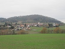
Speisendorf
|
Speisendorf ( village ) locality cadastral community Speisendorf |
||
|---|---|---|
|
|
||
| Basic data | ||
| Pole. District , state | Waidhofen an der Thaya (WT), Lower Austria | |
| Judicial district | Waidhofen an der Thaya | |
| Pole. local community | Raabs an der Thaya | |
| Coordinates | 48 ° 51 '51 " N , 15 ° 25' 52" E | |
| height | 464 m above sea level A. | |
| Residents of the village | 82 (January 1, 2020) | |
| Area d. KG | 6.55 km² | |
| Statistical identification | ||
| Locality code | 06487 | |
| Cadastral parish number | 21050 | |
| Source: STAT : index of places ; BEV : GEONAM ; NÖGIS | ||
Speisendorf is a village and a cadastral municipality in the municipality of Raabs an der Thaya in the Waidhofen an der Thaya district in Lower Austria . The place is on a slope to the Thaya between Karlstein and Raabs an der Thaya.
Settlement development
The settlement was first mentioned in documents in 1204. The market survey took place in 1837
At the turn of the year 1979/1980 there was a total of 79 building areas with 46,344 m² and 89 gardens on 47,249 m² in the cadastral community Speisendorf , in 1989/1990 there were 79 building areas. In 1999/2000 the number of building areas had increased to 133 and in 2009/2010 there were 95 buildings on 203 building areas.
Culture and sights
The Catholic parish church is dedicated to St. Consecrated to Nicholas, was built in 1335 and is located in the north-west of the village, a little higher above the Anger. Originally it was surrounded by a cemetery. The building core is Romanesque, later it was converted to Baroque style with a Gothic choir (14th / 15th century) and tower on the south side. Originally the church was a place of pilgrimage. In the east of the church there is an exit to the fountain area below the choir (originally a voting function).
- Building with a historical function
- No. 3: Former elementary school
- No. 5: The former grocery shop was run by Mrs. Emma Pfeiffer until old age. The shop fitting is located in the Waidhofen an der Thaya City Museum
- No. 7a: Armory of the volunteer fire brigade
- No. 8: Former inn
- No. 15: Former hairdresser
- No. 16: Former inn (building no longer preserved)
- No. 23: Former mill, sawmill, small power station
- No. 35: Former post office
- No. 39: Former bakery, later grocery store
- No. 41: Former tailoring
- No. 43: Parish hall, formerly a doctor's house, later a bank, currently used by the FF-Speisendorf
- No. 44: Former grocery store
- No. 45: Former butcher shop, later an inn
- No. 56: Former carpenter's shop, gas station, post office
- No. 60: rectory, two-storey, baroque
Land use
The cadastral community is characterized by agriculture. 336 hectares were used for agriculture at the turn of the year 1979/1980 and 281 hectares were forest areas. In 1999/2000 agriculture was carried out on 337 hectares and 283 hectares were designated as areas used for forestry. At the end of 2018, 320 hectares were used as agricultural land and forestry was carried out on 294 hectares. The average soil climate number of Speisendorf is 34 (as of 2010).
Web links
Individual evidence
- ^ Dehio Lower Austria - north of the Danube . Anton Schroll & Co, Vienna 1990, ISBN 3-7031-0652-2 .
- ↑ a b BEV : Regional information December 31 , 2018 on bev.gv.at ( online )
- ↑ permanent exhibition. Accessed December 30, 2019 .


