
Stüsslingen
| Stüsslingen | |
|---|---|
 |
|
| State : |
|
| Canton : |
|
| District : | Gösgen |
| BFS no. : | 2499 |
| Postal code : | 4655 |
| Coordinates : | 640.18 thousand / 249427 |
| Height : | 465 m above sea level M. |
| Height range : | 431–807 m above sea level M. |
| Area : | 6.16 km² |
| Residents: | 1055 (December 31, 2018) |
| Population density : | 171 inhabitants per km² |
| Website: | www.stuesslingen.ch |
 Stüsslingen |
|
| Location of the municipality | |
  |
|
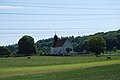
Stüsslingen , in the local dialect Stüüslige [ ʃdy: sligə ], is a municipality in the district of Gösgen in the canton of Solothurn in Switzerland .
geography

Stüsslingen lies at 465 m above sea level. M. , 7 km northeast of the city of Olten (linear distance). The former Bachzeilendorf extends on both sides of the Stüsslinger Bach in a valley north of the Aare valley at the southern foot of the Jura at the foot of the Gugen , in the Solothurn Niederamt.
The area of the 6.2 km² municipal area covers a section of the southern slopes of the Jura and has a great variety of landscapes. The southern part of the community is occupied by the open valley of the Stüsslinger Bach. To the south and south-east, the area extends to the height of the Usserholz forest (up to 520 m above sea level ), which separates the Stüssling Valley from the Aare Valley. The slopes rise gently towards the Jura ( Rebenfeld to the west and Gugenfeld to the east of the Dorfbach); the steep slopes above an average of 560 m above sea level. M. are forest-covered.
The smaller northern part of the municipality includes the eastern Folded Jura , which has a complicated geological structure and is divided into various scales. The foremost Jura chain is formed by the hard limestone chain of Rebenflue ( 688 m above sea level ) and Gugen (at 805 m above sea level, the highest point in Stüsslingen). It is passed by the Stüsslinger Bach in a narrow point. North of this bottleneck is the valley widening of Blauenstein, in which the softer rock layers (marl and clays) have been eroded over the course of millions of years. The northern border runs in the area of another limestone chain, namely that of Änggistein ( 764 m above sea level ) and Stellirain ( 781 m above sea level ). In 1997, 9% of the municipal area was accounted for by settlements, 37% for forests and woodlands and 54% for agriculture.
Some individual farms belong to Stüsslingen. Neighboring communities of Stüsslingen are Erlinsbach , Niedergösgen , Lostorf and Rohr (SO) .
population
With 1,055 inhabitants (as of December 31, 2018), Stüsslingen is one of the smaller communities in the canton of Solothurn. 96.6% of the residents speak German, 0.6% speak Italian and 0.5% speak French (as of 2000). The population of Stüsslingen was 649 in 1850, and 565 in 1900. During the 20th century, the population always fluctuated between 560 and 640 people. Only since 1970 (589 inhabitants) has a significant increase in population been recorded.
economy
Until the second half of the 20th century, Stüsslingen was a village dominated by agriculture . The water power of the village stream was previously used to operate mills and sawmills. In the past, viticulture was widespread, but it was abandoned after the vines were infested by phylloxera . There are now some small vineyards again. Even today arable farming , fruit growing and cattle breeding have a certain place in the income structure of the population. Other jobs are available in local small businesses and in the service sector, including in electrical engineering companies and mechanical workshops. The Heidental golf course is located in Stüsslingen. In the last few decades the village has developed into a residential community thanks to its attractive location. Many employed people are therefore commuters who mainly work in the Olten and Aarau regions.
traffic
The community is located off the main thoroughfares on a connecting road from Lostorf to Erlinsbach SO and also has a direct connection with Niedergösgen . Stüsslingen is connected to the public transport network by a BOGG bus line ( Busbetrieb Olten Gösgen Gäu ), which serves the route from Olten to Erlinsbach SO.
history
The place was first mentioned in a document in 1224 under the name Stüzelingen . Later the names Stuselingen (1266) and Stüslingen (1288) appeared. The place name goes back to the Old High German personal name Stiuzzilo and therefore means for the people of the Stiuzzilo .
Since the Middle Ages , Stüsslingen was part of the Gösgen rule, which was a Habsburg fief. In the course of the conquest of the Aargau by the Bernese and Solothurn residents, Stüsslingen was also affected. The village, which had been under the Falkensteiners since the end of the 14th century, was acquired by Solothurn in 1458 with the rule of Gösgen and was assigned to the new Bailiwick of Gösgen and the Lostorf court. After the collapse of the Ancien Régime (1798), Stüsslingen belonged to the Solothurn administrative district during the Helvetic and from 1803 to the Gösgen district.
Attractions
The church in the village originally dates back to a church from around the year 1000. However, this was abandoned in 1948 and replaced by the modern church of St. Peter and Paul with a free-standing bell tower. The furnishings include parts of the earlier church with a baroque statue of the Madonna and an altarpiece. The cemetery church on the southern edge of the village was built between 1631 and 1635 and is a listed building. Most of the interior furnishings date from the late 19th century.

Entrance to Stüsslingen

Tower of the new church from 1948, under which the Stüsslingerbach flows

Interior of the church
Old church, now serves as an abdication chapel


coat of arms
- In blue three (1 over 2) yellow five-pointed stars
Web links
- Hans Brunner: Stüsslingen. In: Historical Lexicon of Switzerland .
- Official website of the municipality of Stüsslingen
Individual evidence
- ↑ Permanent and non-permanent resident population by year, canton, district, municipality, population type and gender (permanent resident population). In: bfs. admin.ch . Federal Statistical Office (FSO), August 31, 2019, accessed on December 22, 2019 .
- ↑ Solothurn name book. Vol. 1: Solothurn place names. The names of the cantons, districts and municipalities. Collected and edited by Rolf Max Kully u. a. Solothurn 2003.
Erlinsbach (SO) |
Hauenstein-Ifenthal |
Kienberg |
Lostorf |
Niedergösgen |
Obergösgen |
Pipe |
Stüsslingen |
Trimbach |
Winznau |
Wisen
Former communities: Niedererlinsbach | Obererlinsbach
Canton of Solothurn | Districts of the Canton of Solothurn | Municipalities of the Canton of Solothurn