St. Avold (nature reserve)
|
St. Avold
|
||
|
Quarry lake in the NSG |
||
| location | Osterwald west of Elze , Hameln-Pyrmont district , Lower Saxony | |
| surface | 7.5 ha | |
| Identifier | NSG HA 091 | |
| WDPA ID | 165635 | |
| Geographical location | 52 ° 8 ' N , 9 ° 37' E | |
|
|
||
| Sea level | from 365 m to 395 m | |
| Setup date | December 24, 1995 | |
| administration | NLWKN | |
St. Avold is a nature reserve in the Lower Saxony municipality of Salzhemmendorf in the Hameln-Pyrmont district .
The nature reserve with the sign NSG HA 091 is 7.5 hectares in size. It is located within the Weserbergland Schaumburg-Hameln nature park in the Osterwald , a ridge of the Calenberger Bergland , north of the village of Osterwald in the middle of a forest area. The nature reserve is completely from the conservation area surrounded "Osterwald-Saupark". The area has been a nature reserve since December 24, 1985. The responsible lower nature conservation authority is the district of Hameln-Pyrmont.
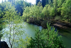
The nature reserve includes the former Oberen or St. Avold quarry with a near-natural still water , the riparian zones and adjacent trees and bushes. The quarry, one of several in the Osterwald, was developed around 1900 and used as a sandstone quarry until 1964 .
A circular route runs along the nature reserve.
Web links
- Nature reserve "St. Avold " in the database of the Lower Saxony State Office for Water Management, Coastal and Nature Conservation (NLWKN)
Individual evidence
- ↑ Osterwalder quarries , Flecken Salzhemmendorf. Retrieved May 15, 2019.


