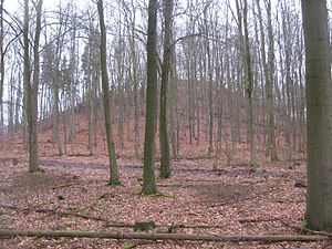
Staufenberg (Vellmar)
| Staufenberg | ||
|---|---|---|
|
Summit of the Staufenberg |
||
| height | 361.2 m above sea level NHN | |
| location | at Vellmar ; District of Kassel , North Hesse ( Germany ) | |
| Mountains | Langen- and Staufenbergplatte ( West Hessian highlands ) | |
| Coordinates | 51 ° 22 '38 " N , 9 ° 25' 55" E | |
|
|
||
The Staufenberg near Vellmar in the north Hessian district of Kassel is 361.2 m above sea level. NHN high mountain of the Langen- and Staufenbergplatte in the West Hessian highlands .
geography
location
The Staufenberg rises in the southeast of the Langen and Staufenbergplatte, in the northwest part of the urban area of Vellmar in the Obervellmar district . Its summit is 2.2 km northwest of Obervellmar, 1.4 km north-northeast of the Ahnatal district of Heckershausen , 4.2 km south-southeast of the core town of Calden and 1.7 km (as the crow flies ) southwest of the Espenau district of Mönchehof . Over its southern flank and its south-southwest foothills, the Stahlberg ( 347.9 m ), its forest landscape falls into the valley section of the Ahne near Heckershausen . Its tributary Elsche rises east of the Staufenberg, and the source of the Fulda tributary Espe is located a little northeast of the mountain. There is a water reservoir to the southwest of its summit .
Diemel-Fulda watershed
The Diemel-Fulda watershed , part of the rather elongated Diemel-Eder / Fulda / Weser watershed , runs over the summit of the Staufenberg : sooner or later, the water of all the streams that flow from the Staufenberg initially in a north-westerly and then in a north-westerly direction reaches it over the Esse and Diemel the Weser ; on the other hand, the small rivers that flow in southeast or east directions reach the Weser via the Ahne or Espe and Fulda .
Natural allocation
The Staufenberg belongs to the main natural unit group West Hessisches Bergland (No. 34) and the main unit West Hessian Senke (343) to the natural area Langen- and Staufenbergplatte (343.51). The landscape leads north and northeast into the Hofgeismarer Rötsenke (343.4) and in a southerly direction past the Stahlberg into the Kassel Basin (343.3).
Traffic and walking
On the eastern flank of the Staufenberg runs a shared, expressway-like section of federal highways 7 and 83 . The L 3217 (Espenau - Wilhelmsthal Castle - Ahnatal ) branches off the expressway at Espenau, first a little north and then west past the mountain . From the latter, in turn , the district road 31 (Heckershausen– Obervellmar ) branches off a little south between Weimar and Heckershausen . For example, starting at these roads, the mountain can be hiked on mostly forest trails and paths. A little north past the Staufenberg leads the Märchenlandweg , 2.1 km (as the crow flies) north-west of the mountain, passing the Wilhelmsthal Castle , south and east past the Kassel-Steig .

