Weimar (Ahnatal)
|
Weimar
community Ahnatal
Coordinates: 51 ° 21 '58 " N , 9 ° 23' 37" E
|
|
|---|---|
| Height : | 255 m above sea level NHN |
| Area : | 11.64 km² |
| Residents : | 4098 (1970) |
| Population density : | 352 inhabitants / km² |
| Incorporation : | August 1, 1972 |
| Postal code : | 34292 |
| Area code : | 05609 |
|
Weimar from above
|
|
Weimar is part of the municipality of Ahnatal in the northern Hessian district of Kassel .
Geographical location
Weimar, which is divided into the village of Weimar and the northeastern residential area Kammerberg , is located a little north of the Hohen Habichtswald a few kilometers northwest of Kassel and a little west of Heckershausen , the other district of Ahnatals. The Hangarstein rises to the west of Weimar, and the Ahne tributary to the Fulda flows to the southeast .
history
For the year 1097 the place is mentioned for the first time in a directory of the Mainz St. Albansstift ; In this mention, the Mainz monastery was given a chapel in Weimar. The monastery maintained a Benedictine abbey in Weimar . In 1302 the Mainz monastery sold the manor including the patronage rights to the Ahnaberg monastery .
Territorial reform
On August 1, 1972, the two were previously independent municipalities Heckershausen and Weimar, in the course of administrative reform in Hesse , powerful state law for greater community Ahnatal together .
Historical place names
Weimar was mentioned in documents that have survived under the following names (the year it was mentioned in brackets): Wimar (1097); villa Winmare (1146) ( Hersfeld Monastery ); Alb. De Wimare (1146) (Hersfeld); Wimar (1209); Wimmare (1252) ( Hasungen Monastery ); Winmar (1349); Weinmar (1585)
Culture and sights
The Bühl leisure area is located in Weimar , a former basalt quarry and today's natural lake, which caused a sensation in mineralogical circles through the discovery of solid iron around 1900 . About three kilometers north of Weimar is Wilhelmsthal Castle , which belongs to the municipality of Calden .
traffic
The county road 30, which from the west from Caldener district Fürstenwald comes through Weimar to the eastern district Ahnataler Heckershausen . The K 29 branches off from this road in Weimar, which leads south-south-west to the federal highway 251 ( Brilon - Kassel ) and via this connection to the federal highway 44 , which runs somewhat to the west .
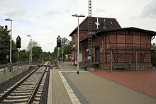
Weimar has a stop at the well of the Kassel Regiotram operated railway Volkmarsen-Vellmar-Obervellmar .
literature
- Carl W. Hochhuth: Statistics of the Protestant Church in the district of Cassel, Province of Hesse-Nassau, Kingdom of Prussia . Verlag Döll, Kassel 1872, p. 56.
- Heinrich Reimer: Historical local dictionary for Kurhessen . Verlag Elwert, Marburg 1974, ISBN 3-7708-0509-7 , p. 501 (reprint of the Marburg edition 1926).
Web links
- Website of the municipality of Ahnatal
- Weimar, Kassel district. Historical local dictionary for Hessen. In: Landesgeschichtliches Informationssystem Hessen (LAGIS).
- Literature about Weimar in the Hessian Bibliography
Individual evidence
- ↑ a b c d Weimar, Kassel district. Historical local dictionary for Hessen. (As of January 18, 2016). In: Landesgeschichtliches Informationssystem Hessen (LAGIS).
- ↑ Law on the reorganization of the districts of Hofgeismar, Kassel and Wolfhagen (GVBl. II 330-17) of July 11, 1972 . In: The Hessian Minister of the Interior (ed.): Law and Ordinance Gazette for the State of Hesse . 1972 No. 17 , p. 225 , § 8 ( online at the information system of the Hessian state parliament [PDF; 1,2 MB ]).
- ^ Federal Statistical Office (ed.): Historical municipality directory for the Federal Republic of Germany. Name, border and key number changes in municipalities, counties and administrative districts from May 27, 1970 to December 31, 1982 . W. Kohlhammer GmbH, Stuttgart / Mainz 1983, ISBN 3-17-003263-1 , p. 401 .


