Hofgeismarer Rötsenke
| Hofgeismarer Rötsenke | |||
|---|---|---|---|
| Systematics according to | Handbook of the natural spatial structure of Germany | ||
| Greater region 1st order | Low mountain range threshold | ||
| Greater region 2nd order | Lower Saxony-Hessian mountainous region | ||
| Main unit group | 34 → West Hessian mountain and valley land |
||
| About main unit | 343 → West Hessian Basin |
||
| Natural space |
343.4 → Hofgeismarer Rötsenke |
||
| Highest peak | Schöneberg ( 323.2 m ) | ||
| Geographical location | |||
| Coordinates | 51 ° 31 '24 .8 " N , 9 ° 24' 9.2" E | ||
|
|||
| local community | Bad Karlshafen , Beverungen , Calden , Espenau , Fuldatal , Grebenstein , Hofgeismar , Immenhausen , Trendelburg , Vellmar | ||
| circle | District of Kassel | ||
| state | Hesse | ||
| Country | Germany | ||

The Hofgeismarer Rötsenke is a 138.45 km² large natural area (No. 343.4) of the West Hessian Depression in the West Hessian mountain and depression region . The valley landscape is particularly located in the Hessian district of Kassel and, with its northern foothills, in the North Rhine-Westphalian district of Höxter ( Germany ) and extends especially along the Esse and Diemel to around 330 m to 106 m above sea level. NHN off.
geography
location
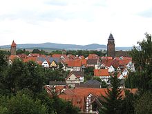
The Hofgeismarer Rötsenke is located a few kilometers north to north-northwest of the north Hessian city of Kassel . It spreads particularly in the north of the Kassel district. Its southern part extends into the outer north of the urban area of Vellmar and the municipality of Espenau , the south-southeast part is in the municipality of Fuldatal , the south-southwest part in that of Calden and the south-south-east part in the urban area of Immenhausen . The southern central part of the depression lies in the urban area of Grebenstein , the northern central part in the Hofgeismar and the northern part in that of Trendelburg . Its north-northeast part extends into the urban area of Bad Karlshafen . Only the north-northwest part extends in the south of the Westphalian district of Höxter into the urban area of Beverungen .
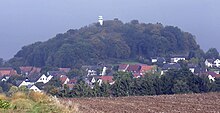
The Hofgeismarer Rötsenke extends especially along the Esse and Diemel . It is 30 km long in the south-north direction and up to 10 km in the west-east direction in the south and up to 3 km in the north. Its altitude ranges from a maximum of around 330 (western slope of an unnamed elevation at Gut Waitzrodt near Immenhausen ) in the south-southeast to only 106 m above sea level. NHN (Diemeltal near Helmarshausen ) in the north-northeast. The highest elevation within the depression is the Schöneberg ( 323.2 m ).
Natural allocation
The sink landscape forms the sub-unit Hofgeismarer Rötsenke (343.4) in the natural spatial main unit group West Hessian mountain and sink country (No. 34 ) and is the northernmost part of the main unit West Hessian sink (343). It is framed by these natural neighbors:
Viewed from the direction of the Kassel Basin and then approximately to the west or left along Esse and Diemel: The subunit Kassel Basin (343.3), in which Kassel is located in particular, spreads out to the south and south-west as part of the subunit North Hawk Forest Foreland (343.5) the natural area Langen- and Staufenbergplatte (343.51); they all also belong to the West Hessian Basin. The Liebenauer Bergland natural area ( Bever-Diemel-Kalkbergland or Beverplatten ; 361.02) joins to the west and northwest, which is part of the Upper Weserbergland main unit group (36) and the Oberwälder Land main unit (361) to the Brakeler Kalkgebiet sub-unit (361.0).
Also viewed from the direction of the Kassel Basin and then approximately to the east or to the right along Esse and Diemel: To the east, the subunit Reinhardswald (370.4) joins and to the north-northeast the subunit Weserbruchstal (370.3) joins the main unit group Weser-Leine-Bergland (37 ) belong to the main unit Solling, Bramwald and Reinhardswald (370). The subunit Weseraue and Weserterrassen (367.0) , which is part of the main unit Holzmindener Wesertal (367) , joins the north- northwest edge.
landscape
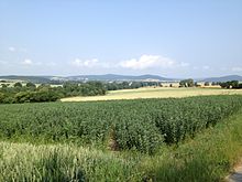
The Hofgeismarer Rötsenke is a lowland filled with loess loam , which spreads in marls of the Röt Formation between the shell limestone plates of the Langen and Staufenberg plates and the Oberwälder Land in the west and the red sandstone elevations of the Reinhardwald in the east. Apart from the pearl grass beech forest on some basalt knolls and slopes in some peripheral areas, the depression is mostly forestless and is used for agriculture.
Flowing waters

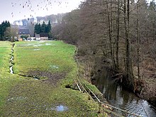
The Hofgeismarer Rötsenke is viewed in a south-north direction and drained by the Espe , Esse and Diemel and their tributaries:
-
Espe (l; 8.6 km), near Simmershausen , to the Fulda
(for details see in the article Espe (Fulda) the section catchment area and tributaries )- Bach from the bell pond (1; 0.65 km), near Hohenkirchen
- Großer Lohbach (l; 2.65 km), above Simmershausen
- Höllgraben (1; 4.3 km), above Simmershausen
-
Esse (r; 27.6 km), near Stammen , to Diemel
(for details see the section catchment area and tributaries in the article Esse (Diemel) )- Jungfernbach (l; 5.8 km), below Hohenkirchen
- Suderbach (1; 4.5 km), below Hohenkirchen
- Holzkape (r; 9.1 km), below Hohenkirchen
- Maibach (1; 3.5 km), in Grebenstein
- Nesselbach (1; 3.6 km), below Grebenstein
- Schlüchtergraben (r; 2 km), below Grebenstein
- Stroforder Graben (1; 1.8 km), below Grebenstein
- Lannegraben (r; 1.6 km), below Grebenstein
- Kelzer Bach (1; 3.1 km), below Grebenstein
- Kelzer Graben (1; 2.8 km), below Grebenstein
- Westheimgrund ( brooks or brook canal ; 1; 4.5 km), in Hofgeismar
- Lempe (r; 16.3 km), in Hofgeismar
- Tiefenbach (r; 2.3 km), in Hümme
-
Diemel (1; 110.5 km), in Bad Karlshafen ; to the Weser
(for details see the section on catchment area and tributaries in the Diemel article )- Kampgrund (r; 5.8 km), near Stammen
- Friedrichsfelder Bach (r; 1.5 km), in Trendelburg
- Forellenbach ( Narrenbach ; 1; 4.9 km), below Deisel
- Holzape (r; 22.8 km), near Wülmersen
- Knickgraben (1; 1.4 km), below Wülmersen
- Höllebach (1; 2.7 km), below Wülmersen
- Hainbach (l; 4.4 km), near Helmarshausen
Mountains and elevations
The mountains and elevations of the Hofgeismarer Rötsenke include - sorted by height in meters (m) above sea level (NHN):
|
|
Localities
Cities and municipalities (viewed roughly in a south-north direction) with, among others, districts in the Hofgeismarer Rötsenke or on the edges thereof are:
|
in Hessen:
|
In North Rhine-Westphalia:
|
Transport links and hiking

The northern part of a joint motor road section of federal roads 7 (Vellmar – Calden) and 83 runs through the south of the Hofgeismarer Rötsenke . While the B 7 runs from the north end of this section in the south-south-west of the Vellmar valley northwest through the Espenau area to Calden, the B 83 runs from there in a south-north direction through the areas of Espenau, Grebenstein, Hofgeismar and Trendelburg to Bad Karlshafen. Within the depression, numerous state and district roads branch off from the B 83 in particular .
The Kassel – Warburg railway runs from Obervellmar through Espenau, Immenhausen, Grebenstein and Hofgeismar to Hümme in a south-north direction through the Rötsenke; at Hümme it bends to the southwest and leaves the depression at Eberschütz. The Carlsbahn (closed), which ran in the northern part of the valley through Trendelburg to Bad Karlshafen, used to branch off to the north in Hümme .
Kassel-Calden Airport is located in the south-southwest of the valley .
Of Obervellmar south to Helmarshausen or bath Karl port in the north through the valley of the tale land the like applied along the Diemel in lowering the northern part, Diemel cycle path on route sections of the disused Carl web runs. The Reinhardswald-Westweg leads east along the valley . The Kassel-Steig runs through the southern part of the valley through Espenau, north of Vellmar and through Rothwesten in a west-east direction . In the area around Hofgeismar and through its core town, the European cultural long-distance hiking trail Huguenot and Waldensian trail runs a short distance through the depression - roughly in a south-west-north-east direction.
Individual evidence
- ↑ a b Map and description in the Hessen Environmental Atlas
-
↑ a b c d The Hofgeismarer Rötsenke lies in the transition area of these natural space sheets:
- Sheet 099 (in the southwest): Jürgen Hövermann: Geographical Land Survey: The natural spatial units on sheet 99 Göttingen. Federal Institute for Regional Studies, Bad Godesberg 1963. → Online map (PDF; 4.1 MB);
The Hofgeismarer Rötsenke is shown on sheet 099 with no.343.0 instead of 343.4 as there: - Sheet 112 (in the north-west): Hans-Jürgen Klink: Geographical Land Survey: The natural spatial units on sheet 112 Kassel. Federal Institute for Regional Studies, Bad Godesberg 1969. → Online map (PDF; 6.9 MB)
- Sheet 099 (in the southwest): Jürgen Hövermann: Geographical Land Survey: The natural spatial units on sheet 99 Göttingen. Federal Institute for Regional Studies, Bad Godesberg 1963. → Online map (PDF; 4.1 MB);
- ↑ a b c Map services of the Federal Agency for Nature Conservation ( information )
-
↑ a b Hiking and Leisure in the Solling-Vogler Nature Park , Topographical Map (1: 50,000; 1975),
Ed .: Lower Saxony State Administration Office - State Surveying - ↑ Water map service of the Hessian Ministry for the Environment, Climate Protection, Agriculture and Consumer Protection ( information )


