
Fulda valley
| coat of arms | Germany map | |
|---|---|---|

|
Coordinates: 51 ° 23 ' N , 9 ° 32' E |
|
| Basic data | ||
| State : | Hesse | |
| Administrative region : | kassel | |
| County : | kassel | |
| Height : | 246 m above sea level NHN | |
| Area : | 33.68 km 2 | |
| Residents: | 12,341 (Dec. 31, 2019) | |
| Population density : | 366 inhabitants per km 2 | |
| Postcodes : | 34233, 34127 (Am Sandkopf) |
|
| Primaries : | 0561, 05607, 05541 | |
| License plate : | KS, HOG, WOH | |
| Community key : | 06 6 33 009 | |
| LOCODE : | DE FUT | |
| Address of the municipal administration: |
Am Rathaus 9 34233 Fuldatal |
|
| Website : | ||
| Mayor : | Karsten Schreiber ( CDU ) | |
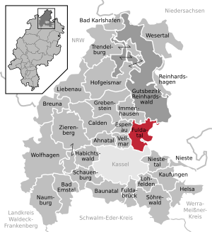
| Location of the municipality of Fuldatal in the district of Kassel | ||
  |
||

Fuldatal is a municipality in the northern Hessian district of Kassel .
geography
location
Fuldatal is located directly northeast of Kassel on the southern edge of the Reinhardswald . It is located on the left-hand bank of Fulda , in the municipality in which the hamlet Simmershausen flowing through aspen and the district Knickhagen continuous Osterbach and in the district Wilhelmshausen lead the Muehlbach and on the eastern outskirts of the Elster river. The municipality extends to 125 to 301 m above sea level. NHN .
Extensive bodies of water that invigorate the landscape cover 70 hectares, which corresponds to 2.1% of the municipal area. The districts of Wahnhausen and Wilhelmshausen are located directly on the Fulda. In the municipality, this is dammed into an elongated lake by the large Wahnhausen barrage and a smaller lake by the small Wilhelmshausen barrage.
Neighboring communities
Fuldatal borders in the north on the city of Immenhausen and the community-free area Gutsgebiet Reinhardswald (both in the district of Kassel), in the east on the city of Hann. Münden and the community of Staufenberg (both in the district of Göttingen in Lower Saxony ), in the south to the independent city of Kassel , and in the west to the city of Vellmar and the community of Espenau (both in the district of Kassel).
structure
These parts of the municipality belong to Fuldatal:
history
Fuldatal was created on January 1, 1970, in the course of the regional reform in Hesse , with the voluntary amalgamation of the previously independent communities Ihringshausen, Simmershausen, Wahnhausen, Knickhagen and Wilhelmshausen. On August 1, 1972, the municipality of Rothwesten was incorporated into the municipality of Fuldatal by state law.
politics
Community representation
The local elections on March 6, 2016 produced the following results, compared to previous local elections:
| Parties and constituencies |
% 2016 |
Seats 2016 |
% 2011 |
Seats 2011 |
% 2006 |
Seats 2006 |
% 2001 |
Seats 2001 |
||
|---|---|---|---|---|---|---|---|---|---|---|
| SPD | Social Democratic Party of Germany | 37.8 | 14th | 41.7 | 15th | 41.7 | 15th | 51.1 | 19th | |
| CDU | Christian Democratic Union of Germany | 33.8 | 13 | 28.3 | 11 | 34.1 | 13 | 28.7 | 11 | |
| GREEN | Alliance 90 / The Greens | 14.6 | 5 | 19.0 | 7th | 11.8 | 4th | 8.5 | 3 | |
| FWG | Free voter community Fuldatal | 6.8 | 2 | 6.2 | 2 | 4.9 | 2 | 3.4 | 1 | |
| FDP | Free Democratic Party | 6.9 | 3 | 4.8 | 2 | 7.5 | 3 | 8.3 | 3 | |
| total | 100.0 | 37 | 100.0 | 37 | 100.0 | 37 | 100.0 | 37 | ||
| Voter turnout in% | 49.5 | 51.8 | 50.1 | 56.5 | ||||||
mayor
Karsten Schreiber (* 1966) (CDU) was elected Mayor of Fuldatal in September 2012. He prevailed against Klaus Exner (SPD). Her predecessor was Anne Werderich (FDP), she was elected in 2000 and re-elected in 2006.
Culture and sights
Buildings
Among the attractions Fulda valley include:
- Wall and moat remains of the former Knickhagen Castle
- Currency Museum in Rothwesten , including information on the currency reform in West Germany (1948)
- Rothwesten public observatory on the Häusensberg
Fulda triathlon
The Fuldataler Triathlon has been held annually since 2004 . Starters have the choice between the Olympic, sprint and people's distance. There is also a kids relay and the opportunity to take part in the people's distance in a relay.
Economy and Infrastructure

Ihringshausen is an industrial and commercial location with basic social, economic and cultural services and a train station on the Hanover Southern Railway . Mainly residential areas with leisure activities and recreational opportunities are Knickhagen, Rothwesten, Simmershausen, Wahnhausen and Wilhelmshausen.
In Fuldatal is located Directorate federal riot police and a federal police -Fliegerstaffel. The Fritz-Erler-Kaserne , which was cleared by the German Armed Forces in 2007, was located in the Rothwesten district . 118 hectares of former barracks and 77 hectares of on- site training grounds are available for subsequent civil uses. A test center for intelligent power grids and electromobility of the Fraunhofer Institute for Wind Energy and Energy System Technology was opened on the site in September 2012 . The bicycle component manufacturer Rohloff AG is located in the Ihringshausen district .
The following cycle paths lead through the Wilhelmshausen district :
- The Fulda Cycle Path (Hessischer Radfernweg R1) leads over 250 km from the heights of the Rhön along the Fulda to Bad Karlshafen on the Weser .
- The D-Route 9 (Weser-Romantic Road) leads from the North Sea via Bremen, Kassel, Fulda and the Taubertal to Füssen in Allgäu (1,197 km).
Web links
- Website of the municipality of Fuldatal
- Fuldatal, district of Kassel. Historical local dictionary for Hessen. In: Landesgeschichtliches Informationssystem Hessen (LAGIS).
- Link catalog on the subject of Fuldatal at curlie.org (formerly DMOZ )
- The world war was at your door - the Kassel Rothwesten air base in the Second World War, on weltkrieg-war-vor-deiner-tuer.de
Individual evidence
- ↑ Hessian State Statistical Office: Population status on December 31, 2019 (districts and urban districts as well as municipalities, population figures based on the 2011 census) ( help ).
- ↑ Merger of the municipalities Ihringshausen, Knickhagen, Simmershausen, Wahnhausen and Wilhelmshausen in the district of Kassel to form the new municipality "Fuldatal" on December 17, 1969 . In: The Hessian Minister of the Interior (ed.): State Gazette for the State of Hesse. 1970 No. 1 , p. 6 , item 11 ( online at the information system of the Hessian state parliament [PDF; 4.0 MB ]).
- ↑ Law on the reorganization of the districts of Hofgeismar, Kassel and Wolfhagen (GVBl. II 330-17) of July 11, 1972 . In: The Hessian Minister of the Interior (ed.): Law and Ordinance Gazette for the State of Hesse . 1972 No. 17 , p. 225 , § 9 ( online at the information system of the Hessian state parliament [PDF; 1,2 MB ]).
- ^ Federal Statistical Office (ed.): Historical municipality directory for the Federal Republic of Germany. Name, border and key number changes in municipalities, counties and administrative districts from May 27, 1970 to December 31, 1982 . W. Kohlhammer, Stuttgart / Mainz 1983, ISBN 3-17-003263-1 , p. 401 .
- ^ Result of the municipal election on March 6, 2016. Hessian State Statistical Office, accessed in April 2016 .
- ^ Hessian State Statistical Office: Result of the municipal elections on March 27, 2011
- ^ Hessian State Statistical Office: Result of the municipal elections on March 26, 2006
- ↑ Results ( Memento of the original from August 16, 2016 in the Internet Archive ) Info: The archive link was inserted automatically and has not yet been checked. Please check the original and archive link according to the instructions and then remove this notice. , Fuldataler Triathlon , archive of previous events from the TriTeam Fuldatal , department of TSV Ihringshausen e. V (wordpress)
- ↑ Test center for smart networks and e-mobility , press release, SUN & WIND ENERGY trade journal, accessed on May 18, 2014, at sonnewindwaerme.de

Ahnatal | Bad Emstal | Bad Karlshafen | Baunatal | Breuna | Calden | Espenau | Fuldabrück | Fulda Valley | Grebenstein | Habichtswald | Helsa | Hofgeismar | Immenhausen | Kaufungen | Liebenau | Lohfelden | Naumburg | Nieste | Niestetal | Reinhardshagen | Schauenburg | Söhrewald | Trendelburg | Vellmar | Wesertal | Wolfhagen | Zierenberg
Community-free area in the Kassel
district of Reinhardswald estate