
Sur Carungas
| Sur Carungas | ||
|---|---|---|
 Sur Carungas rock head taken from the north |
||
| height | 2829 m above sea level M. | |
| location | Canton of Graubünden , Switzerland | |
| Mountains | Oberhalbsteiner Alps | |
| Dominance | 0.8 km → Piz digl Gurschus | |
| Notch height | 126 m ↓ Furcletta dil Garpeder | |
| Coordinates | 758 158 / 159059 | |
|
||
 Summit cross on the top of Sur Carungas |
||

Sur Carungas ( Rhaeto-Romanic in the idiom Surmiran for over cornices ) is a ridge section southwest of the Savognin ski area in the canton of Graubünden in Switzerland with an altitude of 2829 m . A boldly placed rock head forms the highest point. Thanks to its proximity to the ski area and the associated short ascent (200 m) with the long descent (1000 m), it is a popular ski mountain.
Location and surroundings
Sur Carungas belongs to the Piz Curvér group , a subgroup of the Oberhalbsteiner Alps . The municipal boundary between Surses and Ferrera runs over the ridge . The ridge is bordered in the east by the Val Nandro in Oberhalbstein and in the west by the Ferrera valley. It forms the Surses / Val Ferrera watershed.
The neighboring peaks include the Piz Curvér , the Piz Martegnas , the Piz Cartas , the Piz Settember and the Piz digl Gurschus .
The Savognin ski area is located northeast of the Sur Carungas.
Valley locations are Salouf , Riom, Parsonz, Savognin , Ausserferrera and Andeer . Frequent starting points are Radons and Piz Cartas.
Routes to the summit
Over the south ridge
- Starting point: Pass da Schmorras ( 2564 m )
- Difficulty: EB
- Time required: ¾ hours
(Route to Pass da Schmorras see below)
Over the north ridge
- Starting point: Pass da Surcarungas ( 2641 m )
- Difficulty: EB
- Time required: ¾ hours
(See below for route to Pass da Surcarungas)
From Piz Cartas (winter)
- Starting point: P. 2602 between Piz Cartas and Surcarungas
- Time required: ¾ hours
Pass da Schmorras
About the Alp da Schmorras:
- Starting point: Radons ( 1893 m )
- Marked as a white-red-white hiking trail
- Difficulty: B
- Time required: 2¼ hours
About the Alp Mos:
- Starting point: Ausserferrera ( 1300 m )
- Marked as a white-red-white hiking trail
- Difficulty: B
- Time required: 3½ hours
Pass da Surcarungas
About the Alp Andies:
- Starting point: Ausserferrera ( 1300 m )
- Marked as a white-red-white hiking trail
- Difficulty: EB
- Time required: 3¾ hours
About Lambegn:
- Starting point: Bärenburg ( 1047 m ) or Andeer ( 982 m )
- Marked as a white-red-white hiking trail
- Difficulty: B
- Time required: 4 hours from Bärenburg or 4¼ hours from Andeer
Through the Val Cumegna:
- Starting point: Salouf ( 1258 m ) or Cre digl Lai car park ( 1903 m )
- Marked as a white-red-white hiking trail
- Difficulty: B
- Time required: 4¼ hours from Salouf or 2¾ hours from Cre digl Lai
About the Lai Saletscha:
- Starting point: Somtgant ( 2102 m )
- Marked as a white-red-white hiking trail
- Difficulty: B
- Time required: 2½ hours
panorama

gallery

Sur Carungas rock head taken from the north

Sur Carungas rock head taken from the south

Sur Carungas, recorded by Piz Cartas
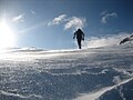
Ski tourers on Sur Carungas

Bergüner sticks with Piz Mitgel , Tinzenhorn , Piz Ela and others

Departure from Sur Carungas towards Pass da Schmorras


literature
- Manfred Hunziker: Club Guide, Bündner Alpen, Volume 3 (obverse) 1st edition. Verlag des SAC, 1994, ISBN 3-85902-140-0 , pp. 285-294.
Web links
- Panorama of Sur Carungas
- www.hikr.org Various tour reports