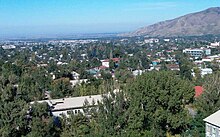
Talghar
| Basic data | ||
|---|---|---|
| State : |
|
|
| Territory : | Almaty | |
| Audany: | Talghar | |
| Founded : | 1858 | |
| Coordinates : | 43 ° 18 ' N , 77 ° 14' E | |
| Height : | 973 m | |
| Area : | 18.8 km² | |
| Residents : | 41,954 (Jan 1, 2020) | |
| Population density : | 2,232 inhabitants per km² | |
| Time zone : | EKST ( UTC + 6 ) | |
| Telephone code : | (+7) 72774 | |
| Postal code : | 041600-041605 | |
| License plate : | 05 (old: B, V) | |
| Community type: | city | |
| Location in Kazakhstan | ||
|
|
||
Talghar ( Kazakh Талғар ; Russian Талгар Talgar ) is a city in southern Kazakhstan .
Geographical location
Talghar is located in southern Kazakhstan in the Almaty area on the northern flank of the Transili-Alatau around 25 km east of the former capital Almaty . The city flows through the Talghar river of the same name , which is fed by glacier water from the nearby mountains. A few kilometers south is the Pik Talgar , with a height of almost 5000 meters the highest mountain in the Transili-Alatau. Talghar is the administrative center of the Talghar district of the same name .
history
After the establishment of the Vernoye fortress , the local authorities decided to found several Cossack villages around Vernoye in order to strengthen the eastern borders of the Russian Empire . The place was founded in 1858 as Stanitsa Sofijskaja (станица Софийская). It developed quickly, which was due to the favorable climatic conditions for agriculture. The residents grew different types of grain. In 1871 there were already 3256 people in the village. In the following years, the first industrial companies were founded, including two distilleries and a sawmill. Founded in 1886 by the Russian businessman Nikita Jakowlewitsch Pugassow, the distillery is now one of the country's oldest food companies. The same businessman also founded a tannery, which was later nationalized and, as a large textile manufacturer, became a major employer in the city. In 1908 the Nikolaus Church was built.
In April 1918 the resistance of the White Guard against the establishment of communist rule by the Bolsheviks organized itself . Only a month later this was suppressed by the Red Army and the village was renamed Murayevo (Мураево) in honor of the leader; Talghar has had its current name since 1919. In 1934, Talghar became the location of an agricultural school that was moved here from nearby Alma-Ata. In 1937 a regional nursing school was opened. In 1954 the school was converted into the Talghar Medical School. On December 22, 1959 Talghar was granted city rights.
population
Talghar has 41,954 inhabitants (2020).
| Population development | ||||||
|---|---|---|---|---|---|---|
| 1939 | 1959 | 1970 | 1979 | 1989 | 1999 | 2009 |
| 11,159 | 20,071 | 31,273 | 36,952 | 43,645 | 43,353 | 45,529 |
sons and daughters of the town
- Ysmajyl Yusupov (1914–2005), politician
- Maria Eichwald (* 1974), ballet dancer
- Shassulan Qydyrbajew (* 1992), weightlifter
- Jan Worogowski (* 1996), football player
See also
Web links
Individual evidence
- ↑ Численность населения Республики Казахстан по полу в разрезе областей и столицы, столицы, столицы, анколицы, столицы, городоав, областей и столицы, анкония, горойцы, коники, городоав,. ( Excel ; 96 KB) stat.gov.kz, accessed on July 19, 2020 (Russian).
- ↑ Маленькая родина: Город Талгар .. , accessed April 20, 2020 (Russian).
- ↑ История Талгарского района , accessed April 20, 2020 (Russian).
- ^ Kazakhstan: Cities and towns. pop-stat.mashke.org, accessed on August 5, 2019.

