Thurner (St. Märgen)
| Thurner Pass | |||
|---|---|---|---|
|
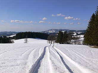
Snow-covered Black Forest landscape (view from Thurner towards Kandel ) |
|||
| Compass direction | south | east | |
| Pass height | 1030 m above sea level NHN | ||
| country | Baden-Württemberg | ||
| Watershed | Zartenbach / Höllenbach / Rotbach → Dreisam → Elz → Rhine | Urach → Hammerbach → Breg → Danube | |
| Valley locations | Buchenbach | Urach (Vöhrenbach) - Urach | |
| expansion | Bundesstrasse 500 (Black Forest High Road) u. a. | ||
| Mountains | Black Forest | ||
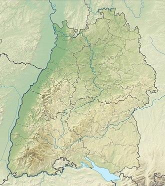
| Map (Baden-Württemberg) | |||
|
|
|||
| Coordinates | 47 ° 58 '18 " N , 8 ° 7' 17" E | ||
The Thurner is a pass and a hamlet in the southeast of the municipality of St. Märgen , part of this municipality in the district of Breisgau-Hochschwarzwald in Baden-Württemberg ( Germany ) on a small plateau, on the road climbs from the valley systems of Zartenbach in the south, Wagensteigbach in the northeast , Wilder Gutach in the north, Urach in the east and Wutach in the southeast.
geography
Thurner is located on the Thurner Pass ( 1030 m above sea level ). The highest point in the Thurner area is the Weißtannenhöhe ( 1190.2 m above sea level ). As is typical of the Black Forest, the Thurner area is partly wooded and partly used for agriculture. The top of the pass, which forms the center of the hamlet, is about seven kilometers south of the center of the municipality of St. Märgen. The Thurner and its surroundings are located in the Southern Black Forest Nature Park .
Thurner Pass
The Thurner Pass has always been a Black Forest crossing on the way from the Upper Rhine Plain and Freiburg im Breisgau towards Baar , Lake Constance and Swabia . It is believed that the Romans already crossed the Black Forest via the Wagensteig Valley , Spirzen and finally the Thurner Pass. The topographical facts speak in favor of this option, as other transition options such as the Höllental were far more difficult and dangerous.
The road that crosses the Thurner is the B 500 , which is also known as the Schwarzwaldhochstraße . On the Thurner, the L 128 and the K 4907 (the "Spirzenstraße") join the B 500.
economy
The economy of the district of Thurner consists of tourism (two hotels), agriculture and craft businesses.
tourism
The Thurner is best known today for the Thurnerspur , which is probably the oldest cross-country center in Germany. The cross-country ski run and a log cabin with sanitary facilities and a kiosk are operated by Club Thurnerspur e. V. operated. Several circuits between 1.5 and 18 kilometers in length are available, the shortest has a floodlight system. The Schonach – Belchen long-distance skiing trail runs on a section of the Thurnerspur track.
Culture and religion
The religious center of the place is the St. Wolfgang Chapel. The small church dates back to the 18th century and was initiated by Petrus Glunk, Abbot of the St. Märgen Monastery . The three altars are decorated with sculptures by the baroque sculptor Matthias Faller .
In the Thurnerwirtshaus cultural events take place regularly: concerts from the fields of pop, folk, jazz etc., cabaret and comedy.


