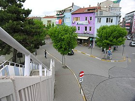
Usak
| Usak | ||||
|
||||
 city |
||||
| Basic data | ||||
|---|---|---|---|---|
| Province (il) : | Usak | |||
| Coordinates : | 38 ° 41 ′ N , 29 ° 24 ′ E | |||
| Height : | 890 m | |||
| Residents : | 228,328 (2019) | |||
| Telephone code : | (+90) 276 | |||
| Postal code : | 64,000 | |||
| License plate : | 64 | |||
| Structure and administration (as of 2019) | ||||
| Structure : | 28 Mahalle | |||
| Mayor : | Mehmet Çakın ( AKP ) | |||
| Website: | ||||
| Uşak County | ||||
| Residents : | 256,669 (2019) | |||
| Surface: | 1,655 km² | |||
| Population density : | 155 inhabitants per km² | |||
Uşak is the capital of the Turkish province of Uşak and at the same time the center of a district directly subordinate to the governor (Vali), the central district ( Merkez ). The city is located about 320 km as the crow flies southwest of the state capital Ankara .
geography
The town
The city ranks 40th among the most populous cities in Turkey. Due to its connection to the main traffic route between İzmir , Istanbul and Ankara , Uşak also functions as a shopping destination for residents of the surrounding districts such as Selendi ( Manisa ) and Gediz ( Kütahya ).
The county
The district is the most populous and largest in the province and also has the highest population density (88.6 inhabitants per km²). It is located in the north of the province and has all five other districts as neighbors, starting from Banaz in the north to Eşme in the southwest. External borders exist with the provinces of Kütahya in the north and Manisa in the north-west.
In addition to the city of Uşak, the district consists of 83 villages ( Köy ) with an average of 347 inhabitants. Four villages have more than a thousand inhabitants: Kaşbelen (3,931), İlyaslı (1,783), Bozkuş (1,460) and Karacahisar (1,036 inhabitants). 23 villages have more than the average (= 347) inhabitants. The eight former villages Çevre , Hacıkadem , İkisaray , Kalfa , Karaağaç Köyü , Kuyucak , Muharremşah and Ovademirler became mahalles (districts) of Uşak in 2018.
The urban population is 88.57 percent.
Canyons
The deep canyons in the area are remarkable. They are mainly to the east of the Banaz Valley and the Dokuzsele River. The gorges run from Hasköy via Ulubey through the areas Asarönü, Çiçeklidere, Hamamdere, Güzelyaka and Camcilar to the south to Pinardere. The total length of the canyons is approx. 75 km. In Çiçeklidere and Caldere they reach a depth of up to 300 m.
climate
| Usak (919 m) | ||||||||||||||||||||||||||||||||||||||||||||||||
|---|---|---|---|---|---|---|---|---|---|---|---|---|---|---|---|---|---|---|---|---|---|---|---|---|---|---|---|---|---|---|---|---|---|---|---|---|---|---|---|---|---|---|---|---|---|---|---|---|
| Climate diagram | ||||||||||||||||||||||||||||||||||||||||||||||||
| ||||||||||||||||||||||||||||||||||||||||||||||||
|
Average monthly temperatures and rainfall for Uşak (919 m)
|
||||||||||||||||||||||||||||||||||||||||||||||||||||||||||||||||||||||||||||||||||||||||||||||||||||||||||||||||||||||||||||||||||||||||||||||||||||||
population
Population development
The following table shows the comparative population level at the end of the year for the province, the central district and the city of Uşak as well as the respective share at the higher administrative level. The figures are based on the address-based population register (ADNKS) introduced in 2007.
| year | province | district | city | ||
|---|---|---|---|---|---|
| absolutely | proportionally (%) | absolutely | proportionally (%) | absolutely | |
| 2018 | 367,514 | 68.58 | 252.044 | 88.57 | 223.246 |
| 2017 | 364.971 | 68.50 | 250.006 | 84.47 | 211.187 |
| 2016 | 358.736 | 67.62 | 242,566 | 85.02 | 206.234 |
| 2015 | 353.048 | 66.93 | 236301 | 85.33 | 201,634 |
| 2014 | 349,459 | 66.26 | 231,563 | 84.84 | 196.466 |
| 2013 | 346.508 | 65.39 | 226,583 | 84.80 | 192.144 |
| 2012 | 342,269 | 65.00 | 222,484 | 84.45 | 187.886 |
| 2011 | 339.731 | 64.45 | 218.953 | 83.87 | 183,640 |
| 2010 | 338.019 | 63.95 | 216.172 | 83.46 | 180.414 |
| 2009 | 335.860 | 63.38 | 212,859 | 83.02 | 176.717 |
| 2008 | 334.111 | 62.83 | 209.912 | 82.44 | 173.053 |
| 2007 | 334.115 | 62.56 | 209.033 | 82.62 | 172,709 |
Census results
The following population information about the city, the district, the province and the country is available for the censuses:
| region | 1965 | 1970 | 1975 | 1980 | 1985 | 1990 | 2000 |
|---|---|---|---|---|---|---|---|
| City (Şehir) | 35,517 | 46,392 | 58,578 | 71,469 | 88,267 | 105,270 | 137.001 |
| central circle (Merkez) | 69,593 | 80.283 | 96,394 | 110.255 | 128,378 | 145.146 | 179,458 |
| Province (İl) | 190,536 | 207,512 | 2,296,679 | 247.224 | 271.261 | 290.283 | 322.313 |
| Turkey | 31,391,421 | 35.605.176 | 40,347,719 | 44,736,957 | 50,664,458 | 56.473.035 | 67,803,927 |
economy
Today, Uşak is an important location for the textile, leather and ceramic production areas. There are two large industrial areas in the province. In the textile sector, Uşak mainly produces plush, blankets, cotton textiles and yarn. There are also three large ceramic producers on site.
The usable agricultural area is only about 240,000 hectares, the area to be irrigated only about 13,000 hectares. Because of this rather limited usability, the agricultural sector only represents a very small part of the overall economy.
Sugar production
The first sugar factory in Turkey, founded on November 26, 1926, is still in operation today (2004). According to the data for 2004, around 10,000 farmers are growing sugar beet on an area of around 4,440 hectares. Over 500 people are employed in the sugar factory.
traffic
The highways D300 ( E96 ) and D959 cross the district and meet in the provincial capital. The distance to Ankara is 371 kilometers by road, to İzmir 211 kilometers by road. In addition, Uşak is one of the first provinces in Turkey to have a railway line built. The railway line via Uşak with a connection to İzmir and Afyon is used more for freight than passenger transport. The rail network is used in particular by the ceramic and marble industries.
After an enormous development of Uşak and also the neighboring cities of Kütahya and Afyonkarahisar, which are rich in minerals and thermal springs, the Uşak airport was opened in 1998. It was decommissioned at the end of January 2012. The number of visitors had increased so much recently that a modern international airport called Zafer was built. The reopening of the Zafer International Airport took place on September 17th, 2012.
History and sights
In the city of Uşak, whose history goes back to around 4000 BC. BC, traces and relics of various civilizations of the past can be seen. A part of it is also located in the district towns around Usak. Probably the most significant relics are the treasures of the Lydian kings , especially the famous Croesus . They are exhibited in the Uşaks Archaeological Museum, where relics from various other eras can also be seen. The Museum of Anatolian Civilizations in Ankara also has a “Lyderschatz” from this area.
There are also numerous historical and geographical sights, such as the Clandras Bridge, the ruins in Selçikler, the canyons of Hasköy and Ulubey, the Ulu Mosque, the Burma Mosque, the old houses of Uşak and the thermal baths Hamamboğazı and Örencik. The ancient city of Blaundos is located about 20 km south of Uşak near the village of Sülümenli .
One school was named after the writer Halid Ziya Uşaklıgil , whose family comes from Uşak.
leisure
In addition to the open-air theater for 4,000 visitors, a chamber theater, a paintball field, a football hall, a swimming pool, tennis and basketball courts, picnic and recreational areas as well as the complex for culture, art and sport built by the city administration of Ilıcaksubaşı, there are many more Leisure facilities offer the Uşakers a wide range of sports, leisure activities, art and social affairs.
Twin cities
sons and daughters of the town
- Ergun Öztuna (* 1937), soccer player and coach
- Ahmet Ünal (* 1943), ancient orientalist
- Güvenç Kurtar (* 1950), football player and coach
- Mehmet Kurtuluş (* 1972), German-Turkish actor
- Ümit Yasin Arslan (* 1993), soccer player
Web links
Individual evidence
- ↑ a b Uşak merkez nüfusu detay , accessed on April 13, 2020
- ↑ citypopulation.de: Cities & Towns , accessed on July 31, 2019
- ↑ Central Dissemination System / Merkezi Dağıtım Sistemi (MEDAS) of the TÜIK , accessed on July 31, 2019
- ↑ Genel Nüfus Sayımları - İllere göre ilçe, bucak, belde ve köy nufusları (census results 1965 to 2000) , accessed on July 31, 2019
- ^ Uşaklıgil School. (No longer available online.) Formerly in the original ; accessed on June 16, 2019 (Turkish). ( Page no longer available , search in web archives )


