Všechlapy (Zabrušany)
| Všechlapy | ||||
|---|---|---|---|---|
|
||||
| Basic data | ||||
| State : |
|
|||
| Region : | Ústecký kraj | |||
| District : | Teplice | |||
| Municipality : | Zabrušany | |||
| Area : | 461.1827 ha | |||
| Geographic location : | 50 ° 36 ' N , 13 ° 47' E | |||
| Height: | 210 m nm | |||
| Residents : | 306 (March 1, 2001) | |||
| Postal code : | 417 71 | |||
| License plate : | U | |||
| traffic | ||||
| Street: | Hostomice - Košťany | |||
Všechlapy (German Wschechlab ) is a district of the Czech community Zabrušany in Okres Teplice . It is located half a kilometer northeast of Zabrušany in the North Bohemian Basin .
geography
Všechlapy is located on the left side of the Bouřlivec ( Katzenbach ) at the Všechlapy reservoir. The Ve chvojkách ( Juniper Mountain , 383 m) rises to the northeast .
Neighboring towns are Hudcov and Řetenice in the north, Štěrbina , Straky and Kladruby in the Northeast, Pytlíkov and Tuchlov the east, Pňovičky, Křemýž, Ohníč , Upor and Hostomice in the southeast, Chotějovice and Želénky in the south, Zabrušany in the southwest, Duchcov and Křinec the west and Lahošť , Jeníkov and Oldřichov in the northwest.
history
The first written mention of the village took place in 1238 as the seat of Vladiken Ctibor of Všechlapy. The following owners included u. a. Niklas von Všechlapy, who also acquired the neighboring Zabrušany estate in 1406 and died in the same year. He left six daughters, including the abbess of the Teplice Benedictine monastery "ad aquas calidas" ( by the warm waters ) Margaret of Všechlapy. The family, which later called themselves Zabrušanský von Všechlapy, held both estates until the end of the 16th century. In 1592 the lords of Lobkowicz acquired the estate and added it to their Dux lordship . The Všechlapy fortress was last mentioned in 1638. In 1642 the Counts von Waldstein inherited the property. In 1680 Johann Friedrich von Waldstein raised the lordships of Dux and Oberleutensdorf to a family affide . In the 18th century the village consisted of 13 farms and a mill. During the Seven Years' War , the Battle of Hundorf and Kradrob took place north in 1762 . In 1787, 24 houses were counted in Wschechlab .
In 1831 Wschechlab / Wssechlab consisted of 26 houses with 90 German-speaking residents. In the village there was an official farm , a shepherd's farm, a washer's farm and the Grinder Buschmühle . The parish was Sobrusan . Until the middle of the 19th century, Wschechlab remained subject to the Fideikommissherrschaft Dux.
After the abolition of patrimonial formed Wschechlab / Všechlapy 1850 with the districts Straka and Sterbina a municipality in Leitmeritzer county and judicial district Dux. From 1868 the village belonged to the Teplitz district. In 1869 it was incorporated into Sobrusan. Since 1896 the place belonged to the district Dux . As a result of the Munich Agreement , Wschechlab was added to the German Reich in 1938 and belonged to the Dux district until 1945 . After the end of the Second World War, the place came back to Czechoslovakia and the German-Bohemian population was expelled. Between 1958 and 1961 the Bouřlivec was dammed near Všechlapy. After the Okres Duchcov was abolished, Všechlapy was assigned to the Okres Teplice in 1961. The former basalt quarries north of the village are where blue aragonite was found . In 1991 Všechlapy had 286 inhabitants. In the 2001 census, 306 people lived in the village's 83 houses. In total, the place consists of 89 houses.
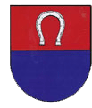
Všechlapy has had a coat of arms since 1997.
Local division
The villages Štěrbina, Straky and Všechlapy belong to the cadastral district of Všechlapy u Zabrušan .
Attractions
- Pietà statue group from 1766, it is protected as a cultural monument
- chapel
- Reservoir Všechlapy, it has a water surface of 33 hectares and is used for flood protection, sport fishing and is also used for swimming and sailing.
Web links
Individual evidence
- ↑ http://www.uir.cz/katastralni-uzemi/789381/Vsechlapy-u-Zabrusan
- ↑ Johann Gottfried Sommer : The Kingdom of Bohemia. Represented statistically and topographically. Volume 1: Leitmeritz Circle. Calve, Prague 1833, 142.
- ↑ http://www.czso.cz/csu/2009edicniplan.nsf/t/010028D080/$File/13810901.pdf


