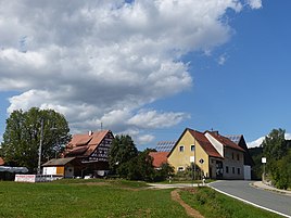
Waiganz
|
Waiganz
City of Betzenstein
Coordinates: 49 ° 40 ′ 21 ″ N , 11 ° 24 ′ 24 ″ E
|
|
|---|---|
| Height : | 503 (498-513) m above sea level NHN |
| Residents : | 23 (1987) |
| Postal code : | 91282 |
| Area code : | 09244 |
|
The Betzenstein district of Waiganz
|
|
Waiganz is a Franconian hamlet that belongs to Betzenstein .
geography
The north of Pegnitz-Kuppenalb location Weiler is one of 23 officially designated districts in Upper Franconia town of Betzenstein. It is located about one and a half kilometers southwest of the center of Betzenstein and is at an altitude of 503 m above sea level. NHN .
history
As a result of the administrative reforms carried out in the Kingdom of Bavaria at the beginning of the 19th century , the town became part of the independent rural community of Stierberg , which also included the villages of Eckenreuth , Hetzendorf , Klausberg and Reipertsgesee , as well as the hamlets of Hunger and Münchs . In the course of the municipal territorial reform carried out in Bavaria in the 1970s , Waiganz was incorporated into the town of Betzenstein together with the entire Stierberg community at the beginning of 1972. In 1987 Waiganz had 23 residents.
traffic
The connection to the public road network is mainly through the district road BT 30 , which comes from the south-west of Hetzendorf and runs through the village and continues north-east to Betzenstein. It is possible to drive onto the Federal Motorway 9 at the Plech junction, about four and a half kilometers east-southeast of the village.
Attractions
In the western area of Waiganz there is a listed residential building that dates from the first half of the 19th century.
literature
- Josef Pfanner: District of Pegnitz . In: Historical book of place names of Bavaria . Commission for Bavarian State History, Munich 1965, ISBN 3-7696-9864-9 .
- Federal Statistical Office (Hrsg.): Historical municipality register for the Federal Republic of Germany. Name, border and key number changes in municipalities, counties and administrative districts from May 27, 1970 to December 31, 1982 . W. Kohlhammer, Stuttgart / Mainz 1983, ISBN 3-17-003263-1 .
Web links
- Bavarian authorities' guide for Waiganz , accessed on September 7, 2019
- Waiganz in the BayernAtlas , accessed on September 7, 2019
- Waiganz on a historical map , accessed September 7, 2019
Individual evidence
- ↑ Bavarian State Office for Statistics and Data Processing (Ed.): Official local directory for Bavaria, territorial status: May 25, 1987 . Issue 450 of the articles on Bavaria's statistics. Munich November 1991, DNB 94240937X , p. 293 ( digitized version ). Retrieved September 7, 2019
- ↑ Waiganz in the location database of the Bavarian State Library Online . Bavarian State Library, accessed on September 7, 2019.
- ↑ Geographical location of Waiganz in the BayernAtlas , accessed on September 7, 2019
- ^ Federal Statistical Office (ed.): Historical municipality directory for the Federal Republic of Germany. Name, border and key number changes in municipalities, counties and administrative districts from May 27, 1970 to December 31, 1982 . W. Kohlhammer, Stuttgart / Mainz 1983, ISBN 3-17-003263-1 , p. 697 .

