Wengern (Turawa)
| Wengern Węgry |
||
|---|---|---|

|
|
|
| Basic data | ||
| State : | Poland | |
| Voivodeship : | Opole | |
| Powiat : | Opolski | |
| Gmina : | Turawa | |
| Geographic location : | 50 ° 45 ' N , 18 ° 1' E | |
| Height : | 160 m npm | |
| Residents : | 973 (March 31, 2013) | |
| Postal code : | 46-023 | |
| Telephone code : | (+48) 77 | |
| License plate : | OPO | |
| Economy and Transport | ||
| Street : | DK 45 Wieluń - Racibórz | |
| Next international airport : | Katowice | |
Wengern (Polish: Węgry ) is a village in Upper Silesia . Wengern is located in the municipality of Turawa in the Opolski powiat (Opole district) in the Polish Opole Voivodeship . Wengern has been officially bilingual (Polish and German) since 2012.
geography
Geographical location
Wengern is located in the historical region of Upper Silesia in the Opole region . The place is four kilometers west of the municipality Turawa and eleven kilometers northeast of the district town and voivodeship capital Opole ( Opole ).
Wengern lies in the Nizina Śląska ( Silesian Plain ) within the Równina Opolska ( Opole Plain ). The Malapane flows north of Wengern . Droga krajowa 45 road runs to the west of the village .
Neighboring places
Neighboring towns of Wengern are Kollanowitz ( Kolanowice ) in the west, Königshuld ( Osowiec ) in the north, Klein Kottorz ( Kotórz Mały ) in the south-east and the hamlets of Borek and Sowade ( Zawada ) in the south-west .
history

The place was first mentioned on November 17, 1295 as "Wangri". Wengern was owned by the bishop for a long time. In 1430 and 1532 the place was mentioned as Wangri . After the First Silesian War in 1742, Wengern and most of Silesia fell to Prussia .
After the reorganization of the province of Silesia which belonged rural community Wengern from 1816 to district Opole in the administrative district of Opole . In 1845 there was a Catholic school and 94 houses in the village. In the same year 571 people lived in Wengern, 17 of them Protestants. In 1865 the place had 16 farmer, 11 gardener, nine farmhand and 52 cottager positions. In addition, a miller, a Kretschmer (innkeeper), a shopkeeper, two butchers, two bakers, three shoemakers, four blacksmiths, two tailors and a wheelwright were resident in the village. A Catholic school with 86 children is also mentioned at this time. In 1874 the district of Sowade was founded. In 1874 the administrative district Königshuld was founded, which consisted of the rural communities Königshuld, Kollanowitz and Wengern.
In the referendum in Upper Silesia on March 20, 1921, 275 eligible voters voted to remain with Germany and 340 for Poland. Wengern stayed with the German Empire . In 1924 the emergency church was built and Wengern, which had previously been parish in Groß Kottorz, became its own parish. 1925 lived in the place 932 inhabitants. In 1937 the memorial for the fallen of the First World War was built. On April 1, 1938, the place was incorporated into Königshuld . The newly built stone church was completed in 1939. Until 1945 the place was in the district of Opole .
In 1945 the previously German place came under Polish administration and was renamed Węgry and joined the Silesian Voivodeship. The incorporation after Königshuld was lifted again. In 1950 the place came to the Opole Voivodeship . In 1999 the place came to the re-established Powiat Opolski . On March 8, 2012, the place was also given the official German place name Wengern .
Sights and monuments
- The Roman Catholic St. Joseph's Church (Polish Kościół św. Józefa Robotnika ) was built between 1934 and 1939. It replaced the half-timbered emergency church built in 1924 that previously stood in Lamsdorf . The first service took place in October 1939 under Archbishop Adolf Bertram .
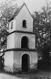
- The road chapel with bell tower was built in 1837 and has a figure of Saint Urban. The bell chapel was included in a memorial for the fallen in 1937. From 1936 to 1937 another identical path chapel with a bell tower was built, which has a figure of Saint Mary. Both wayside chapels were connected with a wall. The plaques donated in 1937 for those who died in the First World War were attached to this wall. In 1993 these were supplemented with memorial plaques for the fallen and victims of the Second World War. A wooden cross stands between the two chapels.
- Bridge over the Malapane from 1903.
- Memorial stone for the 700th anniversary of the town in 1995
- Wooden wayside cross
- Wayside shrine, consisting of a log and a figure of Saint Joseph
societies
- German Friendship Circle
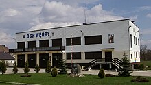
- OSP Węgry volunteer fire brigade with orchestra
- Sports club LZS Strażak Węgry
Personalities
- Peter Klimek (1881–1940), German-Polish Catholic clergyman and Nazi victim
Web links
Individual evidence
- ↑ Population of the municipality of Turawa (Polish) (accessed on May 2, 2018)
- ↑ a b Johann Georg Knie : Alphabetical-statistical-topographical overview of the villages, towns, cities and other places of the royal family. Preuss. Province of Silesia. Breslau 1845, p. 734.
- ↑ Cf. Felix Triest: Topographisches Handbuch von Oberschlesien , Breslau 1865
- ↑ Website of the community ( Memento of the original of July 30, 2012 in the Internet Archive ) Info: The archive link was automatically inserted and not yet checked. Please check the original and archive link according to the instructions and then remove this notice.
- ^ Territorial district of Königshuld
- ↑ See results of the referendum in Upper Silesia of 1921 ( Memento of January 24, 2017 in the Internet Archive )
- ↑ Michael Rademacher: German administrative history from the unification of the empire in 1871 to the reunification in 1990. Opole district (Polish Opole). (Online material for the dissertation, Osnabrück 2006).
- ^ History of the Church of St. Joseph (Polish)


