Westfield, Indiana
| Westfield | ||
|---|---|---|
|
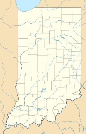
Location in Indiana
|
||
| Basic data | ||
| Foundation : | 1834 | |
| State : | United States | |
| State : | Indiana | |
| County : | Hamilton County | |
| Coordinates : | 40 ° 2 ′ N , 86 ° 8 ′ W | |
| Time zone : | Eastern ( UTC − 5 / −4 ) | |
| Residents : | 30,068 (as of 2010) | |
| Population density : | 1,518.6 inhabitants per km 2 | |
| Area : | 19.8 km 2 (approx. 8 mi 2 ) of which 19.8 km 2 (approx. 8 mi 2 ) is land |
|
| Height : | 270 m | |
| Postcodes : | 46074, 46032, 46033, 46062 | |
| Area code : | +1 317 | |
| FIPS : | 18-82700 | |
| GNIS ID : | 0445833 | |
| Website : | www.westfield.in.gov | |
| Mayor : | Andy Cook | |
Westfield is a city in Hamilton County , Indiana . According to the 2010 census, there are 30,068 residents in the city.
geography
Westfield is 40 ° 1'56 "north and 86 ° 7'44" west (40.032266; −86.129015).
According to the United States Census Bureau , the city has an area of 19.8 km² , of which 0.13 percent of the area is water.
Westfield is 11.75 miles north of Indianapolis . The area is very flat with a few bumps, a few parks and streams.
The population is growing rapidly in Hamilton County and Westfield. Since the 2000 referendum, the estimated population has grown by approximately 50%. New settlements are replacing more and more of the farms. Especially south of IN32 there is very little free space.
history
West Field was founded on May 6, 1834 by Asa Bales, Ambrose Osborne, and Nathan Parker (all Quakers from North Carolina ). One theory is that the city was planned as a stop on the Underground Railroad , as many Quakers and Wesleyan Methodist churches supported this endeavor. When the laws against the support of the escaped slaves were tightened more and more, a part of the Westfield Quakers split off as Anti-Slavery Friends (dt. Friends against slavery).
Demographics
According to the 2010 census, there are 30,068 residents, 10,490 households and 8,146 families in the city. The population density is 432.6 per km². There are 11,209 residential units with an average density of 161.2 per km². The population is made up as follows: 90.9% White , 2.2% African American , 0.2% Native American , 2.5% Asian , 2.6% other , and 1.6% from two or more groups . 5.8% of the population is Hispanic or Latino of any group.
Of the 10,490 households, 47.0% have children under the age of 18, 64.9% are married people living together in the household, 9.3% are single mothers without a husband, 3.4% single fathers without a wife, 22.3% are none Familys. 18.0% of all households are made up of single people and 4.6% are made up of seniors 65 years of age or older. The average household size is 2.85 and the average family size is 3.27.
In the city, the population is structured as follows: 31.9% under 18, 5.9% 18–24, 31.6% 25–44, 23.7% 45–64 and 6.8% are 65 years old or older. The average age is 33.7 years.
The median household income is $ 52,963 and the median family income is $ 65,208. Males have a median income of $ 45,388 compared to $ 26,864 for women. The per capita income for the city is $ 22,160. 4% of the population and 2.3% of families live below the poverty line. 2.5% of those under 18 and 3.7% of those over 65 live below the poverty line .
