Çaldıran
| Çaldıran | ||||
|
||||
 Street scene |
||||
| Basic data | ||||
|---|---|---|---|---|
| Province (il) : | Van | |||
| Coordinates : | 39 ° 9 ' N , 43 ° 55' E | |||
| Height : | 2050 m | |||
| Telephone code : | (+90) 432 | |||
| Postal code : | 65 970 | |||
| License plate : | 65 | |||
| Structure and administration (status: 2018) | ||||
| Mayor : | Tekin Dundar ( ACP ) | |||
| Website: | ||||
| Çaldıran County | ||||
| Residents : | 63,603 (2017) | |||
| Surface: | 1,952 km² | |||
| Population density : | 33 inhabitants per km² | |||
| Kaymakam : | Tekin Dundar | |||
| Website (Kaymakam): | ||||
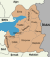
Çaldıran ( Kurdish Ebex ) is a former district in the eastern Anatolian city of Van with the rank of a municipality ( Belediye ). Çaldıran is located in the northeast of the province, bordering the Ağrı Province to the north and Iran to the east. The municipality is located on the D975, which connects Iğdır in the north with Hakkâri in the south.
The region was long fought over between the Ottomans and the Safavids and often changed hands. One of the decisive battles took place in 1514 in the Çaldıran plain ( Battle of Tschaldiran ). The exact location is not known. The modern Ottoman army defeated the Safavids and ended their influence in eastern Anatolia. The final course of the border was established in 1639 with the Treaty of Qasr-e Shirin . During the First World War , the region was occupied by the Russians, who withdrew again in 1917. With the fall of the Ottoman Empire, Çaldıran became part of the Republic of Turkey.
Since 1987 Çaldıran has the status of a municipality ( Belediye ).
geography
The municipality is mountainous while the city is on the Çaldıran plain. In the north there are branches of the Tendürek Dağı . Other high mountains are the Bemraz Dağı (2690 m), Köse Dağı (2646 m), Miladirij Dağı (2611 m), Pireşit Dağı (3109 m), Kebir Dağı (2539 m), Elegan Dağı (2653 m), Aktaş Dağı ( 2844 m), Dumanlı Dağı (3061 m), Alikelle Dağı (2726 m), Boz Dağı (2593 m) and the Kaf Dağı (2464 m). In terms of water, there is the Hındırmenteş Lake and the Bendimahi Çayı River, which flows into Lake Van .
The neighboring Iranian district is called Tschaldiran .
Individual evidence
- ↑ Nufusu.com , accessed November 11, 2018


