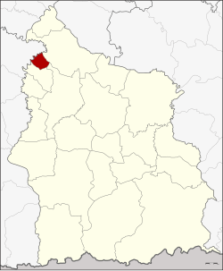
Bueng Bun district
|
Bueng Bun บึง บูร พ์ |
|
|---|---|
| Province: | Si Sa Ket |
| Surface: | 49.582 km² |
| Residents: | 10,679 (2013) |
| Population density : | 214.9 U / km² |
| ZIP : | 33220 |
| Geocode : | 3311 |
| map | |

|
|
Amphoe Bueng Bun (in Thai อำเภอ บึง บูร พ์ ) is a district ( amphoe - administrative district) in the province of Si Sa Ket . The province of Si Sa Ket is located in the northeast region of Thailand , the so-called Isan .
geography
Bueng bun district borders the following districts (from north clockwise) to the Amphoe Rasi Salai , Uthumphon Phisai and Pho Si Suwan in the province of Si Sa Ket, as well as Amphoe Rattanaburi the province of Surin .
history
Bueng Bun was initially set up on July 18, 1988 as a “branch circle” ( King Amphoe ) by separating the four Tambon Po, Dot, Siao and Nong Ma from the Amphoe Uthumphon Phisai . In 1979 all tambon except Po were assigned back to Uthumphon Phisai. Bueng Bun was promoted to Amphoe on July 4, 1994.
administration
Provincial Administration
Bueng Bun County is divided into two tambon ("subdistricts" or "communities"), which are further subdivided into 25 muban ("villages").
| No. | Surname | Thai | Muban | Pop. |
|---|---|---|---|---|
| 1. | Po | เป๊าะ | 16 | 6,177 |
| 2. | Bueng Bun | บึง บูร พ์ | 9 | 4,502 |
Local administration
There is one municipality with "small town" status ( Thesaban Tambon ) in the district:
- Bueng Bun (Thai: เทศบาล ตำบล บึง บูร พ์ ), consisting of the entire Tambon Bueng Bun and parts of the Tambon Po.
There is one municipality with "local government organization" status ( tambon administrative organizations ) in the county:
- Po (Thai: องค์การ บริหาร ส่วน ตำบล เป๊าะ )
Individual evidence
- ↑ ประกาศ กระทรวง มหาดไทย เรื่อง แบ่ง ท้องที่ อำเภอ อุทุมพรพิสัย จังหวัด ศรีสะเกษ ตั้ง เป็น กิ่ง อำเภอ บึง บูร พ์ . In: Royal Gazette . 94, No. 67 ง , July 19, 1977, p. 2886.
- ↑ ประกาศ กระทรวง มหาดไทย เรื่อง เปลี่ยนแปลง เขต กิ่ง อำเภอ บึง บูร พ์ อำเภอ อุทุมพรพิสัย จังหวัด ศรีสะเกษ . In: Royal Gazette . 96, No. 192 ง , November 20, 1979, p. 4343.
- ↑ พระราชกฤษฎีกา ตั้ง อำเภอ เปือยน้อย ... และ อำเภอ ศรีวิไล พ.ศ. ๒๕๓๗ . In: Royal Gazette . 111, No. 21 ก , June 3, 1994, pp. 32-35.
- ↑ 2013 population statistics ( Thai ) Department of Provincial Administration. Retrieved August 3, 2014.
Web links
Coordinates: 15 ° 20 ′ N , 104 ° 3 ′ E