Bahnhofsvorstadt (Plauen)
|
Station suburb
City of Plauen
Coordinates: 50 ° 30 ′ 0 ″ N , 12 ° 8 ′ 24 ″ E
|
|
|---|---|
| Residents : | 8478 (May 9, 2011) |
| Postcodes : | 08523, 08525, 08527 |
| Area code : | 03741 |
|
Location of the Bahnhofsvorstadt district in Plauen
|
|
The Bahnhofsvorstadt is a district of Plauen in the city center .
geography
The station suburb is in the center of Plauen and borders on seven other districts.
| Syratal | Haselbrunn | Torn suburb |
| Bear stone |

|
Hammertorvorstadt |
| Dobenau | Schlossberg |
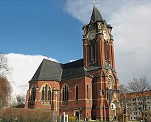
In the north-western corner of the district is the eponymous Obere Bahnhof . In the south-eastern part there is a residential area with many listed houses on the edge of which is the Pauluskirche . Approximately in the middle of the station suburb is a prefabricated housing estate from GDR times, which was created during the reconstruction because the original development was almost completely destroyed by the bombing of the city at the end of the Second World War .
Individual evidence
- ↑ Population of the district in the 9th Official Statistics Report 2014, Chapter 5.02. Retrieved February 10, 2016 .


