Neundorfer suburb
|
Neundorfer suburb
City of Plauen
Coordinates: 50 ° 29 ′ 24 ″ N , 12 ° 7 ′ 12 ″ E
|
|
|---|---|
| Postcodes : | 08523, 08527 |
| Area code : | 03741 |
|
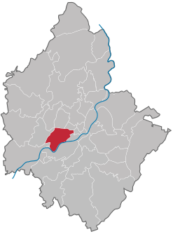
Location of the Neundorfer suburb in Plauen
|
|
The Neundorfer Vorstadt is a district of Plauen in the west of the city .
geography
The Neundorfer Vorstadt district is located in the western center of Plauen and borders eight other districts.
| Syratal | Bear stone | Dobenau |
| Neundorf settlement |

|
Old town |
| Strassberg | Hofer suburb | Upper floodplain |
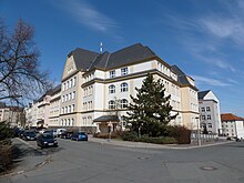
The western border of the district is formed by the Plauen – Cheb railway line and the southern border by the Weisse Elster . The Plauen police station is located on the northern border. The Diesterweg-Gymnasium and Kurt-Helbig- Platz are roughly in the middle of the district . While the north and east of the Neundorfer suburb are relatively densely built up, allotment gardens and some agricultural areas dominate the rest of the district.


