Bieber (Rodau)
| Beaver | ||
|
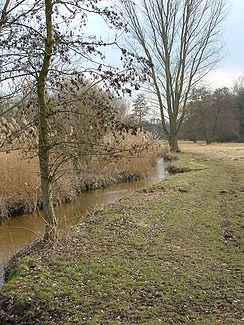
Bieberbach Höhe Obermühle in Offenbach-Bieber |
||
| Data | ||
| Water code | DE : 247928 | |
| location |
Rhine-Main lowlands
|
|
| River system | Rhine | |
| Drain over | Rodau → Main → Rhine → North Sea | |
| source | "On the green Born" north-east of Dreieich -Götzenhain 50 ° 0 '21 " N , 8 ° 44' 27" O |
|
| Source height | 180 m above sea level NHN | |
| muzzle | a little north of the Markwald residential area in Mühlheim, turn left into the Rodau coordinates: 50 ° 6 ′ 57 ″ N , 8 ° 50 ′ 6 ″ E 50 ° 6 ′ 57 ″ N , 8 ° 50 ′ 6 ″ E |
|
| Mouth height | 103 m above sea level NHN | |
| Height difference | 77 m | |
| Bottom slope | 4.6 ‰ | |
| length | 16.8 km | |
| Catchment area | 51.81 km² | |
| Discharge A Eo : 51.81 km² at the mouth |
MNQ MQ Mq |
67 l / s 224 l / s 4.3 l / (s km²) |
The Bieber , also of or the Bieberbach called, is a 17 km long left tributary of Rodau in Mühlheim am Main in Offenbach district in Hesse .
geography
course
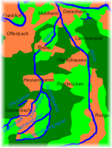
The Bieber rises at a height of about 180 m above sea level. NHN northeast of Dreieich - Götzenhain in the field "Amgrün Born" a little west of a homestead Am Kirchborn and flows from there in a northeast direction. It takes up the right source branch Kirchborn and then moves through the southern tip of the Lichteichen forest , where it flows through the Wollwiesenteich , in which it experiences another inflow from the left. After re-entering the field, it soon crosses the district town of Dietzenbach and behind it again enters the forest between Dietzenbach and Heusenstamm, where it passes the Patershäuser Hof through its long forest clearing, here called Liliengraben .
Towards the end of the clearing, it takes on the Schmittgraben from the south and then turns in its direction of flow to the north, crosses Heusenstamm , passes the Heusenstammer Castle and is then passed under the A 3 that crosses it . It enters the Offenbach district of Bieber in roughly parallel to the S-Bahn after another forest and field section from the Strutäckern and turns to the northeast.
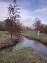
In Bieber it runs underground in a pipe from the upper mill and only comes back to light at the corridor boundary of the town. After crossing under the B 448, it runs through the Feldmark at the Käsmühle and accompanied by a wide strip of meadows through the forest east of Offenbach.
Behind it it touches the residential area of Markwald von Mühlheim and then flows a little north of it at an altitude of about 103 m above sea level. NHN from the left and southwest across the Henningweg into the Rodau , which after about a last kilometer northwards soon flows into the Main.
The 16.8 km long run of the Bieber ends about 77 meters below its source, so it has a mean bed gradient of about 4.6 ‰.
Tributaries
also higher order (indented), from source to mouth. Length of water and lake size measured on the Hessenviewer.
Source of the Bieberbach , northeast of Dreieich-Götzenhain in the field "Amgrün Born" less than 0.3 km west of a homestead at Am Kirchborn.![]()
-
Kirchborn , from the right just before entering the forest in the southern tip of Lichteichen , approx. 1.0 km. Source about 500 m southeast of the homestead. The main source load is only a few meters longer than this.

- Runs through the elongated wool meadow pond in the forest , approx. 1.4 ha.
- Königs- or Luderbach , from the left in the Wollwiesenteich, approx. 1.3 km. Arises east of the L 3317 between Götzenhain and Neuhof in the north and flows to the east, apparently in a shared ditch line with the Königsbach , also called Luderbach , which runs north from here.
- Forehead ditch
- Stiergraben , from the left in Dietzenbach just before crossing under the railway line, approx. 1.7 km. Created next to the B 459 at the Schützenhaus on the western edge of Dietzenbach.
-
Schmittgraben , from the right near the edge of the forest south of Heusenstamm on the northern tip of the Flurinsel in it, which begins at Paterhauser Hof, around 4.0 km from the confluence, 9.3 km with the somewhat longer right source branch Kaupenwiesengraben. (The Bieberbach upper course is called Liliengraben here and is a little over a kilometer shorter.) Arises from the confluence of the Gehrengraben and Kaupenwiesengraben on the eastern edge of the Dietzenbach industrial area to the forest. Flows in an arc from southeast to northeast through the forest to the east of the Patershauser Hof.
- Gehrengraben , left source branch of the Schmittgraben, approx. 5.0 km. Arises just beyond the L 3001 a little northwest of Hexenberg. Runs between Hexenberg and Dietzenbach and crosses the Dietzenbach industrial zone in the south and east.
- Kaupenwiesengraben , right source branch of the Schmittgraben, approx. 5.4 km. Arises directly on the southern edge of the settlement of Hexenberg. Draw an arc along the southern and eastern edge of the Dietzenbacher Flur to the forest.
The mouth of the Bieberbach at the northern tip of the Markwald residential area of Mühlheim from the left and southwest into the Rodau .
nature and environment
Protected area
The Bachaue is an important cold air generation area for the independent city of Offenbach am Main . Between the Offenbacher Stadtwald (section from Heusenstamm to Bieber) and the Mühlheimer Wald, the brook almost only flows through open meadow and farmland. The valley area is protected as a landscape protection area, which is only interrupted by the development of the town of Bieber of the same name.
The Bieber flows for about 600 meters through the nature reserve Erlensteg von Bieber (located east of the course of the brook partly in the Bieber forest) with orchid meadows. Here and in the Bieberbach Süd landscape protection area to the north, up to the entrance to the village of Bieber, the water flow of the stream is improved by means of near-surface seepage water and the confluence of several drainage ditches from the neighboring forest.
The Bieber flows through an ecologically valuable area with wet and humid meadows in the Bieberbach Süd landscape protection area . Many species of birds live here, including some endangered. Gudgeon and loach are found in the beaver fish species . On the banks of the brook, which is now clear again, species-rich hay meadows are next to dark swamp forests and a habitat for many animal and plant species. The bird species that occur include hawk and quail .
In the neighborhood of the beaver near Heusenstamm is the nature reserve Nachtweide von Patershausen . "The ecological water condition is good in the Dietzenbach area, unsatisfactory in the Heusenstamm area and moderate in the Biebers area on the south side of the village and good on the north side up to the confluence with the Rodau." (Status: 2007). The Hessian State Office for Environment and Geology in Wiesbaden classifies the Bieber together with the Rodau as one of the "most polluted waters in Hesse". The stream has an extremely high proportion of clarified water. The water quality class would correspond to level III to IV (very heavily polluted). It is not so much a question of the actual quality of the water, but rather the ratio of natural stream water to clarified water. The state office therefore recommends not to bathe in the stream. Small crabs or small snails are only found in small numbers in the Bieber and diatoms do not find favorable living conditions here either.
Renaturation measures
The renaturation measures should begin in the Mühlheim district from November 2007. The city wants to buy land between Käsmühle and Ulmenstrasse in the Markwald residential area and use it as retention area in the future . In the event of flooding, this area could serve as a flood plain. For this purpose, EU funds of 51,900 euros are available.
Between the Ulmenstrasse and the mouth of the Bieber in the Rodau, the stream is to be reconnected to the surrounding meadow landscape . In addition, sand and gravel banks are to be created and side arms and still water zones are to be established. The channeling at this point would be reversed. EU funding is also available for this (397,340 euros).
Extensive renaturation measures also began in 2007 on the Bieber district, on the section between Bieber and Käsmühle . So the continuous meadow landscape from Bieber to the mouth is to be restored and in the future it will be looked after by farmers. The work was actually supposed to start in spring 2007, but was postponed to autumn 2007 due to unsuitable weather conditions.
Renaturation measures are also planned in the Heusenstammer city area. First of all, the northern part of the stream between Woogbrücke and the city limits is to be renatured. The plan is to encourage the formation of loops and loops by anchoring dead wood in the stream. This meandering should also be supported by attachments made of fine gravel . One would like to support the fish migration by resting stones in the concreted and fast-flowing area, since upward moving fish can rest in the slowly flowing water behind these stones. With the planting of alders and English oaks , an alluvial forest greening is to be created. The work in Heusenstamm could begin in autumn 2009 if all permits have been received by then. The city of Heusenstamm's own contribution for these measures is around 60,000 euros.
The part of the stream south of the town of Heusenstamm is also to be renatured. The city of Heusenstamm must first agree the details with the city of Dietzenbach.
The Schmittgraben usually only leads to shortly after the industrial area in Steinberg Wasser. In heavy rain alone, water flows up to the beaver. The stream is partially interrupted in the forest.
history
Only a few hundred meters after its source, the Bieber flows through the Kirchborn pond, an area of Götzenhain that has been designated a natural monument . There is another source area that feeds the beavers. In 1927 a Roman lime kiln was excavated in the immediate vicinity. There are also the remains of a Roman estate, a villa rustica , which was inhabited from the middle of the 2nd to the 3rd century AD.
There were numerous mills on the banks of the stream, five in Bieber alone . In the Middle Ages the beaver carried far more water than today, so that fishing was possible. It flowed through the Biebermark , and only Märkers were allowed to fish in it. In the 20th century, the water quality deteriorated sharply because the places along the stream discharged their sewage into the beavers. The water quality was improved again through the construction of sewage treatment plants. The Bieber is canalised in places and has been piped in the Offenbach district of Bieber since 1963. On August 9, 1981, heavy rainfalls, especially in the catchment area of the Bieberbach, caused severe flooding in the center of Bieber. In Dietzenbach, where the Bieber flows under the town hall, the flooding at the time flooded the town hall cellar and damaged the files in the city archive.
From 2007, extensive renaturation measures were started in the Bieber and Mühlheim districts (see above). In Dietzenbach, a 600-meter-long dam and rainwater retention basin as well as the natural design of the course of the stream have been designed to help prevent floods like the one in 1981.
The brook is probably the namesake of today's Offenbach district of Bieber and thus indirectly also for the Bieberer Berg , the stadium of the same name and the historic Biebermark . The earlier spellings of the place name such as Bieberau and Bieberaha suggest this, because the word endings -aha and -au mean something like water in the old Germanic languages. The name itself is probably of Celtic origin and is probably related to the animal beaver (Celtic: bevere ), which, however, has not been proven on the stream in historical times. Rennigishausen , which became desolate in the Middle Ages , was located on the banks of the Bieber. The associated mill has been archaeologically excavated since April 2009.
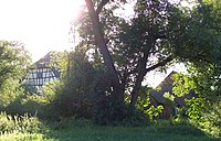
The Paterhäuser Hof near Heusenstamm and Obermühle and Käsmühle near Offenbach-Bieber (part of the Hessian apple wine and orchard route ), all on the banks of the stream, are popular excursion destinations in the region.
Individual evidence
- ↑ Water map service of the Hessian Ministry for the Environment, Climate Protection, Agriculture and Consumer Protection ( information )
- ↑ Water map service of the Hessian Ministry for the Environment, Climate Protection, Agriculture and Consumer Protection ( information )
- ↑ Hessenviewer (Geoportal Hessen) of the Hessian State Office for Soil Management and Geoinformation with property mapping ( information )
- ↑ The origin of the inflow is assumed to be the highest point according to the contour diagram.
- ↑ www.offenbach.de: Information on biotopes in the Offenbach city area ( Memento from November 27, 2012 in the Internet Archive )
- ↑ op-online.de: "Extremely highly loaded"
- ↑ Offenbach-Post from March 28, 2009
- ↑ The dam is supposed to protect Dietzenbacher Westend
- ↑ Offenbach-Post from April 10, 2009
Web links
- Environmental report of the city of Offenbach on the condition of the beavers in the city area (see from page 41) ( Memento from September 30, 2007 in the Internet Archive ) (PDF file; 4.3 MB)
- Waters in Offenbach ( Memento from March 1, 2013 in the Internet Archive ) (PDF file; 1.9 MB)
- Water profile and program of measures 247928.1 ( Memento from January 1, 2013 in the web archive archive.today ) ( Notes ) → Overview of all Hessian river systems (PDF, 1.7 MB) Bieber / Rodgau


