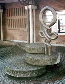
Offenbach-Bieber
|
Beaver
City of Offenbach am Main
|
|
|---|---|
| Coordinates: 50 ° 5 ′ 20 ″ N , 8 ° 48 ′ 11 ″ E | |
| Height : | 115 m above sea level NHN |
| Area : | 8.51 km² |
| Residents : | 15,965 (Jun. 30, 2019) |
| Population density : | 1,876 inhabitants / km² |
| Incorporation : | April 1, 1938 |
| Postal code : | 63073 |
| Area code : | 069 |
|
Location of Bieber in Offenbach am Main
|
|
Bieber , formerly an independent town, is a district of the southern Hessian city of Offenbach am Main and is located on the Bieber stream , a tributary of the Rodau . Around 16,000 people lived in this district in October 2019. The Bieber district covers about 850 hectares.
geography
Geographical location
Bieber is located in the Rhine-Main conurbation and is surrounded by forests, meadows and parks. Extensive meadows, fields and allotment gardens stretch along the stream of the same name. South of Bieber is the 72.96 hectare large nature reserve Erlenstegenstraße of Bieber . In the north of Bieber there are extensive orchards . The Hessian apple wine and orchard route leads through Bieber and has four stations here.
Direct neighbors are Mühlheim am Main with the district Lämmerspiel as well as Obertshausen and Heusenstamm .
In addition to the town center, Bieber has two districts, Bieber-Waldhof and Bieber-West . A third district, Bieber-Nord , is planned for the future. It should extend between the tracks of the S-Bahn line and the 448 federal road and provide living space for around 2,400 people. The reallocation of building land and the corresponding planning have been going on for decades. A development under private law planned by the city failed due to resistance from some property owners. A development under private law would have been cheaper for the city treasury, and the owners might have to bear higher costs. At the moment the area is mainly arable and garden land. As a compensatory measure, part of the orchards is to be preserved.
Beaver West
Bieber-West is a district of Bieber and is located west of the old town center. The reallocation of building land began in 1965. Before that, extensive orchards stretched here. The district is built on with single and multi-family houses and mostly moderate high-rise residential buildings. Bieber-West is the location of the Geschwister-Scholl-Schule, which opened in 1966.
The streets in Bieber-West are named in the eastern part after old Bieber field names and in the western part after German politicians of the 20th century.
Bieber-Waldhof
Bieber-Waldhof is another district of Bieber and is located between the center of Bieber and the town of Obertshausen and borders on the Lammerspieler forest. The Waldhof area is divided into a residential area and an extensive industrial area . Many world-famous companies have their offices in the industrial area.
The district was named after the large "Gutshof Waldhof", built in 1829 by the Frankfurt citizen Joseph Anton Bertarelli in the middle of the extensive forest of the old Biebermark . After his death the farm came into the possession of the landgrave's head office in Rumpenheim through inheritance and the farm was administered by a tenant.
The Waldhof area itself was cleared by Russian prisoners of war during the First World War . Another farm named Neuwerk was built on the cleared part . The city of Offenbach acquired the property through purchases in 1914, 1928 and 1962. Bombs from the Second World War destroyed the Waldhof on November 29, 1944. The Neuhof farm was also destroyed by bombs during the war. From 1967 the development of the eastern Waldhof area for the settlement of industrial and commercial enterprises began. The residential area was then built. The streets of the residential area wear old Bieberer field names , the name of the industrial area of German industrialists.
The sports field of the FV Germania Bieber is called the sports field at the Waldhof .
In Bieber-Waldhof there is a branch of the elementary school in Bieber, a municipal kindergarten, a community center for the Catholic parish and the Protestant parish. The district is accessible by the bus routes 101 and 102 of Offenbacher Verkehrsbetriebe and the S1 line of the Rhein-Main S-Bahn with its own S-Bahn stop.
At the beginning of 2005, 3365 people lived in Bieber-Waldhof.
history
Origins
In the district numerous findings were from prehistoric, Roman and Frankish made time. Relics from the recent Bronze Age , the Urnfield Culture , the Hallstatt Culture , the Latène Age and finally the Roman Age have been found on the stone fields in the direction of Lammerspiel . Through excavations, continuous settlement from the first millennium BC to Roman times has been proven. At this point, extensive layers of iron slag could be excavated, which, in connection with vessel and tool finds from the Iron Age, suggests iron smelting at that time.
The place name is probably of Celtic origin. Like the many other place and river names in the Celtic heartland, the name Bieber could be derived from the Celtic word Bebros for the animal beaver . According to another theory, the name is derived from the Celtic bi-para , meaning between the districts. The fact that the old Celtic place name was retained in Germanic times can indicate that it was an important settlement at that time. In the course of time the place wrote itself Bieberaha and Bibera .
Since a Celtic settlement south of today's town on the Struthäckern is probable and proven on the Steinäcker , it is assumed that the place was moved in Germanic times to the place of today's historic town center while retaining the Celtic name. A Roman villa rustica and a Roman burial ground were found on the above-mentioned stone fields between Bieber and Waldhof. Roman roads also traversed the Bieber district and presumably crossed near the Villa Rustica. The area belonged to the Roman Civitas Auderiensium in the province of Upper Germany . During the Roman period and the migration period, the old Celtic-Germanic mixed population remained resident.
middle Ages
The Frankish Gaugraf Warin and his wife Friderum gave in the late 8th century the monastery of Fulda four hooves to "Bieber in Maingau ". Count Walah also donated his property in Bieber to the Fulda monastery. A Franconian grave field with 50 graves was discovered in the area of Herderstrasse and Uhlandstrasse. The skeleton of an approximately eleven-year-old girl is completely preserved and can be seen in the permanent exhibition of the City Museum in Offenbach. A coin found in a grave was minted around the year 650 AD.
The settlement was first mentioned in a document in a deed of donation from the Franconian landowner Erlulf on April 22, 791 in the Lorsch Codex . As the two older donations cannot be dated with certainty, this date is considered to be the first documentary mention of Bieber. Another donation was made in 868 by a theotger to Lorsch Abbey.
In the Middle Ages , the surrounding forests belonged to the Dreieich Wildbann , which maintained one of its 30 Wildhuben in Bieber . The Lords of Hagenhausen (later von Eppstein) gradually gained sovereignty in Bieber from 1290 due to their feudal , judicial and fundamental rights. Bieber belonged to their office in Steinheim , which from 1371 was given half as pledge to the Counts of Katzenelnbogen and half to the Lords of Hanau . In 1393 the pledge came to the Lords of Kronberg .
Early modern age
In 1425 Gottfried von Eppstein sold the office to the Electorate of Mainz . In the years 1631–1634, during the Thirty Years' War , King Gustav II Adolf confiscated the office as spoils of war and used it to equip Count Heinrich Ludwig von Hanau-Münzenberg and Jakob Johann von Hanau-Münzenberg , who were allied with him. During the Thirty Years' War, plague, troop movements and devastation caused great strains and losses among the population. Since both counts died soon and the Peace of Westphalia was based on the normal year 1624, Bieber returned to Kurmainz, where it remained until 1803.
Until 1819, Bieber was part of the so-called Biebermark , a market cooperative, with the annual Märkerding on the southeastern outskirts of Oberhof . From 1372, its residents had castle rights in Frankfurt with all the rights and obligations resulting therefrom (in times of war they were allowed to seek refuge in the fortified city, in return they had to maintain 10 rods of the city moat).
Modern times
After the secularization of the Electorate of Mainz , Bieber belonged to the Principality of Isenburg- Birstein from 1803 to 1816 and then became part of the Grand Duchy of Hesse-Darmstadt . In 1819, the Biebermark was divided among the villages belonging to it. Bieber received the forest to the southeast.
After Bieber was administered from the Mainzischen Amt Steinheim for centuries, the new grand ducal sovereigns dissolved these old structures and replaced them with new ones. On July 20, 1821, the Seligenstadt district council was founded, to which Bieber was also added. As early as September 5, 1832, this classification was rejected and the Offenbach district was formed, to which the former Seligenstadt district office was assigned with Bieber.
On April 1, 1938, Bieber was forcibly incorporated into Offenbach. Numerous streets have been renamed if their names were already in Offenbach or in Bürgel, which was also incorporated into Offenbach in 1908 . The town hall was demolished in August of the same year. The Second World War brought numerous destruction and losses in the population through bombing raids.
In the 19th century, Bieber changed from a farming village to an industrial community. Many workers from the neighboring and Rodgau villages found their daily commute here. At the beginning of the 20th century the leather goods industry flourished, which had its heyday in the 1950s and 1960s. Due to changed market conditions, sales of leather goods fell sharply in the 1970s, so that today only three leather goods companies are located in Bieber. Until the beginning of the 19th century, Bieber was purely a farming village. Today there are still two farms.
In 1965 and 1967, Bieber-West and Bieber-Waldhof were expanded to include large new building areas, and the Waldhof area also became an industrial area.
On August 9, 1981, heavy rains, particularly in the Bieberbach catchment area , caused severe flooding in the center of the village. In 1991, Bieber celebrated the 1200th anniversary after the first documentary mention with a large parade and folk festivals. In December 2003, after a long construction and planning period, the S-Bahn connection was opened. Since then, Bieber and the Waldhof district have been accessible by the Rhein-Main S-Bahn . Before that, Bieber had been connected to the rail network via the Rodgau Railway since 1896 .
The Offenbach-Post reports on local events every Wednesday with a page for the Bieber district. The Offenbach Post also publishes the “Bieberer Heimatblatt” monthly.
Religions
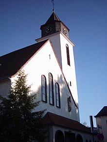
Bieber was purely Catholic until the 19th century . A large number of Protestants came to Bieber, mainly through immigration . The Catholic parish of St. Nikolaus is still larger today than the Protestant Luther parish in Bieber, although the Protestant parish of Bieber is the largest in the Offenbach dean's office . The Catholic parish hall, inaugurated on August 19, 1967, is an important venue. The parish of St. Nikolaus has been an independent parish since 1307 . Before that, the parish belonged to Mühlheim. In the 16th century, Bürgel was the parish church of the mother church in Bieber. Today's St. Nicholas Church with 720 seats was rebuilt in 1936 according to plans by the Mainz cathedral master builder Ludwig Becker and Anton Falkowski under the supervision of Peter Grimm.
The church interior is spanned by a high barrel vault, 16 m wide and 35 m long. The upstream choir is raised by six steps, 10 m wide and 11 m deep. On the west side, a flat aisle and the 38 meter high tower are attached. Church buildings have been documented on the site of today's church since 1270. The church, which was demolished for today's new building, was rebuilt in 1701–1708 and considerably expanded in 1878–1879. The St. Hildegard House in Waldhof has existed as a community center and church building for the parish of St. Nikolaus in the Waldhof district. The parish belongs to the diocese of Mainz with the Offenbach dean's office . In addition to St. Nicholas, the Bieber Catholics especially worship St. Sebastian because, according to tradition, he saved the residents from the plague a long time ago.
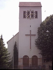
In 1865 the first Protestant service took place in a roof structure. In 1869 a small chapel, the Gustav-Adolf-Kapelle , was built with considerable financial support from Prince Georg of Hesse, among others, which was expanded in 1935 to become the Luther Church in its current form with around 450 seats.
In the choir of the church there is a three-part wall painting by the Frankfurt painter Hans Kohl , which depicts the birth, crucifixion and resurrection of Christ. In their heroic representation, these altarpieces, like the entire church, are considered important evidence of the National Socialist period in Hesse due to their good state of preservation from the construction period .
In 1869 the Protestant parish of Bieber was founded. The branch communities Bürgel, Heusenstamm and Mühlheim as well as the places without their own Protestant church service such as Obertshausen, Rembrücken, Dietesheim and Lämmerspiel were subordinate to this . By 1923 these parishes were all separated from the Bieber parish. As part of the Offenbach dean's office, the Protestant parish of Bieber belongs to the Evangelical Church in Hesse and Nassau . Because there was another Luther parish in the Offenbach dean's office, the parish was called "Evangelical Church Parish Bieber". Today there are additional community centers in Waldhof and Bieber-West.
Population development
| year | Population numbers |
|---|---|
| 1580 | about 300 |
| 1638 | 26th |
| 1681 | 150 * |
| 1817 | 646 |
| 1861 | 1,440 |
| 1890 | 2,527 |
| 1910 | 4,510 |
| 1925 | 5,149 |
| 1939 | 6,150 |
| 1946 | 6.152 |
| 1960 | 7,329 |
| 1980 | 12,854 |
| Dec 31, 2010 | 15,028 |
| Sep 30 2017 | 15,731 |
* After the plague and war, refugees return home
politics
Bieber does not have a local advisory board , but the parties CDU , FDP and SPD have founded their own local and district associations in Bieber. There is also a local association of the CDU youth organization Junge Union .
In Bieber there was a resistance group against the National Socialists from the start . The resister Adam Pfeifer fell as a soldier in the notorious 999 Battalion , his brother Ludwig Pfeifer survived and later became district administrator in Dieburg . The last freely elected mayor of Bieber was Adam Marsch (SPD). He was deposed by the National Socialists in 1933 and replaced by Fritz Bosche. This was followed in 1934–1936 by Wilhelm Peterhänsel, who in turn was replaced in 1937 by Wilhelm Kromm from Northern Hesse. Kromm concluded a contract with the then mayor of Offenbach, Schranz, on the incorporation of Bieber. Except for the incorporation, the contents of this contract have not yet been fulfilled. The incorporation was finally issued in 1938 by the Nazi Gauleiter and Reich Governor of Hesse Jakob Sprenger .
coat of arms
The Bieber coat of arms shows three yellow ears of corn on a green background. The colors yellow-green are the local colors. In addition to the coat of arms, the Bieberers also have a Bieber song: "We are Bieberer with body and soul"
Culture and landmarks
Landmark
- The " Bieberer Berg " is an elevation between Bieber and the city of Offenbach. Its highest point is in the Bürgel district. Nevertheless, he calls himself Bieberer Berg, because the place Bieber is closest to him. The stadium on Bieberer Berg and the football club Kickers Offenbach, which is based there, are directly connected to the name . The stadium was demolished in 2011. The Sparda-Bank-Hessen-Stadion is located in the same place today .
- From the 24 meter high Bieberer observation tower on the Bieberer Berg you have a wide view of the Spessart and the Frankfurt skyline. Although the tower stands just under 10 meters from the Bieber boundary on the Rumpenheim area and was built by the Offenbach Beautification Association in 1882, it is called the Bieber observation tower - probably because of its geographical proximity to Bieber and its location on the Bieberer Berg. From May to September the tower can be climbed on Sundays and public holidays.
A farmer found the grave on the Bieberer Struthäckern in a prehistoric burial ground. The Bieber amulet can be viewed in the House of City History in Offenbach.
music
In Bieber there is the music association Eintracht Offenbach 1898, three choirs: GV Concordia 1874 e. V., GV Polyhymnia 1893 e. V. and GV Frohsinn 1842 e. V. as well as three church choirs (Catholic choir St. Nikolaus and St. Hildegard as well as Protestant church choir). In addition, there is the Chara group (youth choir and band) and a Catholic children's school and a Protestant children's choir.
Bieber houses some recording studios in which well-known German and international artists record or have recorded, such as Boney M , No Angels , Henni Nachtsheim (ex- Rodgau Monotones , Badesalz ).
Culinary specialties
The Bieber potato salad is well known and is only dressed with vinegar , oil and onions . The old song about the Bieber potato salad was born from the Bieber potato salad .
Due to the very calcareous soils in the Bieber district, apples have been grown since ancient times. Even today there are extensive orchards in the Bieber fields. This results in the widespread use and popularity of the Bieber cider , which is still pressed and sold by two companies today.
A local specialty are the Bieber “Riwwel and Quetschekuche”. The former is known outside of Bieber as streusel cake, the latter as plum cake. From the time before the Thirty Years War there are reports of viticulture in Bieber. Of these, however, only the old field names remain, after which the “Wingert” and “Weinbergstrasse” were named.
Regular events
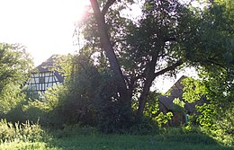
- Every year on Shrove Saturday, the Bieber carnival parade takes place with the active participation of local associations (see also: Carnival in the Rhine-Main area ).
- Carnival sessions of the KJB (Catholic Youth Bieber) and the IGBiF (Bieberer Fastnacht Interest Group).
- The Bieberer Markt takes place on the main street on a Sunday in June . Associations and shops introduce themselves here.
- During the summer holidays, the Bieber clubs invite you to the club festival on Ostendplatz.
- For the Bieberer Curb on Ostendplatz on the Sunday after the Assumption of the Virgin , a large parish festival takes place in the rectory of St. Nicholas.
- On the second Saturday in September, the Waldhoff Festival is celebrated in Bieber-Waldhof .
- On the Saturday before the first Advent, the Bieberer Nikolausmarkt takes place on Ostendplatz. Until a few years ago it took place around the parish church of St. Nicholas.
Economy and Infrastructure
traffic
Apart from the main roads, the whole place is designated as a 30 km / h zone. There is a fast connection to the federal highway 45 and the federal highway 3 via the federal highway 448 . Bieber is close to the Frankfurt airport , the Frankfurt motorway junction and the Frankfurt main train station and therefore has good cross-regional transport connections. The people of Bieber have to pay for this location with the high price of heavy aircraft noise pollution caused by the approach to Frankfurt airport.
The center of the district and Bieber-Waldhof can be reached by local transport in Offenbach with the bus routes 101, 102 and 104 of Offenbacher Verkehrsbetriebe .
Offenbach-Bieber train station
The Offenbach-Bieber station is a separation station where the Offenbach-Bieber-Dietzenbach railway from the Rodgaubahn branches. The station building from 1896 is a listed building.
The station of Category 4 is connected to the S-paths of the lines S1 and S2 of the Rhein-Main-transport network to reach (RMV).
Offenbach-Waldhof stop
The Offenbach-Waldhof stop is a category 5 stop on the Rodgaubahn . It was only opened on December 14, 2003 when the Rodgaubahn was taken over by the Rhein-Main S-Bahn . Only the S-Bahn ( S-Bahn) line S1 in the direction of Rödermark-Ober Roden (via Obertshausen and Rodgau ) ( platform 1) or Wiesbaden Hbf (via Offenbach Ost , the Offenbach and Frankfurt City Tunnels , Frankfurt Central Station , Frankfurt-Höchst , Hattersheim , Hochheim and Mainz-Kastel ) (platform 2).
At the nearby bus stops S-Bahn station Waldhof with the names bus platform 1 and bus platform 2 , bus line 102 stops in the direction of Bieber industrial area (bus platform 1) or in the direction of Areva am Kaiserlei . The Frankfurt night bus line n65 in the direction of Rödermark-Ober-Roden Bahnhof or Offenbach Marktplatz / Berliner Straße also stops at the Waldhof S-Bahn station .
The Waldhof stop is located in the middle of the Lämmerspieler forest .
Established businesses
Many companies have their headquarters or branches in the Waldhof industrial area. Examples include the Honda development center, Dematic , Danfoss , GKN , Maestro Lederwaren, P & A Heberer Lederwaren, Clou Lackfabrik, Seeger Lederwaren and the forwarding company Dachser .
The HCL leather goods factory is based in Bieber, as is Raiffeisenbank Offenbach / M.-Bieber and the measurement technology manufacturer tecsis, which emerged from the VDO .
The “Hauptstrasse” (Aschaffenburger and Seligenstädter Strasse) and the Bieber-West shopping center serve as shopping centers for local supplies.
Public facilities
- Kindergartens: one municipal kindergarten in Bieber-West and Waldhof, two denominational and three private kindergartens.
- Halls: St. Nikolaus parish hall, TV gymnasium and gymnasium of the primary school and the Geschwister-Scholl-Schule
- also: cemetery, volunteer fire brigade , football fields, playgrounds and allotment gardens and sports facilities.
- School Bieber (elementary school, also called "Mauerfeldschule") with a branch in the Waldhof district
- Geschwister-Scholl-Schule (former secondary and secondary school with special needs, integrated comprehensive school since 2009) in Bieber-West
literature
- Alfred Kurt: From Bieber and Bieberern. Bieberer Heimatverein, Offenbach am Main 1991.
- Alfred Kurt: Bieber - eight thousand years of history. Offenbach History Association, Offenbach am Main 1980.
- Otto Schlander: Bieber and his portfolios . Bieberer Heimatverein, Offenbach am Main 2004.
- Offenbacher Geschichtsverein: On the history of the Offenbach suburbs (= Offenbacher Geschichtsblätter 20 ), ISSN 0471-122X . Offenbach History Association, Offenbach am Main 1970.
- Hartmut Gries: About mills and millers in Bieber. Series: Offenbacher Geschichtsblätter , No. 43, ed. from Offenbacher Geschichtsverein, Offenbach am Main 1999, DNB 958115737 .
- Alfred Kurt: View of Bieber - sheets of the Bieberer Heimatverein. Bieberer Heimatverein, Offenbach am Main, an annual edition since 1993, ZDB -ID 920961-x .
Web links
- Official website of the city of Offenbach am Main for the Bieber district
- Bieber, City of Offenbach am Main. Historical local dictionary for Hessen. In: Landesgeschichtliches Informationssystem Hessen (LAGIS).
- Literature on Offenbach-Bieber in the Hessian Bibliography
- History at the "Bieberer Heimatverein"
- District portal for Bieber-Waldhof
Individual evidence
- ↑ a b Residents of the city of Offenbach am Main according to statistical districts on June 30, 2019. (PDF; 29 kB) City of Offenbach am Main, accessed on August 22, 2019 .
- ↑ Land Surveying Office Offenbach: Cider Route Offenbach. Catering establishments, wine presses and weekly market. (PDF; 166 kB) In: offenbach.de. August 2015, accessed December 10, 2015 .
- ^ Coalition argues about the development of the new building areas. In: op-online.de. January 26, 2009, accessed December 10, 2015 .
- ^ Archaeological finds in Offenbach am Main. ( Memento from May 15, 2011 in the Internet Archive ) The map gives the locations only approximately in order to avoid damage by self-declared but inexperienced archaeologists. PDF, 45 kB.
- ↑ The Bronze Age. From: offenbach.de , accessed on April 27, 2016.
- ↑ Late Bronze Age snaffle gag. ( Memento from March 16, 2016 in the Internet Archive ). Formerly in: offenbach.de , on May 11, 2004, accessed on August 10, 2016.
- ↑ The Migration Period and the Merovingian Period. From: offenbach.de , accessed on April 27, 2016.
- ^ Ernst Friedrich Johann Dronke: Traditiones et antiquitates Fuldenses . C. Müller, 1844 ( p. 111; Chapter 42 No. 234 in the Google book search).
- ^ Ernst Friedrich Johann Dronke: Traditiones et antiquitates Fuldenses . C. Müller, 1844 ( p. 114; Chapter 42, No. 309 in the Google book search).
- ↑ Route 3 - Three cities, four streams: pure nature in the middle of the metropolitan area. In: offenbach.de. Retrieved April 27, 2016 .
-
↑ Glöckner, Karl, Codex Laureshamensis 2nd volume - copy book, Part I Upper Rhine, Lobden, Worms, Nahe and Speiergau , Darmstadt 1933, p. 489, no. 1965 (Reg 2311),
- "Donatio Erlulfi in Buosinesheim"
- Gift of Erlulf in Biedesheim under Emperor Karl and Abbot Richbod In Christ's name, on April 22nd in the 23rd year of King Karl (791), I, Erlulf, intend a donation to St. N (azarius), whose body is in Lorscher Monastery rests, whose lord is the venerable abbot Richbodo. I give gifts in pago worm. in Buosinesheim, in Guntheim and in Dagolfesheim everything I have there. I also give my share of the basilica in Mumenheim, then everything I own in Magontia, also everything I own in Hemme and Heichino, also in Awa, located in pago renensi, furthermore in Rorheim and in Bellingon, located in Monichgowe and in Biberhahen and in Rotahen superior et inferior. Everything I own in the mentioned places: riding school, forests, vineyards, houses, farm buildings and forty serfs I give in accordance with the following production.
-
↑ Glöckner, Karl, Codex Laureshamensis: 3rd volume Kopialbuch, Part II: The other Franconian and Swabian Gaue property lists, late donations and interest lists, general register , Darmstadt 1936, p. 135; No. 3454 (Reg. 3480),
- "Donatio Theotgeri in villa Biberaha"
- Donation from Theotger in the village of Bieberau under Abbot Teotroh and Emperor Ludwig In the name of God, Teotger, I am making a donation to the holy martyr 'N (azarius) for the salvation of my soul. The body of the saint rests in the Lorsch monastery, in which the venerable Teotroch holds the abbot dignity. It is my wish that this foundation will last forever, and I explicitly mention that it was made entirely voluntarily. I give everything I own in pago Moynachgowe, in the village of Biberaha. The agreement has thus entered into force. Happened in the Lorsch monastery on September 28th in the 28th year of King Ludwig (868)
- ^ Richard Wille: Hanau in the Thirty Years' War . Hanau 1886, p. 91, 593f.
- ↑ Parish history
- ↑ Data on the church building
- ↑ Jesus and Mary as Lord Men in FAZ from September 5, 2013, page 38
- ↑ Information on the Evangelical Luther Church from the "Monument Topography City of Offenbach", pp. 375–377 ISBN 3-87079-009-1
- ↑ 128 steps to the beauty of the vastness. (No longer available online.) In: offenbach.de. Archived from the original on March 5, 2016 ; Retrieved July 29, 2016 .
- ↑ Bieber amulet. (No longer available online.) In: offenbach.de. May 14, 2004, archived from the original on December 22, 2015 ; accessed on August 10, 2016 .
- ↑ Bieberer Nikolausmarkt
- ^ Bieberer Bahnhof is sold . In: Frankfurter Rundschau of February 19, 2010, accessed on October 3, 2011
- ↑ tecsis in profile. From: tecsis.de , accessed on April 27, 2016.


