
Trujillo (State)
| Trujillo | ||
|---|---|---|
 .svg) |
||
| Symbols | ||
|
||
| Basic data | ||
| Country | Venezuela | |
| Capital | Trujillo | |
| surface | 7400 km² | |
| Residents | 840,600 (2017 estimate) | |
| density | 114 inhabitants per km² | |
| ISO 3166-2 | VE-T | |
| Website | www.gbet.gov.ve (Spanish) | |
| politics | ||
| governor | Hugo Cesar Cabezas Bracamonte | |
| Political party | United Socialist Party of Venezuela | |

Coordinates: 9 ° 25 ′ N , 70 ° 30 ′ W
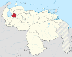
Trujillo is a state in western Venezuela , which is located in the Andes . It is bordered by Mérida to the west, Apure and Barinas to the south, Lara to the east and Falcón and Zulia to the north .
Its area is 7400 km² and it has about 840,600 inhabitants.
It is named after its capital Trujillo , which in turn is named after the birthplace of Francisco Pizarro .
The largest city in the state is Valera .
Administrative division
Trujillo is divided into the following districts ( Municipios ):
- Andrés Bello ( Santa Isabel )
- Boconó ( Boconó )
- Bolívar ( Sabana Grande )
- Candelaria ( Chejendé )
- Carache ( Carache )
- Escuque ( Escuque )
- José Felipe Márquez Cañizales ( El Paradero )
- José Vicente Campo Elías ( Campo Elías )
- La Ceiba ( Santa Apolonia )
- Miranda ( El Dividive )
- Monte Carmelo ( Monte Carmelo )
- Motatán ( Motatán )
- Pampan ( pampan )
- Pampanito ( pampanito )
- Rafael Rangel ( Betijoque )
- San Rafael de Carvajal ( Carvajal )
- Sucre ( Sabana de Mendoza )
- Trujillo ( Trujillo )
- Urdaneta ( La Quebrada )
- Valera ( Valera )
States:
Amazonas |
Anzoátegui |
Apure |
Aragua |
Barinas |
Bolívar |
Carabobo |
Cojedes |
Delta Amacuro |
Falcón |
Guárico |
Vargas (La Guaira) |
Lara |
Mérida |
Miranda |
Monagas |
Nueva Esparta |
Portuguesa |
Sucre |
Táchira |
Trujillo |
Yaracuy |
Zulia
Capital District :
Distrito Capital
Federal immediate area:
Dependencias Federales