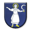
Chvojnica (Myjava)
| Chvojnica | ||
|---|---|---|
| coat of arms | map | |

|
|
|
| Basic data | ||
| State : | Slovakia | |
| Kraj : | Trenčiansky kraj | |
| Okres : | Myjava | |
| Region : | Stredné Považie | |
| Area : | 16.34 km² | |
| Residents : | 339 (Dec. 31, 2019) | |
| Population density : | 21 inhabitants per km² | |
| Height : | 390 m nm | |
| Postal code : | 906 06 | |
| Telephone code : | 032 | |
| Geographic location : | 48 ° 48 ' N , 17 ° 24' E | |
| License plate : | MY | |
| Kód obce : | 504408 | |
| structure | ||
| Community type : | local community | |
| Administration (as of November 2018) | ||
| Mayor : | Marian Kollár | |
| Address: | Obecný úrad Chvojnica 1 Vrbovce |
|
| Website: | www.chvojnica.sk | |
| Statistics information on statistics.sk | ||
Chvojnica ( Hungarian Fenyvesd ) is a municipality in western Slovakia with 339 inhabitants (as of December 31, 2019).
Location and general
The village arose in 1957 from parts of the municipalities Častkov , Sobotište and Vrbovce , since 1960 it has been an independent municipality. It is located in the Chvojnická pahorkatina ( Chvojnicaer hilly landscape of the White Carpathian Mountains ) named after the municipality . The municipality is located on the border between the Trenčiansky kraj and Trnavský kraj administrative districts . Nové Mesto nad Váhom is about 35 kilometers east of the municipality, Myjava about 10 kilometers east, Senica about 15 kilometers west.
Web links
Commons : Chvojnica (Myjava) - collection of pictures, videos and audio files

