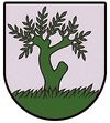
Vrbovce
| Vrbovce | ||
|---|---|---|
| coat of arms | map | |

|
|
|
| Basic data | ||
| State : | Slovakia | |
| Kraj : | Trenčiansky kraj | |
| Okres : | Myjava | |
| Region : | Stredné Považie | |
| Area : | 51.52 km² | |
| Residents : | 1,491 (Dec 31, 2019) | |
| Population density : | 29 inhabitants per km² | |
| Height : | 317 m nm | |
| Postal code : | 906 06 | |
| Telephone code : | 032 | |
| Geographic location : | 48 ° 48 ' N , 17 ° 28' E | |
| License plate : | MY | |
| Kód obce : | 504971 | |
| structure | ||
| Community type : | local community | |
| Structure of the municipality: | 2 parts of the community | |
| Administration (as of November 2018) | ||
| Mayor : | Dušan Eliáš | |
| Address: | Obecný úrad Vrbovce 42 Vrbovce |
|
| Website: | www.vrbovce.sk | |
| Statistics information on statistics.sk | ||
Vrbovce (Hungarian Verbóc , German Werbowe ) is a municipality in western Slovakia right on the border with the Czech Republic .
location
The name of the parish was first mentioned in 1394 as Vrbowich . The municipality is located on the Teplica river in the White Carpathians near the Czech border. Myjava is about 10 km southeast of the municipality. Since 1998, the municipality has been divided into the main town of Šance , which previously belonged to the Czech Republic .
Transport links
The municipality is connected to the regional public bus network and the Nové Mesto nad Váhom – Veselí nad Moravou railway line . The railway station tracks border on three sides directly on the border with the Czech Republic.
Personalities
- Karol Adamiš (1813–1849), author and Protestant pastor
- Ján Beblavý (1898–1968), writer and Protestant pastor
- Ján Pravoslav Leška (1831–1909), writer and Protestant pastor
- Štěpán Leška (1757–1818), writer and superintendent
Culture
See also: List of listed objects in Vrbovce
Web links
Commons : Vrbovce - collection of images, videos and audio files

