Wire village
|
Wire village
Community Rietz-Neuendorf
Coordinates: 52 ° 17 '14 " N , 14 ° 13' 54" E
|
|
|---|---|
| Height : | 51 m above sea level NHN |
| Area : | 9.35 km² |
| Residents : | 53 (December 31, 2011) |
| Population density : | 6 inhabitants / km² |
| Incorporation : | December 31, 2001 |
| Postal code : | 15848 |
| Area code : | 033672 |
|
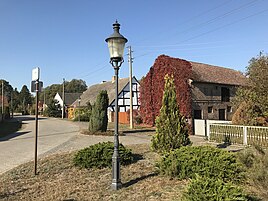
Village street
|
|
Drahendorf is the smallest district of the municipality of Rietz-Neuendorf in the Oder-Spree district in Brandenburg . Up to December 31, 2001, Drahendorf was an independent municipality administered by the Glienicke / Rietz-Neuendorf office.
location
Drahendorf is located in the north of the municipality of Rietz-Neuendorf, about 14 kilometers as the crow flies north of the district town of Beeskow and just as far southeast of Fürstenwalde / Spree . Surrounding villages are Kersdorf and Briesen in the northeast, Neubrück and Raßmannsdorf in the southeast, Sauen in the south, Pfaffendorf in the southwest, Kunersdorf in the west and Alt Golm , Langewahl and Streitberg in the northwest.
The Spree flows through Drahendorf and the Oder-Spree Canal flows into it north of the village . Drahendorf is at the end of a municipal road that connects the place with the federal highway 168 , which runs nine kilometers to the south .
history
The cul-de-sac village Drahendorf, originally in its settlement form , was first mentioned in a document in 1402 with the name Dreyndorf . The place name is derived from the Old Sorbian personal name "Droga", which indicates a former village owner or founder. In 1438 the place was mentioned as Dragendorf , in the following the place name developed from Draendorff via Dranendorff to Dragendorff in 1652, at that time still with two f as an ending.
Drahendorf historically belonged to the Beeskow rule in the former Bees and Storkowic district and was originally shaped by agriculture . In the past it was only possible to cross the Drahendorfer Spree, which flows north of the village, by boat, before a bridge was built at the end of the street. On April 30, 1815, the Drahendorf community came to the district of Lübben in the administrative district of Frankfurt in the province of Brandenburg . On January 1, 1836, the Beeskow and Storkow lordships reunited to form the Beeskow-Storkow district , which was part of the Potsdam administrative district . In 1841 the village and the Drahendorf estate had a total of 81 inhabitants, the place was parish after Sauen. The Drahendorf Manor was then owned by the Chamber judge von Dziembowski.
On April 1, 1939, Drahendorf was forcibly incorporated into the municipality of Sauen. After the Second World War, Drahendorf became an independent municipality again and was initially in the Soviet occupation zone and then in the GDR . During the district reform carried out in the GDR on July 25, 1952, the Drahendorf community was incorporated into the Beeskow district in the Frankfurt (Oder) district. After the fall of the Berlin Wall, the Beeskow district was renamed the Beeskow district , and for the district reform in December 1993, the Beeskow district was merged with two other districts to form the new Oder-Spree district . Drahendorf belonged there to the office Glienicke / Rietz-Neuendorf . The population of Drahendorf then fell sharply, mainly due to its remote location, at times the population fell to below 40. Since the late 1990s, the population has increased again slightly. On December 31, 2001, Drahendorf and ten other communities were merged to form the new community of Rietz-Neuendorf . On October 26, 2003 the Glienicke / Rietz-Neuendorf office was dissolved, and the place has been vacant since then.
Population development
| Population development in Drahendorf from 1875 to 2000 | |||||||||||||
|---|---|---|---|---|---|---|---|---|---|---|---|---|---|
| year | Residents | year | Residents | year | Residents | ||||||||
| 1875 | 116 | 1939 | oA | 1981 | 45 | ||||||||
| 1890 | 126 | 1946 | 147 | 1985 | 46 | ||||||||
| 1910 | 114 | 1950 | 121 | 1989 | 36 | ||||||||
| 1925 | 126 | 1964 | 80 | 1995 | 39 | ||||||||
| 1933 | 114 | 1971 | 64 | 2000 | 49 | ||||||||
Web links
- Drahendorf on the side of the municipality of Rietz-Neuendorf
- Drahendorf in the RBB broadcast Landschleicher on October 24, 2010
Individual evidence
- ↑ Müller's Large German Local Book 2012: Complete local dictionary. 33. revised and exp. Ed., Walter de Gruyter, Berlin and Boston 2012, ISBN 978-3-11-027420-2 , online at Google Books , p. 282
- ↑ Reinhard E. Fischer : The place names of the states of Brandenburg and Berlin: age - origin - meaning . be.bra Wissenschaft, 2005, p. 47 .
- ↑ Ernst Eichler : The place names of Niederlausitz. 1st edition. VEB Domowina publishing house, Bautzen 1975, p. 41.
- ↑ Topographical and statistical overview of the administrative district of Potsdam and the city of Berlin . Verlag der Gander'schen Buchhandlung, Berlin 1841, p. 257 ( zlb.de ).
- ↑ Historical municipality register of the state of Brandenburg 1875 to 2005. (PDF; 331 kB) Landkreis Oder-Spree. State Office for Data Processing and Statistics State of Brandenburg, December 2006, accessed on September 29, 2018 .
