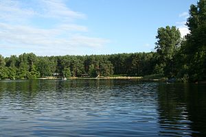
Dreetzsee (Carwitz)
| Dreetzsee | ||
|---|---|---|

|
||
| Camping site and swimming area at the southern end of the lake | ||
| Geographical location | District of Mecklenburg Lake District | |
| Tributaries | Carwitzer See | |
| Drain | Groundwater runoff to the Krüselinsee | |
| Places on the shore | Carwitz | |
| Data | ||
| Coordinates | 53 ° 17 '13 " N , 13 ° 25' 58" E | |
|
|
||
| Altitude above sea level | 83.9 m above sea level NHN | |
| surface | 63 ha | |
| volume | 3,650,000 m³ | |
| Maximum depth | 11 m | |
| Middle deep | 4.79 m | |

|
||
The Dreetzsee (sometimes just referred to as Dreetz) is a mesotrophic lake in the south of Mecklenburg-Western Pomerania . It is located in the district of Carwitz in the Feldberger Seenlandschaft community ( Mecklenburg Lake District ). The lake was first mentioned in 1556. The sea name is probably derived from the Slavic word drêt for comfort .
location
The Dreetzsee is located in the Feldberger Seenlandschaft nature park southeast of Feldberg . The lake is over 1900 meters long and around 800 meters in the south and around 250 meters wide in the north. The east bank of the lake belongs to the state of Brandenburg .
Emergence
The lake, located between terminal moraine and sand , was created at the end of the Vistula Ice Age when the ice masses melted.
structure
The Dreetzsee is watered from the northeastern Carwitzer See , to which it is connected directly via the neck. It drains underground over the Krüselinsee, which is 9.8 meters lower, and then over the Küstriner Bach towards Lychener Seen and on to the Havel .
The lake is very indented. On the eastern bank, on the border with Brandenburg, there are two bays, the Grote Urt and the Lütte Urt. Further to the south-east is the Kätelkuhl, a small body of water that is only connected to the lake by a narrow and flat point. To the south follow the very small bays Rosenkunkel and Wiesenkunkel. At the southern end, at the Landgraben, there is a campsite with a swimming area. From here, the water from the Feldberg lakes seeps through and flows through ribbon springs into the Krüselinsee. To this day, these springs are the only natural outflow from the Feldberg Lakes. The village of Carwitz is not far from the north bank. Large parts of the hilly shore are forested. On the western bank there is mainly deciduous forest, south and east mainly coniferous forest. The heights around the lake reach 100 m above sea level. NHN .
use
The lake is used for recreational purposes and for fishing. Carwitz is located on the north bank. Some of the land owned by the residents extends as far as the lake. On the south bank, on the Landgraben, is the campsite C 86 and along it is a beach. The Dreetzsee is closed to boats with combustion engines.
fauna
Common fish species are burbot , bleak , carp , catfish , lead , pike , rudd , tench , eel , ruff , crucian carp , river perch , roach , three-spined stickleback and bream . Brown lamprey , rainbow trout , dwarf catfish , gudgeon , grass carp , silver carp and pikeperch are rare .
See also
swell
- Topographic map 1: 100 000: C 2746 Prenzlau (State Survey Office Mecklenburg-Western Pomerania)
- Hiking map Feldberger Landschaft 1994: 1:25 000: Tourist Verlag Kümmerly + Frey
Individual evidence
- ↑ In: Yearbooks of the Association for Mecklenburg History and Archeology. Vol. 46, 1881, ISSN 0259-7772 , pp. 3-168, here p. 43.

