
Eggerberg
| Eggerberg | |
|---|---|
 |
|
| State : |
|
| Canton : |
|
| District : | Brig |
| BFS no. : | 6004 |
| Postal code : | 3939 |
| Coordinates : | 633 845 / 128494 |
| Height : | 846 m above sea level M. |
| Height range : | 649–1911 m above sea level M. |
| Area : | 6.05 km² |
| Residents: | 335 (December 31, 2018) |
| Population density : | 55 inhabitants per km² |
| Website: | www.eggerberg.ch |
 Eggerberg |
|
| Location of the municipality | |
  |
|
Eggerberg ( Valaisian German : Eggerbärg ) is a political municipality and a civic community with a civic council in the Brig district and a parish of the Visp dean's office in the German-speaking part of the canton of Valais in Switzerland . Parts of the municipality are part of the Jungfrau-Aletsch-Bietschhorn World Heritage Site by UNESCO . Mayor is Reto Zimmermann. All five elected municipal councils are independent.
geography
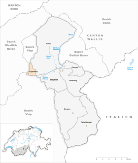
Eggerberg is located in the German-speaking Upper Valais on the south side of the Bernese Alps on the north side of the Rhone Valley . The community consists of the villages of Eggerberg and Eggen, the hamlets of Finnu (Finns), Mühlackern, Wirmschland, Weitematte, Schliecht, Nest, Engernhaus, Berg, Lipboden, Halta, Zum Stadel, Rohrli, Hohwang, the areas of Wang and Wyer in the foothills of the Alps as well different alpine pastures. The village is part of the Brig-Visp-Naters agglomeration. The neighboring communities of Eggerberg are in the north an exclave of Baltschieder , in the east Naters , in the south Lalden , in the south-west Baltschieder and in the north-west Ausserberg .
Land use
In 2009, the municipality area of 6.0 km 2 consisted of 15.2% agricultural and 6.0% urban areas. Historically, this means an increase in settlement area of 11 ha since 1985 . The wooded area (i.e. wood, forest) made up 62.1%, the remaining portion was considered unproductive area.
history
The municipality was mentioned for the first time in 1307 under the name "Ecun". Five years later, the village was first referred to as «communitas» ( Latin for community), at that time the village was still under the rule of Zenden Brig. In the late Middle Ages, the village was under the jurisdiction of the lords of Raron. In the course of time the name of the village developed from “Eccun” to “Eccon” and finally to “Egcon”. Eggen, now a hamlet, used to be the main village of the scattered settlement. The parish hall in the mountain was built in 1658, in 1798 seven inhabited hamlets belonged to the village. In 1854 the hamlet of Finnu was incorporated. Today the municipality of Eggerberg consists of a total of 13 hamlets and has a diverse club landscape.
population
In 2016 Eggerberg had 341 inhabitants in 150 households, of which around 95.9% were Swiss and 4.1% were foreigners. The population comprised 47 young people and 294 adults, of which 65 were residents 65 years of age or older. 1.7% of the population lived on social assistance .
The inhabitants are colloquially called "Grieniga", based on the color of the native green lizards .
| Population development | |||||||||||||
|---|---|---|---|---|---|---|---|---|---|---|---|---|---|
| year | 1802 | 1850 | 1860 | 1870 | 1900 | 1910 | 1920 | 1950 | 2000 | 2010 | 2012 | 2014 | 2016 |
| Residents | 153 | 217 | 241 | 197 | 224 | 622 (construction of the Lötschbergbahn) | 262 | 344 | 382 | 341 | 342 | 334 | 341 |
politics
National elections
In the 2015 National Council elections, the share of the vote in Eggerberg was: CVP 48.0%, SVP 33.2%, SP 16.8%, Greens 1.4%, FDP 0.5%.
economy
While Eggerberg itself has a few small businesses, there are significantly more jobs in neighboring Visp . Tourism plays a smaller role: the municipality, along with Steg-Hohtenn , Baltschieder and Ausserberg, belongs to the “Sonnige Halden” tourist office and has a well-developed network of hiking trails that is 40 km long. The village chose “Smaragd am Lötschberg ” as its advertising slogan .
traffic

Eggerberg is well connected to main road 9 , which leads from Sion via Visp and Brig via the Simplon Pass to Italy . The village can be reached by car all year round. The community can also be reached by Postbus , some of which end in Visp, others lead from Spiez to Brig. Eggerberg also has an unattended train station, which is used by the BLS .
Attractions
Eggerberg has three chapels, of which the St. Agatha Chapel in Eggen and the Mother of God Chapel in Finns are the most important. Two more had to be demolished, but their foundations were preserved. The parish church was built on the site of the former St. Josef Chapel in Mühlackern in 1863 after churchgoers had to make a pilgrimage to Naters or Glis for centuries . Other places worth visiting include the stone curlew by Mühlackern, an ancient wine and cider press, the historic water Leite ( Bisse ) "Gorperi" in "Mehrheji" two Harzöfen in "Schmittuwald" and the arty village square.
literature
- Philipp Kalbermatter: Eggerberg. In: Historical Lexicon of Switzerland . 2004 .
- Philipp Kalbermatter: Finns. In: Historical Lexicon of Switzerland . 2017 .
Web links
- Eggerberg on the ETHorama platform
- Official website of the municipality of Eggerberg
Individual evidence
- ↑ Permanent and non-permanent resident population by year, canton, district, municipality, population type and gender (permanent resident population). In: bfs. admin.ch . Federal Statistical Office (FSO), August 31, 2019, accessed on December 22, 2019 .
Brig-Glis | Eggerberg | Naters | Ried-Brig | Simplon | Terms | Between mountains
Former communities: Birgisch | Brig | Brigerbad | Glis | mouth
Canton of Valais | Districts of the canton of Valais | Municipalities of the canton of Valais