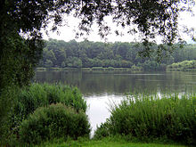
Emmer (Weser)
| Emmer | ||
|
Emmer in Lügde |
||
| Data | ||
| Water code | EN : 456 | |
| location | North Rhine-Westphalia , Lower Saxony ; Germany | |
| River system | Weser | |
| Drain over | Weser → North Sea | |
| source | West of Langeland 51 ° 46 ′ 38 ″ N , 8 ° 59 ′ 12 ″ E |
|
| Source height | approx. 308 m above sea level NN | |
| muzzle | At Emmern in the Weser Coordinates: 52 ° 3 '25 " N , 9 ° 22' 53" E 52 ° 3 '25 " N , 9 ° 22' 53" E |
|
| Mouth height | approx. 65 m above sea level NN | |
| Height difference | approx. 243 m | |
| Bottom slope | approx. 3.9 ‰ | |
| length | 61.8 km | |
| Catchment area | 535.113 km² | |
| Discharge at the Schieder – Ness gauge . A Eo : 267.22 km² Location: 35.03 km above the mouth |
NNQ (03.09.1991) MNQ 1981/2014 MQ 1981/2014 Mq 1981/2014 MHQ 1981/2014 HHQ (28.10.1998) |
385 l / s 803 l / s 4.12 m³ / s 15.4 l / (s km²) 71 m³ / s 174 m³ / s |
| Discharge at the Welsede A Eo gauge : 509 km² Location: 7 km above the mouth |
NNQ (10/31/1964) MNQ 1961/1985 MQ 1961/1985 Mq 1961/1985 MHQ 1961/1985 HHQ (01/15/1968) |
1.29 m³ / s 2.2 m³ / s 7.5 m³ / s 14.7 l / (s km²) 70.3 m³ / s 133 m³ / s |
| Discharge at the mouth of the A Eo : 535.11 km² |
MQ Mq |
7.71 m³ / s 14.4 l / (s km²) |
The Emmer (formerly called Ambriuna in Latin ) is a 61.8 km long, southwest or left-hand tributary of the Weser in North Rhine-Westphalia and Lower Saxony ( Germany ). The Emmerweg and partly the Hanover – Altenbeken railway line run along the Emmer .
geography
source

The Emmer rises in the Egge Mountains . Its source is located on the eastern slope of the 427 m high Rehberg, north of an eastern foothill called Habichtsberg. It is located in the Langeland district of the city of Bad Driburg , about one kilometer southwest of Langeland .
course

Initially the Emmer flows in a north-easterly direction and crosses Langeland. In the village of Erpentrup , the river absorbs the water of the Breitenbach and flows through the areas of the cities of Nieheim , Steinheim to Schieder-Schwalenberg , where it was dammed directly northeast of Schieder after the Diestel and Niese from 1983 to 2015 to the Schiedersee . Since the Schiedersee threatened to silt up due to the sedimentation of the Emmer and also represented a migration barrier for aquatic animals, a flood was built on the north shore of the lake from 2012 to 2015. Due to this flood, the Emmer has been bypassed the Schiedersee since June 2015. Then the Emmer flows through Lügde and Bad Pyrmont . Not far from its confluence with the Weser, the Emmer flows directly past Hämelschenburg Castle , where it drives the mill wheel of the historic mill and a modern turbine for generating electricity. Between Bodenwerder and Hameln in the district of Emmern in the municipality of Emmerthal , the river finally empties after 61.8 km at an altitude of 76 m above sea level. NN from the left into the Weser. At its mouth, the Emmer has an average water flow of around 7.7 m³ / s.
Tributaries
viewed downstream
|
|
|
Localities
viewed downstream
|
Hydrology
The catchment area of the Emmer is 535 km². The discharge on the lower reaches of the Emmer, at the Welsede gauge in Emmerthal, averages 2.2 m³ / s at low water level (MNQ). The mean discharge (MQ) is 7.6 m³ / s, the mean flood discharge (MHQ) 38.4 m³ / s and the discharge during a hundred year flood (HQ100) 229 m³ / s.
natural reserve
The Emmer and its valley below the Emmerstausee up to the confluence with the Weser are completely protected. The section in North Rhine-Westphalia was placed under nature protection in 1992, the section in Lower Saxony followed in 1994.
use
There are hydropower plants along the Emmer in Steinheim, Wöbbel, Schieder ( Emmer reservoir hydropower plant ) and in Bad Pyrmont. There are also barrages in Welsede, Hämelschenburg and Emmerthal that generate electricity using turbines.
literature
- Johannes Waldhoff: The Emmer. Heimatverein Steinheim, Steinheim 1986.
Individual evidence
- ↑ a b Topographic map 1: 25,000
- ↑ a b Topographical Information Management, Cologne District Government, Department GEObasis NRW
- ^ Deutsches Gewässerkundliches Jahrbuch Weser-Ems 2014. Lower Saxony State Agency for Water Management, Coastal and Nature Conservation, p. 159, accessed on October 4, 2017 (PDF, German, 8805 kB).
- ↑ a b Welsede gauge value increased by the drainage of the remaining catchment area (8.3 / s.km² to 25.51 km²), derived from the values of the enclosing intermediate catchment area of the gauges Bodenwerder (Weser), Oelkassen (Lenne), Welsede (Emmer), Afferde (Fluthamel), Klein Berkel (Humme), Uchtdorf (Exter) and Vlotho (Weser) and from the Hydrological Atlas of Germany - annual discharge height
- ↑ Emmer-Umflut is ready. nw.de, June 15, 2015, accessed on September 17, 2016 .


