
South Savo
| coat of arms | map |
|---|---|

|
  |
| Basic data | |
| Country: | Finland |
| Municipalities: | 14th |
| Administrative headquarters: | Mikkeli |
| Surface: | 18,767.36 km² of which land: 13,977.34 km² |
| Residents: | 149,674 May 31, 2016 |
| Population density: | 8.0 inhabitants per km² |
| ISO 3166 : | FI-04 |
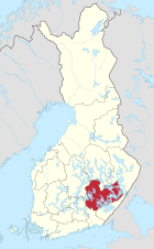
South Savo ( Finnish Etelä-Savo ; Swedish Södra Savolax ) is a landscape ( maakunta ) in Finland. According to its name, South Savo forms the southern part of the historical region of Savo . A large part of the Finnish lake district with the Saimaa lake area is located in southern Savo.
coat of arms
Description of the coat of arms : In the black shield a golden bow with a silver string. The bow points to the top left and its golden arrow has a silver tip and fletching.
Communities
South Savo has 14 municipalities , three of which are cities (in bold). Population figures as of December 31, 2018.
- Enonkoski (1405)
- Heinävesi (3329)
- Hirvensalmi (2152)
- Joroinen (4812)
- Juva (6225)
- Kangasniemi (5452)
- Mäntyharju (5924)
- Mikkeli (53,818)
- Pertunmaa (1713)
- Pieksämäki (17,933)
- Puumala (2197)
- Rantasalmi (3514)
- Savonlinna (33,611)
- Sulkava (2530)
References
- ↑ Tilastokeskus.fi (Finnish Statistics Office), Finnish
- ↑ Statistical Office Finland: Table 11ra - Key figures on population by region, 1990-2018
Web links
Commons : Southern Savonia - Collection of images, videos and audio files
Landscapes of Finland