Exira
| Exira | |
|---|---|
|
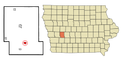
Location in Iowa
|
|
| Basic data | |
| Foundation : | 1857 |
| State : | United States |
| State : | Iowa |
| County : | Audubon County |
| Coordinates : | 41 ° 35 ′ N , 94 ° 53 ′ W |
| Time zone : | Central ( UTC − 6 / −5 ) |
| Residents : | 840 (as of 2010) |
| Population density : | 318.2 inhabitants per km 2 |
| Area : | 2.64 km 2 (approx. 1 mi 2 ) |
| Height : | 387 m |
| Postal code : | 50076 |
| Area code : | +1 712 |
| FIPS : | 19-26265 |
| GNIS ID : | 456456 |
| Website : | www.cityofexira.com |
| Mayor : | Brenda Bengard |
Exira is a small town (with the status " City ") in Audubon County in the US -amerikanischen State Iowa . In 2010 Exira had 840 inhabitants.
geography
Exira is located in the west of Iowa on the East Nishnabotna River , which belongs to the Missouri basin over the Nishnabotna River . This forms the border between Iowa and Nebraska around 100 km west of Exira . The border with the neighboring state of Missouri to the south is around 120 km away.
The geographical coordinates of Exira are 41 ° 35'27 "north latitude and 94 ° 52'32" west longitude. The urban area extends over an area of 2.64 km² and is located in the Exira Township .
Neighboring towns of Exira are Adair (28.8 km southeast), Anita (26 km south-southeast), Wiota (22.8 km south), Atlantic (28.9 km south-southwest), Elk Horn (15.5 km west), Kimballton ( 21.1 km west-northwest), Hamlin (9.8 km north-northwest), and Audubon (15.9 km in the same direction).
The closest major cities are the Twin Cities in Minnesota ( Minneapolis and Saint Paul ) (510 km northeast), Cedar Rapids (303 km east-northeast), Iowa's capital Des Moines (119 km east), Kansas City , Missouri (313 km south), Nebraska's largest city, Omaha (121 km southwest), Sioux City (219 km northwest), and South Dakota's largest city Sioux Falls (355 km in the same direction).
traffic
The US Highway 71 runs north-south through the west of Exira. All other roads are subordinate country roads, some unpaved roads and inner-city connecting roads.
With the Audubon County Airport is located 13.8 km north-northwest of Exira a small airfield. The nearest commercial airports are Eppley Airfield in Omaha (122 km southwest) and Des Moines International Airport (125 km east).
| Population development | |||
|---|---|---|---|
| Census | Residents | ± in% | |
| 1860 | 83 | - | |
| 1870 | 161 | 94% | |
| 1880 | 604 | 275.2% | |
| 1890 | 575 | -4.8% | |
| 1900 | 851 | 48% | |
| 1910 | 787 | -7.5% | |
| 1920 | 840 | 6.7% | |
| 1930 | 937 | 11.5% | |
| 1940 | 1046 | 11.6% | |
| 1950 | 1129 | 7.9% | |
| 1960 | 1111 | -1.6% | |
| 1970 | 966 | -13.1% | |
| 1980 | 978 | 1.2% | |
| 1990 | 955 | -2.4% | |
| 2000 | 810 | -15.2% | |
| 2010 | 840 | 3.7% | |
| 1860-2000 2010 | |||
population
According to the 2010 census , 840 people in 381 households lived in Exira. The population density was 318.2 people per square kilometer. Statistically, 2.06 people lived in each of the 381 households.
The racial the population was composed of 98.6 percent white, 0.2 percent African American, 0.1 percent (one person) Native American and 0.4 percent Asian; 0.7 percent were descended from two or more races. Hispanic or Latino of any race was 1.4 percent of the population.
16.4 percent of the population were under 18 years old, 54.3 percent were between 18 and 64 and 29.3 percent were 65 years or older. 56.9 percent of the population were female.
The average annual income for a household was 36,731 USD . The per capita income was $ 23,316. 14.1 percent of the population lived below the poverty line.
Known residents
- Ben F. Jensen (1892–1970) - Republican member of the US House of Representatives (1939–1965) - lived in Exira for the last few years and is buried here
Individual evidence
- ↑ City of Exira - Council Members ( Memento of the original from October 18, 2014 in the Internet Archive ) Info: The archive link was inserted automatically and has not yet been checked. Please check the original and archive link according to the instructions and then remove this notice. Retrieved October 13, 2014
- ↑ a b c American Fact Finder. Retrieved October 13, 2014
- ↑ Distance information according to Google Maps. Accessed on October 13, 2014
- ↑ AirNav.com - Audubon County Airport Accessed on October 13, 2014
- ↑ State Data Center of Iowa (PDF; 86 kB) Retrieved October 13, 2014
